Waldseemuller_map_closeup_with_America.jpg

Size of this preview:
547 × 600 pixels
.
Other resolutions:
219 × 240 pixels
|
438 × 480 pixels
|
700 × 768 pixels
|
934 × 1,024 pixels
|
1,774 × 1,945 pixels
.
Summary
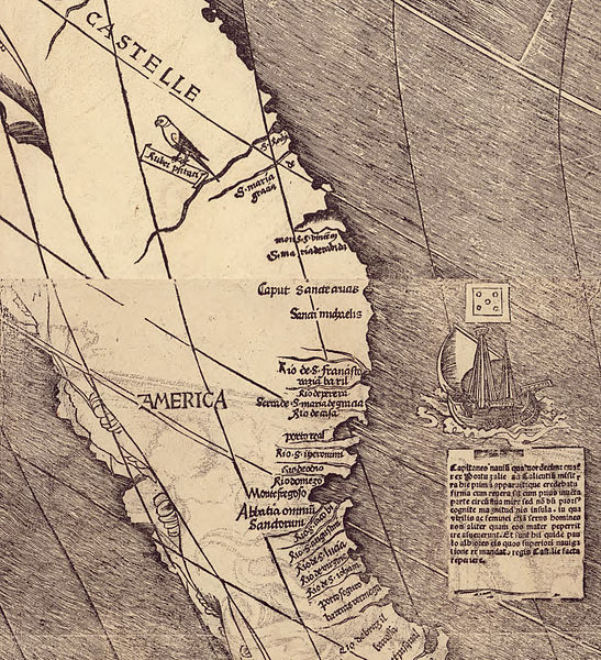
| Description | Closeup of the Martin Waldseemüller map showing South America and the word "AMERICA" | |||||||||||||||||||||||
| Date | original map: 1507 | |||||||||||||||||||||||
| Source | Library of Congress, [1] | |||||||||||||||||||||||
| Author |
|
|||||||||||||||||||||||
|
Permission
( Reusing this file ) |
reproduction of public domain work (due to age) | |||||||||||||||||||||||

Licensing
|
|
This work is in the public domain in its country of origin and other countries and areas where the copyright term is the author's life plus 100 years or fewer . |
| This file has been identified as being free of known restrictions under copyright law, including all related and neighboring rights. | |