Western_Han_Mawangdui_Silk_Map.JPG

Size of this preview:
621 × 600 pixels
.
Other resolutions:
249 × 240 pixels
|
497 × 480 pixels
|
795 × 768 pixels
|
1,060 × 1,024 pixels
|
2,121 × 2,048 pixels
|
3,675 × 3,549 pixels
.
Summary
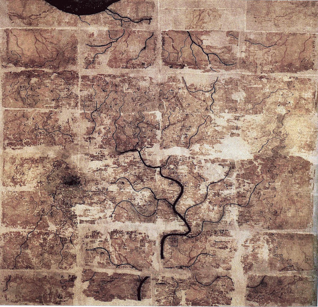
| Description | A Chinese topographic map (with the south positioned at the top) from Mawangdui tomb 3; dated to the early Western Han period (183–168 BC); length is 96 cm; width is 96 cm; the map is made of ink on silk. It is now housed in the Hunan Provincial Museum, Changsha. The map depicts a large territory in southern China spanning from the imperial fiefdom of Changsha (a semi-autonomous kingdom within the Han Empire, now modern-day Hunan) to the independent and sometimes hostile Kingdom of Nanyue in what is now modern-day Guangdong and northern Vietnam. |
| Date | 2nd century BC (anywhere from 183 to 168 BC) |
| Source | Scanned from Barbieri-Low, Anthony J. (2007). Artisans in Early Imperial China . Seattle and London: University of Washington Press. ISBN 0295987138 . Page 174. |
| Author | Anonymous ancient Chinese cartographer |
| Other versions | Derivative works of this file: Cypraea mappa map comparison.jpg |
Licensing
|
This is a faithful photographic reproduction of a two-dimensional,
public domain
work of art. The work of art itself is in the public domain for the following reason:
The official position taken by the Wikimedia Foundation is that "
faithful reproductions of two-dimensional public domain works of art are public domain
".
This photographic reproduction is therefore also considered to be in the public domain in the United States. In other jurisdictions, re-use of this content may be restricted; see Reuse of PD-Art photographs for details. |
||||