Whitworth_Hall_Manchester.jpg

Size of this preview:
624 × 600 pixels
.
Other resolutions:
250 × 240 pixels
|
500 × 480 pixels
|
640 × 615 pixels
.
Summary
| Description |
English:
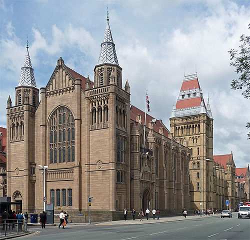
Started by Alfred Waterhouse in 1898 and completed by his son, Paul, in 1902. Named after a prosperous local industrialist, Joseph Whitworth, is now used for major functions including graduation ceremonies.
|
| Date | |
| Source | https://www.geograph.org.uk/photo/2819836 |
| Author | Stephen Richards |
|
Attribution
( required by the license ) |
Stephen Richards / Whitworth Hall, Oxford Road, Manchester / |
| Camera location |
|
View this and other nearby images on: OpenStreetMap |
|
|---|
Licensing

|
This image was taken from the
Geograph project
collection. See
this photograph's page
on the Geograph website for the photographer's contact details. The copyright on this image is owned by
Stephen Richards
and is licensed for reuse under the
Creative Commons
Attribution-ShareAlike 2.0 license.
|
This file is licensed under the
Creative Commons
Attribution-Share Alike 2.0 Generic
license.
Attribution:
Stephen Richards
-
You are free:
- to share – to copy, distribute and transmit the work
- to remix – to adapt the work
-
Under the following conditions:
- attribution – You must give appropriate credit, provide a link to the license, and indicate if changes were made. You may do so in any reasonable manner, but not in any way that suggests the licensor endorses you or your use.
- share alike – If you remix, transform, or build upon the material, you must distribute your contributions under the same or compatible license as the original.