Xinjiang_Internment_Map,_US-Aus_Gov_Assessment.jpg
Size of this preview:
800 × 495 pixels
.
Other resolutions:
320 × 198 pixels
|
640 × 396 pixels
|
1,024 × 634 pixels
|
1,280 × 792 pixels
|
2,048 × 1,267 pixels
.
Summary
| Description |
English:
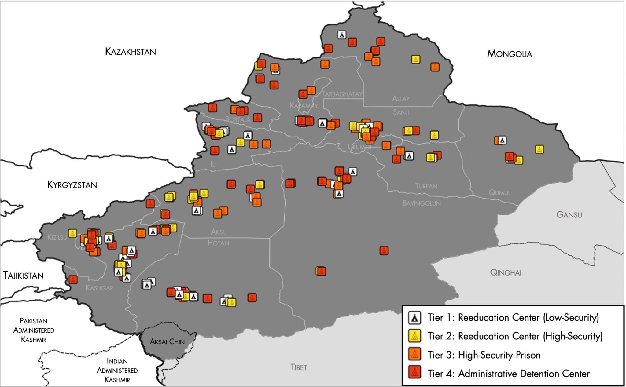
Map of the
Xinjiang Internment Camps
created by the
RAND Corporation
based on data collected by the US
National Geospatial Intelligence Agency
and the
Australian Strategic Policy Institute
. Open source
here
.
|
||||||||
| Date | |||||||||
| Source | https://www.tearline.mil/public_page/xinjiang-nighttime-1/ | ||||||||
| Author | National Geospatial Intelligence Agency , using data from the Australian Strategic Policy Institute , and administrative boundaries from GADM . | ||||||||
|
Permission
( Reusing this file ) |
|

