Zhenghe-sailing-chart.gif
Size of this preview:
800 × 570 pixels
.
Other resolutions:
320 × 228 pixels
|
640 × 456 pixels
|
1,024 × 730 pixels
|
1,280 × 912 pixels
|
1,454 × 1,036 pixels
.
Summary
| Description |
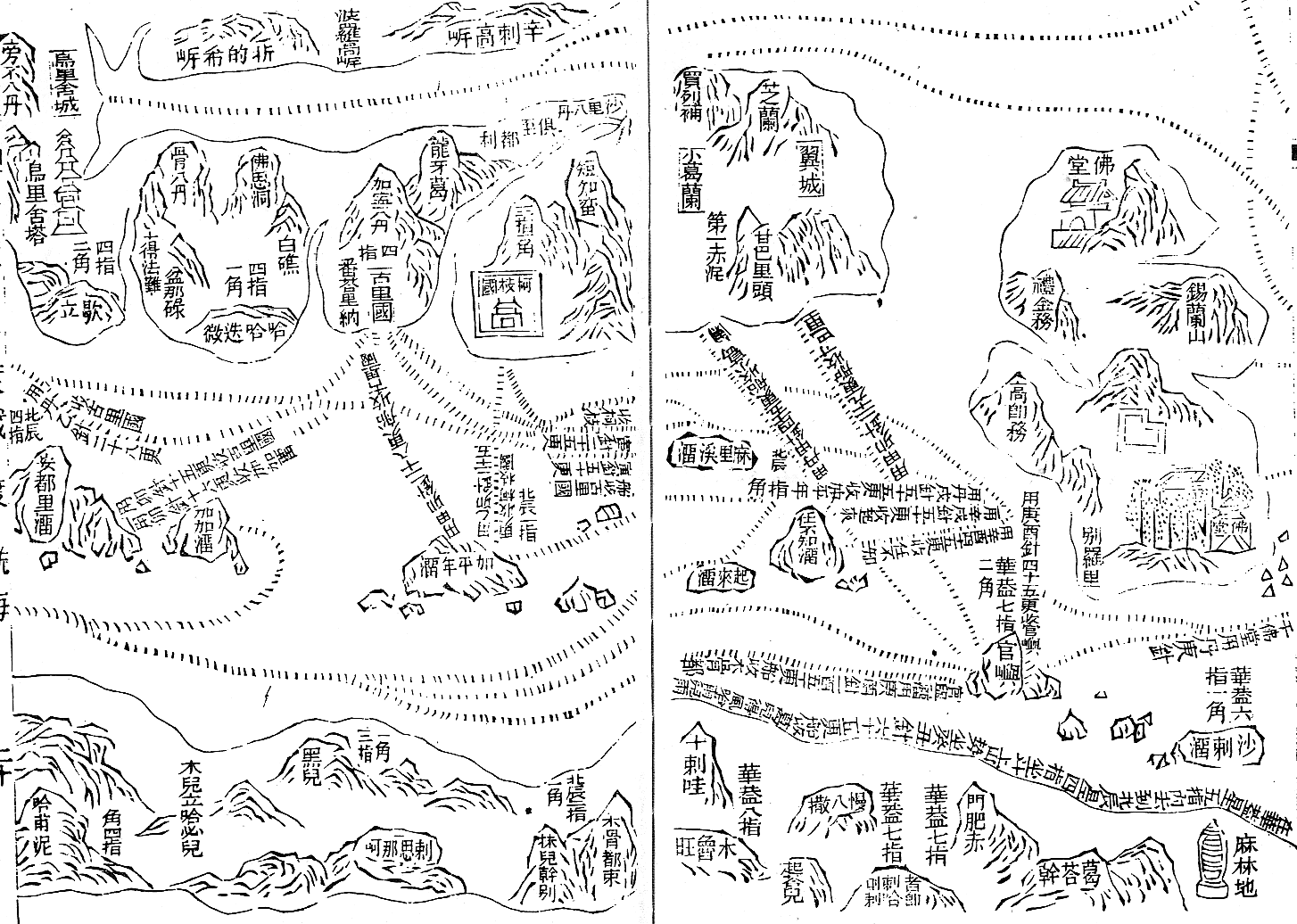
English:
Part of the Wu bei zhi chart of Zheng He showing the west coast of India along the top, Ceylon top right and Africa along the bottom. The sailing directions are shown using
zhen lu
compass directions.
Русский:
Фрагмент навигационной карты ("карта Мао Куня") из энциклопедии "Убэй чжи", показывающий бассейн Аравийского моря.
Север слева, восток вверху. В правом верхнем углу - остров Цейлон (錫蘭山,Силаньшань - остров/гора Силань); в правом нижнем углу - порт Малинди (麻林地, Малиньди)
|
| Date | Early 15th century map. Published in Wubei Zhi in 1628. |
| Source | Wubei Zhi |
| Author |
Licensing
|
|
This work is in the public domain in its country of origin and other countries and areas where the copyright term is the author's life plus 100 years or fewer . |
| This file has been identified as being free of known restrictions under copyright law, including all related and neighboring rights. | |
Original upload log
The original description page was
here
. All following user names refer to en.wikipedia.
- 2008-07-04 22:54 Chris55 1454×1036× (177834 bytes) Part of the Wu bei zhi chart of Zheng He showing the west coast of India along the top, Ceylon top right and Africa along the bottom. The sailing directions are shown using zhen lu compass directions.