Zunghar_Khanate_at_1760.jpg
No higher resolution available.
Summary
| Description |
English:
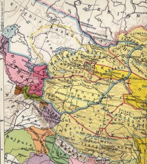
Old map of Northern India / Tibet /Xinjiang ca. 1760, showing Dzungars. Drawn in 1935 by Albert Herrmann.
|
| Date | 25 December 2008 (original upload date) |
| Source | Transferred from en.wikipedia to Commons by Podzemnik using CommonsHelper . |
| Author |
Part of the map of Albert Herrmann, published by Georg Westermann in 1935 (see complete version below)
The original uploader was Enerelt at English Wikipedia . ("I fixed the pic myself") |
| Other versions |
Complete map

|
Licensing

|
Permission is granted to copy, distribute and/or modify this document under the terms of the GNU Free Documentation License , Version 1.2 or any later version published by the Free Software Foundation ; with no Invariant Sections, no Front-Cover Texts, and no Back-Cover Texts. A copy of the license is included in the section entitled GNU Free Documentation License . |
|
|
This file is licensed under the Creative Commons Attribution-Share Alike 3.0 Unported license. | |
|
||
| This licensing tag was added to this file as part of the GFDL licensing update . |
Original upload log
The original description page was
here
. All following user names refer to en.wikipedia.
- 2008-12-25 03:20 Enerelt 495×657× (124748 bytes) I fixed the pic myself