Mountain, hill
or high point | Height
(m) [1]
| Location in Harz area,
national park (NLP)
or nature park (NRP)
| Towns or villages
in the vicinity
| County or
unincorp. area
(for abbr. see below)
| State
(for abbr. see below)
| Points of interest e.g.:
sights, nearby rivers or streams, springs,
(whether located in/by a: BR, NR)
| Image
|
Brocken
(Großer Brocken;
Blocksberg) | 1,141.1
[2] | Upper Harz
(High Harz);
Harz NLP,
Harz/S-A NRP | Ilsenburg,
Schierke,
Wernigerode | HZ | S-A | Brocken Railway,
The Brockenhaus inn (hotel, museum, restaurant),
Brandklippe,
Kahle Klippe,
Brocken Transmitter,
Weather station,
The Wolkenhäuschen,
former location of 2 listening posts of the
USSR (GRU) and GDR (MfS);
Nearby :
S: Ecker,
S: Große Bode,
S: Ilse,
S: Kalte Bode |  |
Heinrichshöhe
(subpeak of the Brocken) | 1,0450
[3] | Upper Harz
(High Harz);
Harz NLP,
Harz/S-A NRP | Ilsenburg,
Schierke,
Wernigerode | HZ | S-A | Brocken Railway
(runs past),
Brockenteich,
Brockentor-Klippe;
S: Ilse |  |
Königsberg
(Wernigerode);
(subpeak of the Brocken) | 1,033.5 | Upper Harz
(High Harz);
Harz NLP,
Harz/S-A NRP | Ilsenburg,
Schierke,
Wernigerode | HZ | S-A | Brocken Railway
(runs past),
many granite tors (e. g. Gipfelklippe, Hirschhornklippen, Kanzelklippe, Schluftkopfklippe, Stangenklippe),
S: Ecker,
S: Kalte Bode |  |
Kleiner Brocken
(subpeak of the Brocken)
(Wernigerode) | 1,018.4 | Upper Harz
(High Harz);
Harz NLP,
Harz/S-A NRP | Ilsenburg,
Schierke,
Wernigerode | HZ | S-A | S: Morgenbrodsbach | |
| Wurmberg | 971.2
[4] | Upper Harz
(High Harz);
Harz NRP (LS) | Braunlage | GS | LS | Hexentreppe ("Witches' Staircase"),
Wurmbergklippen
(Gr. and Kl. Wurmbergklippe),
Wurmberg NR,
Wurmbergbaude inn,
winter sports area
(incl: toboggan run/
toboggan house, ski lifts/pistes),
Wurmberg ski jumps
(with observation platform), Wurmberg Gondola Lift),
Former location of a
US surveillance tower;
S: Bremke |  |
| Renneckenberg | 9330
[5] | Upper Harz
(High Harz);
Harz NLP,
Harz/S-A NRP | Schierke,
Wernigerode | HZ | S-A | Kapellenklippe, Brockenkinderklippe, Zeterklippen;
S: Holtemme,
S: Wormke |  |
| Bruchberg | 9270 | Upper Harz
(High Harz);
Harz NLP | Altenau,
Torfhaus | UA-GS;
GS | LS | Okerstein,
Skikreuz,
Steile Wand,
Wolfswarte;
Clausthaler Flutgraben,
S: Sieber,
S (near): Große Söse |  |
Achtermannshöhe
(Achtermann, Uchteneshoge, Uchtenhoch) | 924.7
[4] | Upper Harz
(High Harz);
Harz NLP | Braunlage,
Torfhaus | UA-GS;
GS | LS | Achtermannstor,
Breitesteinklippen;
Oderteich,
S: Kleine Bode,
S: Oder |  |
Pferdekopf
(Schierke)
(subpeak of the Renneckenberg) | 9200 | Upper Harz
(High Harz);
Harz NLP,
Harz/S-A NRP | Schierke,
Wernigerode | HZ | S-A | Kapellenklippe;
S: Holtemme,
S: Ilse,
S: Wormke | |
| Großer Winterberg | 906.4 | Upper Harz
(High Harz);
Harz NLP,
Harz/S-A NRP | Schierke | HZ | S-A | near: S: Bremke |  |
Hohnekamm
(Hohneklippen) | 900.6 | Upper Harz
(High Harz);
Harz NLP,
Harz/S-A NRP | Schierke,
Wernigerode | HZ | S-A | Hohneklippen
(Bärenklippe, Grenzklippe, Höhlenklippe,
Leistenklippe & Trudenstein),
Hohnekopf,
near: Hohensteinklippen,
near: Ottofels;
S: Zillierbach |  |
| Rehberg | 8930
[5] | Upper Harz
(High Harz);
Harz NLP | St. Andreasberg | UA-GS;
GS | LS | Rehberger Graben
and Grabenhaus |  |
| Quitschenberg | 881.5 | Upper Harz
(High Harz);
Harz NLP | Torfhaus | UA-GS;
GS | LS | Hopfensäcke (Klippen),
Luisenklippe,
Quitschenbergklippen;
Abbegraben
S (near): Abbe | |
| Auf dem Acker | 865.1 | Upper Harz
(High Harz);
Harz NLP | Herzberg,
Osterode,
St. Andreasberg | UA-OHA;
OHA | LS | Numerous tors and crags (e.g. the Hanskühnenburgklippe),
Hanskühnenburg;
S: Goldenke,
S: Große Kulmke,
S: Große Lonau,
S: Große Söse,
S: Kleine Kulmke,
S: Kleine Steinau,
S: Schwarze Kulmke,
S: Verlorene Kulmke |  |
Sonnenberg
Großer Sonnenberg:
Kleiner Sonnenberg:
| 853.4
853.4
853.0 | Upper Harz;
Harz NLP | Braunlage,
St. Andreasberg | UA-GS;
GS | LS | Winter sports area |  |
| Erdbeerkopf | 847.7 | Upper Harz;
Harz NLP,
Harz/S-A NRP | Schierke,
Wernigerode | HZ | S-A | Brocken Railway
(runs past);
S: Wormke | |
| Kleiner Winterberg | 837.0 | Upper Harz;
Harz NLP,
Harz/S-A NRP | Schierke | HZ | S-A | S: Bremke | |
Lerchenköpfe
(Lärchenköpfe)
North top:
South top: | 821.0
821.0
8010 | Upper Harz;
Harz NLP | Torfhaus | UA-GS;
GS | LS | Torfhaus/Harz Transmitter,
winter sports area;
Abbegraben,
Flörichshaier Graben,
S: Radau | |
| Dehnenkopf | 773.6 | Upper Harz;
Harz NLP | Torfhaus | UA-GS;
GS | LS | Jungfernklippe;
S: Kalbe | |
| Schalke | 7620 | Upper Harz;
Harz NRP (LS) | Clausthal-Zellerfeld,
Hahnenklee,
Schulenberg | UA-GS;
GS | LS | Schalke OT,
until 2003 there was a:
surveillance tower;
S: Abzucht,
S: Schalke |  |
| Abbenstein | 7690 | Upper Harz;
Harz NLP | Torfhaus | UA-GS;
GS | LS | Dam of the Ecker Reservoir;
S: Fuhler Lohnbach | |
| Hohe Wand | 758.0 | Upper Harz;
Harz NLP,
Harz/S-A NRP | Hasserode,
Schierke,
Wernigerode | HZ | S-A | Ohrenklippen;
S: Chaussee Bach | |
Haspelkopf
(subpeak of
Auf dem Acker) | 7490
[6] | Upper Harz,
Harz NLP,
Harz NRP (LS) | Riefensbeek,
Sieber | UA-OHA;
OHA | LS | Sophienklippe,
Spießerklippe
(q. v. Auf dem Acker);
S: Große Steinau,
S: Kleine Lonau | |
| Kuppe | 729.1 | Upper Harz;
Harz NRP (LS) | Sankt Andreasberg | UA-GS;
GS | LS | Glückaufklippen;
near: Siebertal NR;
S: Sperrlutter | |
| Bocksberg | 7260
[7] | Upper Harz;
Harz NRP (LS) | Hahnenklee | GS | LS | Brockenblick OT,
Bocksberg Hut inn,
Bocksberg Cable Car,
transmission tower,
summer rodelbahn,
winter sports area,
Former location of a bob and luge run;
S: Gose,
S: Grane,
S: Grumbach |  |
| Jordanshöhe | 7230 | Upper Harz;
Harz NRP (LS) | Sankt Andreasberg | GS | LS | Bergwiesen bei St. Andreasberg NR,
Jordanshöhe Geological Educational Path (Gesteinskundlicher Lehrpfad Jordanshöhe),
Jordanshöhe youth hostel,
Glückaufklippen;
S: Sperrlutter | |
Stöberhai
(The Brocken of the South Harz) | 7200
[8] | South Harz;
Harz NRP (LS) | Bad Lauterberg,
Wieda | UA-OHA;
OHA | LS | communication tower,
Former location of the Berghotel Stöberhai,
Former location of a
Bundeswehr surveillance tower;
Dam of the Oder Reservoir,
S: Steinaer Bach |  |
Schlufterkopf
(east of the Sieber) | 715.2 | South Harz;
Harz NLP | Sieber,
Sonnenberg | UA-GS;
OHA,
GS | LS | | |
| Großer Breitenberg | 7110
[6] | Upper Harz,
Harz NLP,
Harz NRP (LS) | Riefensbeek | UA-OHA;
OHA | LS | Sergeantenklippe;
near: Dam of the Söse Reservoir | |
| Wolfsklippen | 7100 | Upper Harz;
Harz NLP,
Harz/S-A NRP | Drei Annen Hohne,
Plessenburg | HZ | S-A | Wolfsklippen OT;
S: Tänntalbach (Rammelsbach) |  |
Jagdkopf
(subpeak of the Stöberhai) | 701.2 | Upper Harz;
Harz NRP (LS) | Odertal,
Wieda | UA-OHA;
OHA | LS | S: Steinaer Bach | |
Schlufterkopf
(west of the Sieber) | 7000 | South Harz;
Harz NLP | Sieber,
Sonnenberg | UA-OHA;
OHA,
GS | LS | | |
| Riesenbachskopf | 699.5 | Upper Harz;
Harz NRP (LS) | Schulenberg | UA-GS;
GS | LS | S (near): Abzucht (Wintertalbach),
S: Riesenbach | |
Scharfenstein
(Ilsenburg) | 697.6 | Upper Harz;
Harz NLP,
Harz/S-A NRP | Ilsenburg | HZ | S-A | near: the dam of the Ecker Reservoir;
ranger station,
Scharfensteinklippe |  |
Barenberg
(Bärenberg) | 695.5 | Upper Harz;
Harz/S-A NRP | Elend,
Schierke | HZ | S-A | Mäuseklippe,
Scherstorklippen,
Schnarcherklippen | |
| Altetalskopf | 693.4 | Upper Harz;
Harz NRP (LS) | Schulenberg | UA-GS;
GS | LS | S: Lange Bramke,
S: Riesenbach | |
| Großer Knollen | 687.4 | South Harz;
Harz NRP (LS) | Bad Lauterberg,
Sieber | UA-OHA;
OHA | LS | Knollen Tower OT,
Knollenbaude inn;
S: Bremke |  |
| Hinterer Ebersberg | 6860 | Upper Harz;
Harz NRP (LS) | Braunlage,
Hohegeiß | UA-GS;
GS | LS | Nullpunkt Monument;
S: Ebersbach,
S (near): Sprakelbach;
S: Steinbach | |
| Kleiner Oderberg | 685.1 | Upper Harz;
Harz NLP,
Harz NRP (LS) | Sankt Andreasberg | GS | LS | near: Bergwiesen bei St. Andreasberg NR;
S (near): Breitenbeek | |
| Aschentalshalbe | 6850 | South Harz;
Harz NRP (LS) | Sieber | UA-OHA;
OHA | LS | S: Grade Lutter,
S: Tiefenbeek | |
| Vorderer Ebersberg | 6840 | Upper Harz;
Harz NRP (LS) | Braunlage,
Hohegeiß | UA-GS;
GS | LS | Bechlerstein Monument;
S: Ebersbach,
S: Kleiner Wolfsbach | |
Wolfsberg
(Ilsenburg)
| 6750 | Upper Harz;
Harz NLP,
Harz/S-A NRP | Ilsenburg | HZ | S-A | Ferdinandsstein | |
| Koboltstaler Köpfe | 6730 | South Harz;
Harz NRP (LS) | Sankt Andreasberg,
Sieber | UA-OHA;
OHA | LS | S: Krumme Lutter | |
Großer Schleifsteinsberg,
(Großer Schleifsteinberg) | 670.7 | Upper Harz;
Harz NRP (LS) | Goslar,
Schulenberg | GS | LS | Großfürstin Alexandra Pit;
S (near): Abzucht (Wintertalbach) | |
| Sägemühlenberg | 6700 | Upper Harz;
Harz NLP,
Harz NRP (LS) | Sankt Andreasberg | UA-GS;
GS | LS | | |
| Ifenkopf | 668.9 | Upper Harz;
Harz NRP (LS) | Altenau,
Kamschlacken | UA-OHA;
GS,
OHA | LS | Ifenkopferklippe,
Siebenwochenklippe | |
| Dicker Kopf | 6680 | Upper Harz;
Harz NRP (LS) | Goslar | UA-GS;
GS | LS | Oker-Grane-Stollen,
S: Steile Bramke,
S: Gelmke |  |
| Wolfskopf | 668.5 | Upper Harz;
Harz NRP (LS) | Kamschlacken | UA-OHA;
OHA | LS | Wolfsklippen | |
Mittelberg
(Torfhaus) | 667.1 | Upper Harz;
Harz NRP (LS) | Altenau,
Torfhaus | UA-GS;
GS | LS | near: Upper Harz NR | |
| Großer Birkenkopf | 664.1 | Upper Harz;
Harz/S-A NRP | Wernigerode,
Hasserode | HZ | S-A | near: Kleine Renne,
near: Steinerne Renne | |
| Matthias-Schmidt-Berg | 6630 | Upper Harz;
Harz NRP (LS) | Sankt Andreasberg | GS | LS | winter sports area,
near: Bergwiesen bei St. Andreasberg NR;
S (near): Breitenbeek | |
| Ravensberg | 6590 | South Harz;
Harz NRP (LS) | Bad Lauterberg,
Bad Sachsa,
Wieda | UA-OHA;
OHA | LS | Berghof Ravensberg,
communication tower
(Ex-BNM surveillance tower),
Wilhelmshöh,
winter sports area |  |
| Beerberg | 658.1 | Upper Harz;
Harz NRP (LS) | Sankt Andreasberg | GS | LS | Bergwiesen bei
St. Andreasberg NR | |
| Hübichentalsköpfe | 654.0 | South Harz;
Harz NRP (LS) | Bad Lauterberg,
Sieber | UA-OHA;
OHA | LS | S: Bremke | |
| Übelsberg | 651.3
[5] | South Harz;
Harz NRP (LS) | Bad Lauterberg,
Sieber | UA-OHA;
OHA | LS | S: Übelsbach
S (near): Schadenbeek | |
| Großer Oderberg | 649.6 | Upper Harz;
Harz NLP | Sankt Andreasberg | UA-GS;
GS | LS | S (near): Breitenbeek | |
| Kl. Steffentalskopf | 6480 | Upper Harz;
Harz NRP (LS) | Goslar,
Schulenberg | GS | LS | S: Große Romke | |
| Brautstein | 647.7 | Upper Harz;
Harz NRP (LS) | Goslar,
Oker | UA-OHA;
GS | LS | | |
| Braakberg | 645.5 | South Harz;
Harz NLP | Lonau | UA-OHA;
OHA | LS | S (near): Kl. Lonau,
S (near): Gr. Steinau | |
| Großer Wiesenberg | 645.4 | Upper Harz;
Harz NRP (LS) | Schulenberg | GS | LS | winter sports area | |
| Oberer Meineckenberg | 644.3 | Upper Harz;
Harz NLP,
Harz/S-A NRP | Ilsenburg | HZ | S-A | near: Ilsefälle | |
| Breitenberg | 643.8 | Upper Harz;
Harz NLP | Sankt Andreasberg | UA-GS;
GS | LS | | |
| Großer Ehrenberg | 635.5
[3] | South Harz;
South Harz NRP | Rothesütte | NMH | TH | S: Kunzenbach | |
| Rammelsberg | 635.1 | Upper Harz;
Harz NRP (LS) | Goslar | GS | LS | Rammelsberg show mine,
Maltermeister Tower,
Blockschutthalden am Rammelsberg NR;
Herzberger Teich,
S (near): Dörpke | |
Königsberg
(Sieber) | 634.5
[5] | Upper Harz;
Harz NRP (LS) | Sieber | UA-OHA;
OHA | LS | near: Siebertal NR | |
| Vogelheerd | 634.4 | South Harz;
South Harz NRP | Rothesütte | NMH | TH | S: Dammbach,
S: Kleiner Reddenbeek | |
| Wagnerskopf | 6330 | South Harz;
Harz NRP (LS) | Wieda,
Zorge | UA-OHA;
OHA | LS | | |
| Kleiner Knollen | 6310 | South Harz;
Harz NRP (LS) | Bad Lauterberg,
Sieber | UA-OHA;
OHA | LS | | |
| Großer Bockstalskopf | 6300 | South Harz;
Harz NRP (LS) | Bad Lauterberg,
Bad Sachsa,
Wieda | UA-OHA;
OHA | LS | S: Klettenberger Mühlgraben | |
| Schindelkopf | 6290 | Upper Harz;
Harz NRP (LS) | Osterode am Harz | UA-OHA;
OHA | LS | S: Eipenke,
S: Kleine Steinau | |
Glockenberg
(Sankt Andreasberg) | 6270 | Upper Harz;
Harz NRP (LS) | Sankt Andreasberg | GS | LS | near: Bergwiesen bei St. Andreasberg NR;
transmission tower | |
| Carlshaushöhe | 626.3 | Lower Harz;
Harz/S-A NRP | Benneckenstein,
Hasselfelde,
Trautenstein | HZ | S-A | |  |
| Großer Wurzelnberg | 625.8 | Upper Harz;
Harz NRP (LS) | Sieber | UA-OHA;
OHA | LS | near: Siebertal NR;
S (near): Kleine Kulmke | |
Schloßkopf
(Braunlage) | 623.5 | Upper Harz;
Harz NLP | Braunlage,
St. Andreasberg,
Oderhaus | UA-GS;
GS | LS | S: Trutenbeek | |
| Große Wulpke | 6220 | Upper Harz,
Harz NRP (LS) | Lautenthal,
Münchehof | UA-GS;
GS | LS | Stundenbuche;
S (near): Schildau | |
| Heidelbeerköpfe | 6210 | Upper Harz,
Harz NRP (LS) | Buntenbock,
Lerbach | UA-OHA;
GS,
OHA | LS | S Brautbrunnen,
S (near): Kleine Limpig | |
| Großer Steierberg | 619.5 | South Harz;
South Harz NRP | Rothesütte | NMH | TH | | |
Adlersberg
(Wildemann) | 6150 | Upper Harz;
Harz NRP (LS) | Wildemann | UA-GS;
GS | LS | | |
| Rauhe Höhe | 614.2 | Lower Harz;
Harz/S-A NRP | Benneckenstein,
Rothesütte,
Zorge | HZ | S-A | S: Rappbode | |
Hasselkopf
(Braunlage) | 6120 | Upper Harz;
Harz NRP (LS) | Braunlage | GS | LS | Hasselkopf Tunnel (B 4),
Ski lift, piste, cross country skiing trail | |
| Bärentalsköpfe | 611.2 | South Harz;
Harz NRP (LS) | Bad Lauterberg,
Sieber | UA-OHA;
OHA | LS | | |
| Kleiner Ehrenberg | 610.1 | South Harz;
South Harz NRP | Rothesütte | NMH | TH | S: Ehrenbergsborn,
S: Ellerbach,
S: Fuhrbach | |
| Kleiner Wurzelnberg | 6100 | Upper Harz;
Harz NRP (LS) | Sieber | UA-OHA;
OHA | LS | near: Siebertal NR;
S (near): Kleine Kulmke,
S (near): Verl. Kulmke | |
| Hoher Berg | 609.3 | Upper Harz;
Harz NRP (LS) | Wildemann | UA-GS;
GS | LS | Einersberger Teiche,
S: Juliaquelle | |
| Großer Trogtaler Berg | 608.6 | Upper Harz;
Harz NRP (LS) | Lautenthal,
Seesen | UA-GS;
GS | LS | Lynx Stone (monument) ];
Dam of the Innerste Reservoir,
S: Tränkebach | |
| Schwarzenberg | 606.3 | Upper Harz;
Harz NRP (LS) | Altenau | UA-GS;
GS | LS | OP Brockenblick | |
| Langfast | 606.1 | South Harz;
Harz NLP,
Harz NRP (LS) | Herzberg,
Sieber | UA-OHA;
OHA | LS | near: Siebertal NR | |
| Kaltetalskopf | 6050
[9] | Upper Harz;
Harz NLP | Bad Harzburg | GS | LS | near: Hausmannsklippen,
Rabenklippe,
Lynx
enclosure,
Rabenklippe inn;
Grimmeckenteich,
Reuscheteich,
S: Förstertränke,
S: Kältetalsbach,
S: Stübchenbach | |
| Schadenbeeksköpfe | 605.0 | South Harz;
Harz NRP (LS) | Sieber,
Bad Lauterberg | UA-OHA;
OHA | LS | Pits: Johanne-Elise
und near: Wolkenhügel,
S: Schadenbeek | |
| Huthberg | 604.8 | Upper Harz;
Harz NRP (LS) | Oker,
Schulenberg | UA-GS;
GS | LS | Feigenbaumklippe/-kanzel, Kästeklippen; Treppenstein-Klippe;
S: Jägerborn,
S: Kleine Romke |  |
Heimberg
(Lautenthal) | 604.5 | Upper Harz,
Harz NRP (LS) | Hahnenklee,
Lautenthal,
Wolfshagen | UA-GS;
GS | LS | near: Altarklippen;
Dam of the Grane Reservoir,
S: Bauernholzbach,
S: Borbergsbach | |
| Buchenköpfe | 603.1 | Lower Harz;
Harz/S-A NRP | Benneckenstein,
Rothesütte | HZ,
NMH | S-A,
TH | Stierbergsteich,
S: Dammbach | |
Jagdkopf
(Zorge) | 603.1 | South Harz;
Harz NRP (LS) | Wieda,
Zorge | UA-OHA;
OHA | LS | Bremer Klippe;
S: Breitenbach | |
| Stierberg | 602.4 | South Harz;
South Harz NRP | Rothesütte,
Sophienhof | NMH | TH | Stierbergsteich,
S (near): Dammbach,
S: Tiefenbach | |
Jagdkopf
(Wieda) | 602.1 | South Harz;
Harz NRP (LS) | Wieda | UA-OHA;
OHA | LS | | |
| Poppenberg | 600.6 | South Harz;
South Harz NRP | Ilfeld,
Birkenmoor | NMH | TH | Poppenberg Tower (OT) |  |
Birkenkopf
(Ilfeld) | 599.8 | South Harz;
South Harz NRP | Ilfeld,
Birkenmoor,
Breitenstein | NMH,
NMH,
MSH | TH,
TH,
S-A | S Harz Karst Landscape BR;
S: Bere;
S: Krebsbach
(Tiefetalswasser),
near: Neustadt Dam | |
Wolfsberg
(Hohegeiß)
(Hinterer, Oberer, Vorderer Wolfsberg) | 599.6 | Upper Harz;
Harz NRP (LS) | Hohegeiß | UA-GS;
GS | LS | Wolfsbachmühle | |
| Große Harzhöhe | 599.3 | Lower Harz;
Harz/S-A NRP | Stiege,
Breitenstein,
Birkenmoor | HZ,
MSH,
NMH | S-A,
ST,
TH | S: Bere,
S: Katzsohlbach | |
| Steintaler Berg | 598.5 | Upper Harz,
Harz NRP (LS) | Clausthal,
Bad Grund | UA-OHA;
OHA,
GS | LS | Hahnebalzer Teiche,
S: Große Bremke,
S: Großer Uferbach | |
| Gr. Steffentalskopf | 5900 | Upper Harz;
Harz NRP (LS) | Goslar,
Schulenberg | GS | LS | | |
Hasselkopf
(Bad Harzburg) | 5900 | Upper Harz;
Harz NRP (LS) | Bad Harzburg | GS | LS | Muxklippe,
Pferdediebsklippe;
near: Dam of the Ecker Reservoir | |
| Schalliete | 595.1 | Lower Harz;
Harz/S-A NRP | Stiege,
Breitenstein,
Friedrichshöhe,
Birkenmoor | HZ,
MSH,
MSH,
NMH | S-A,
ST,
ST,
TH | S: Steigerbach,
S (near): Katzsohlbach | |
| Gropenbornskopf | 5950
[9] | South Harz;
Harz NRP (LS) | Sieber | UA-OHA;
OHA | LS | near: Siebertal NR;
S: Gropenborn | |
| Galgenberg | 594.3 | Upper Harz;
Harz NRP (LS) | Sankt Andreasberg | GS | LS | near: Bergwiesen bei St. Andreasberg NR | |
Adlersberg
(Sieber) | 593.2
[10] | South Harz;
Harz NRP (LS) | Sieber | UA-OHA;
OHA | LS | | |
Ziegenberg
(Buntenbock) | 592.0 | Upper Harz,
Harz NRP (LS) | Buntenbock | GS | LS | & a.: Ziegenberger Teich,
S: Lerbach | |
| Einersberg | 591.7 | Upper Harz;
Harz NRP (LS) | Bad Grund,
Clausthal-Zellerfeld,
Wildemann | UA-GS;
GS | LS | Einersberger Teiche | |
| Kleiner Birkenkopf | 590.8 | Upper Harz;
Harz/S-A NRP | Wernigerode,
Hasserode | HZ | S-A | near: Kleine Renne,
near: Steinerne Renne | |
| Großertalsköpfe | 587.5 | South Harz;
Harz NRP (LS) | Bad Lauterberg,
Sieber | UA-OHA;
OHA | LS | S: Gr. Andreasbach | |
| Zwißelkopf | 587.3 | Upper Harz;
Harz NLP,
Harz/S-A NRP | Ilsenburg | HZ | S-A | S: Kienbach,
S: Suenbeek | |
Ramberg
(Harz region, ridge)
(see individual hills) | 587.1 | Ramberg;
Harz/S-A NRP | Friedrichsbrunn,
Gernrode,
Thale | HZ | S-A | Ramberg high points:
– Old Castle
– Birkenkopf
– Burgberg
– Gr. Dambachskopf
– Kl. Dambachskopf
– Mailaubenkopf
– Steinköpfe
– Viktorshöhe
– Wegenerskopf | |
| Wegenerskopf | 587.1 | Ramberg;
Harz/S-A NRP | Friedrichsbrunn | HZ | S-A | Ruins of Erichsberg Castle,
transmission tower,
Spaltenmoor NR;
S: Friedenstalbach,
S: Kleiner Uhlenbach,
S: Wurmbach | |
Winterberg
(Bad Harzburg) | 585.3 | Upper Harz;
Harz NLP | Bad Harzburg | GS | LS | Rudolfklippe;
near: Hasselteich,
near: Radau
Waterfall
S: Großer Hasselbach | |
Spitzer Klinz
(Spitzer Glinz) | 585.1 | South Harz;
South Harz NRP | Rothesütte,
Sülzhayn | NMH | TH | S (near): Fuhrbach | |
| Blockkötenkopf | 5850 | Upper Harz,
Harz NRP (LS) | Buntenbock,
Lerbach | UA-OHA;
GS,
OHA | LS,
|LS | Antonsblick;
near: Dam of the Söse Reservoir | |
| Höxterberg | 584.0 | South Harz;
Harz NRP (LS) | Sieber | UA-OHA;
OHA | LS | Lübbersbuche;
S: Eichelnbach,
S: Eichelngraben | |
| Hirtenberg | 5820 | South Harz;
Harz NLP | Lonau | UA-OHA;
OHA | LS | |  |
| Nesselkopf | 581.6 | South Harz;
Harz NRP (LS) | Bad Lauterberg,
Bad Sachsa,
Wieda | UA-OHA;
OHA | LS | | |
| Viktorshöhe | 581.5 | Ramberg;
Harz/S-A NRP | Friedrichsbrunn,
Gernrode,
Mägdesprung | HZ | S-A | Viktorshöhe OT,
transmission tower,
Bear Monument,
Gr. / Kl. Teufelsmühle
(rock formation/crags),
Draht-/Seilwerke Rothenburg holiday home ruins;
Bergrat-Müller-Teich,
Bremer Teich,
Erichsburger Teich,
S: Krebsbach |  |
Großer Auerberg
(north summit) | 580.4 | Lower Harz;
Harz/S-A NRP | Stolberg,
Straßberg | MSH,
HZ | S-A | S Harz Karst Landscape BR,
until 1880 site of an OT,
near: Josephshöhe | |
Josephshöhe
(south summit of the
Gr. Auerberg) | 580.3 | Lower Harz;
Harz/S-A NRP | Stolberg,
Straßberg | MSH,
HZ | S-A | S Harz Karst Landscape BR,
Joseph‘s Cross OT,
near: Großer Auerberg |  |
| Kargeskopf | 580.1 | South Harz;
Harz NLP | Lonau | UA-OHA;
OHA | LS | | |
Langenberg
(Sülzhayn) | 5800
[9] | South Harz;
Harz NRP (LS),
South Harz NRP | Sülzhayn,
Zorge | NMH,
UA-OHA;
OHA | TH,
LS | S: Sülze,
S: Elsbach | |
| Breitentalskopf | 579.1 | South Harz;
Harz NRP (LS) | Sieber | UA-OHA;
OHA | LS | near: Siebertal NR;
S (near): Tiefenbeek | |
| Dornkopf | 579.0 | South Harz;
South Harz NRP | Rothesütte | NMH | TH | | |
| Krödberg | 577.8 | South Harz;
South Harz NRP | Sülzhayn,
Zorge | UA-OHA;
NMH,
OHA | TH,
LS | S: Kl. Kunzentalbach | |
Schieferberg
(Buntenbock) | 577.5 | Upper Harz,
Harz NRP (LS) | Buntenbock,
Lerbach | UA-OHA;
GS,
OHA | LS | near: Kuckholzklippe OT
an gleichnamiger Klippe,
S (near): Lerbach | |
Heiligenstock
(Sülzhayn) | 575.8 | South Harz;
South Harz NRP,
Harz NRP (LS) | Sülzhayn,
Zorge | NMH,
UA-OHA;
OHA | TH
LS | S: Sülze,
S: Elsbach | |
| Scholben | 575.1 | South Harz;
Harz NRP (LS) | Bad Lauterberg | UA-OHA;
OHA | LS | near: Wiesenbeker Teich;
S: Gretaquelle | |
Meineberg
(Darlingerode) | 574.4 | Upper Harz;
Harz NLP,
Harz/S-A NRP | Darlingerode | HZ | S-A | S: Saneltalsbach
(Sandtalsbach) | |
| Mailaubenkopf | 573.4 | Ramberg;
Harz/S-A NRP | Friedrichsbrunn | HZ | S-A | S: Steinbach,
S: Wurmbach | |
Hohestein
(Hohenstein);
(Seesen) | 5720 | Upper Harz;
Harz NRP (LS) | Seesen | UA-GS;
GS | LS | Dam of the Innerste Reservoir,
S: Grane,
S: Kaltebach,
S: Neile,
S: Wroxenbach | |
| Hasenberg | 572.0 | Upper Harz;
Harz NRP (LS) | Wildemann | UA-GS;
GS | LS | Tillyschanze;
S: Pandelbach | |
| Halberstädter Berg | 571.5 | Upper Harz;
Harz/S-A NRP | Darlingerode,
Drübeck | HZ | S-A | Harschenhöllenklippe |  |
| Zwergsberg | 570.7 | South Harz;
South Harz NRP | Netzkater,
Rothesütte | NMH | TH | | |
| Bettler | 568.8 | South Harz;
South Harz NRP,
Harz/S-A NRP | Neustadt,
Breitenstein | NMH,
MSH | TH,
S-A | near: S Harz Karst Landscape BR;
Neustadt Dam | |
Rauher Jakob
(Rauher Jacob) | 568.6 | Lower Harz;
Harz/S-A NRP | Elend,
Tanne | HZ | S-A | S (near): Kl. Allerbach | |
| Großer Romke | 568.2 | Upper Harz;
Harz NRP (LS) | Goslar,
Schulenberg | GS | LS | near: HS Romkerhalle | |
| Giersberg | 567.4
[3] | South Harz;
South Harz NRP | Netzkater,
Rothesütte | NMH | TH | | |
| Unterer Meineckenberg | 565.9 | Upper Harz;
Harz NLP,
Harz/S-A NRP | Ilsenburg | HZ | S-A | near: Ilsefälle | |
| Sangenberg | 565.9 | Upper Harz,
Harz NRP (LS) | Hahausen,
Langelsheim | UA-GS;
GS | LS | Dam of the Innerste Reservoir,
S: Gr. Steimker Bach,
S: Kl. Steimker Bach | |
| Woldsberg | 5650
[3] | Upper Harz;
Harz NLP;
Harz NLP | Bad Harzburg | GS | LS | Ruins of Hasselburg,
Woldsbergklippen;
S: Blaubach | |
Iberg
(Bad Grund) | 562.6 | Upper Harz;
Harz NRP (LS) | Bad Grund,
Wildemann | OHA,
GS | LS | ,
Iberg Dripstone Cave;
S: Alter Pandelbach | 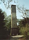 |
| Franzosenkopf | 562.0 | South Harz;
Harz NLP | Lonau | UA-OHA;
OHA | LS | | |
| Dietrichsberg | 5600
[11] | Upper Harz;
Harz NRP (LS) | Altenau,
Schulenberg | UA-GS;
GS | LS | Oker Reservoir;
Ravensklippen | |
| Gillenkopf | 558.2 | South Harz;
South Harz NRP | Birkenmoor,
Breitenstein | NMH,
MSH | TH,
S-A | S: Bere;
near: Neustadt Dam | |
| Ecksberg | 556.9 | Upper Harz;
Harz NRP (LS) | Lautenthal | UA-GS;
GS | LS | | |
Kontorkopf
(Höhenzug Hippeln) | 556.1 | Upper Harz;
Harz NLP,
Harz/S-A NRP | Wernigerode,
Hasserode | HZ | S-A | near: Steinerne Renne | |
| Wellbornskopf | 555.1 | Upper Harz,
Harz/S-A NRP | Drei Annen Hohne,
Hasserode,
Nöschenrode | HZ | S-A | Dam of the Zillierbach Reservoir | |
| Großer Staufenberg | 5540 | South Harz;
Harz NRP (LS) | Zorge | UA-OHA;
OHA | LS | Staufenberg NR;
S: Limbach | |
Kloppstert
(Klappstept),[12]
(Sieber) | 5530
[10] | South Harz;
Harz NRP (LS) | Sieber | UA-OHA;
OHA | LS | near: Siebertal NR | |
| Solberg | 552.9 | South Harz;
South Harz NRP | Netzkater,
Rothesütte | NMH | TH | | |
| Honigberg | 551.8 | South Harz;
South Harz NRP | Netzkater,
Rothesütte | NMH | TH | S: Fuhrbach | |
| Ortberg | 550.1 | Lower Harz;
Harz/S-A NRP | Elbingerode | HZ | S-A | Kunstbergschacht,
transmission tower;
Dam of the Zillierbach Reservoir | |
| Kleiner Steierberg | 548.9 | South Harz;
South Harz NRP | Rothesütte | NMH | TH | Pfaffenborn | |
| Stehlenberg | 548.7 | South Harz;
South Harz NRP | Rothesütte,
Sülzhayn | NMH | TH | S: Ellerbach,
S: Goldbrunnen | |
| Rabenkopf | 547.4 | South Harz;
South Harz NRP | Ilfeld,
Netzkater | NMH | TH | Brandesbachtal NR (north flank) | |
| Leckenkopf | 546.9 | Lower Harz;
Harz/S-A NRP | Stiege,
Birkenmoor | HZ,
NMH | S-A,
TH | | |
| Saxonyberg | 5460 | Upper Harz;
Harz NRP (LS) | Bad Harzburg | GS | LS | Reste einer Wallanlage,
Saxonystein,
near:Sennhütte inn | |
| Eichelnkopf | 545.7
[10] | South Harz;
Harz NRP (LS) | Scharzfeld,
Sieber | UA-OHA;
OHA | LS | Euleneiche,
S (near): Eichelnbach,
S (near): Eichelngraben |  |
| Pagelsburg | 5450
[13] | South Harz;
Harz NRP (LS) | Sieber | UA-OHA;
OHA | LS | | |
Meineberg
(Ilsenburg) | 544.5 | Upper Harz;
Harz NLP,
Harz/S-A NRP | Ilsenburg | HZ | S-A | Bäumlersklippe,
Froschfelsen | |
Butterberg
(Ilfeld) | 539.5 | South Harz;
South Harz NRP | Bahnhof Eisfelder Talmühle,
Birkenmoor | NMH | TH | | |
| Hagenberg | 538.6
[5] | South Harz;
South Harz NRP | Bahnhof Eisfelder Talmühle,
Birkenmoor,
Christianenhaus,
Netzkater | NMH | TH | | |
| Großer Hornberg | 537.6 | Lower Harz,
Harz/S-A NRP | Kalkwerk Hornberg halt (Rübeland Railway),
Königshütte | HZ | S-A | | |
Hohenstein
(Sülzhayn) | 536.3
[5] | South Harz;
South Harz NRP | Sülzhayn | NMH | TH | S: Ellerbach | |
Kummelberg
(Kummel) | 536.0 | Upper Harz;
Harz NRP (LS) | Bad Lauterberg | UA-OHA;
OHA | LS | Bismarck Tower,
Bad Lauterberg (OT),
Kummelbaude inn |  |
| Kapitelsberg | 535.7
| Lower Harz;
Harz/S-A NRP | Tanne | HZ | S-A | near:Harzer Bachtäler NR | |
| Eulenkopf | 534.5
[5] | South Harz;
South Harz NRP | Netzkater,
Rothesütte | NMH | TH | | |
Kleiner Brocken
(Breitenstein) | 533.1 | Lower Harz;
Harz/S-A NRP | Breitenstein | MSH | S-A | S Harz Karst Landscape BR;
S: Lude | |
Mittelberg
(Herrmannsacker) | 533.0 | South Harz;
South Harz NRP,
Harz/S-A NRP | Herrmannsacker,
Neustadt,
Hainfeld | NMH,
NMH,
MSH | TH,
TH,
S-A | near: S Harz Karst Landscape BR;
Neustadt Dam | |
Großer Mittelberg
(Lonau) | 531.0 | South Harz;
Harz NLP | Lonau | UA-OHA;
OHA | LS | | |
| Großer Hengstrücken | 530.8
[5] | South Harz;
South Harz NRP | Netzkater,
Rothesütte | NMH | TH | | |
Heidelberg
(Neustadt) | 527.5 | South Harz;
South Harz NRP | Neustadt,
Birkenmoor | NMH,
NMH | TH,
TH | Neustadt Dam | |
| Fissenkenkopf | 527.0 | South Harz;
Harz NRP (LS) | Sieber | UA-OHA;
OHA | LS | near: Siebertal NR | |
Oberer Großer Balkenberg
(…Bakenberg) | 526.4 | Upper Harz,
Harz NRP (LS) | Hahausen | UA-GS;
GS | LS | S: Gr. Steimker Bach,
S: Hummecke | |
| Stahlberg | 525.2 | Lower Harz;
Harz/S-A NRP | Rübeland | HZ | S-A | Ex: Grube Stahlberg | |
Bielstein
(Wernigerode) | 5250[3] | Upper Harz;
Harz/S-A NRP | Wernigerode,
Hasserode | HZ | S-A | near: Steinerne Renne | |
Steinberg
(Hasserode) | 5250 | Upper Harz;
Harz/S-A NRP | Hasserode,
Wernigerode | HZ | S-A | near: Elversstein | |
| Heiligenberg | 524.7
[3] | South Harz;
South Harz NRP | Sülzhayn | NMH | TH | | |
| Burgbeil | 524.2 | Lower Harz;
Harz/S-A NRP | Breitenstein,
Hainfeld | MSH | S-A | S Harz Karst Landscape BR;
S: Lude;
S (near): Katzsohlbach | |
| Hahnenberg | 520.3 | Upper Harz;
Harz NRP (LS) | Goslar,
Oker | UA-OHA;
GS | LS | Hauenschildklippe | |
Eichenberg
(Hasselfelde) | 5200 | Lower Harz;
Harz/S-A NRP | Hasselfelde | HZ | S-A | Eichenberg NR,
near: Präzeptorklippe;
Dam of the Rappbode Reservoir | |
Steile Wand
(q. v.: Steile Wand
on the Bruchberg) | 518.9 | South Harz;
Harz NRP (LS) | Herzberg,
Sieber | UA-OHA;
OHA | LS | near: Siebertal NR | |
| Scheffeltalsköpfe | 518.0 | South Harz;
Harz NRP (LS) | Bad Lauterberg | UA-OHA;
OHA | LS | S (near): Heibeek | |
| Großer Stemberg | 517.1 | Lower Harz;
Harz/S-A NRP | Altenbrak,
Hasselfelde | HZ | S-A | Dam of the Rappbode Reservoir,
Oberbecken of the PSW Wendefurth | |
| Sandlünz | 516.2 | South Harz;
South Harz NRP | Ilfeld,
Netzkater | NMH | TH | Brandesbachtal NR(north and northwest flanks),
Dreitälerblick OP,
Rabensteiner Stollen(visitor mine) | |
Hartenberg
(Büchenberg) | 516.0 | Lower Harz;
Harz/S-A NRP | Elbingerode,
Hartenberg | HZ | S-A | Hartenberg-Freizeitwohngebiet
Büchenberg-Siedlung,
Büchenberg Pit (show mine)
S: Teufelsbach | |
| Langer Berg | 515.9 | South Harz;
South Harz NRP | Sülzhayn | NMH | TH | | |
| Bastkopf | 513.0 | Lower Harz,
Harz/S-A NRP | Königshütte,
Neue Hütte | HZ | S-A | near: Dam of the Mandelholz Reservoir | |
| Kleiner Schumannsberg | 512.0
[3] | South Harz;
South Harz NRP | Haltepunkt Tiefenbachmühle,
Sophienhof | NMH | TH | | |
| Kaulberg | 511.7 | South Harz;
South Harz NRP | Ilfeld | NMH | TH | | |
Sattelkopf
(q. v. Sattelköpfe) | 510.4 | South Harz;
South Harz NRP | Netzkater,
Rothesütte | NMH | TH | | |
Rabensteine
(q. v.: Rabenstein
near Königshütte) | 5100 | Lower Harz;
Harz/S-A NRP | Hasselfelde | HZ | S-A | near: Rabenklippen
(Gr. and Kl. Rabenklippe);
Dam of the Hassel Forebay,
TSP Rappbode Forebay,
TSP Rappbode Reservoir | |
Steinköpfe
(Friedrichsbrunn)
southern Steinkopf:
northern Steinkopf: | 507.6
507.6
488.0 | Ramberg;
Harz/S-A NRP | Friedrichsbrunn,
Thale | HZ | S-A | | |
Hoppelberg
(Hasselfelde) | 507.5 | Lower Harz-N;
Harz/S-A NRP | Hasselfelde | HZ | S-A | Pullman City Harz;
Dam of the Hasselvorsperre,
TSP Rappbode Reservoir | |
| Hilmersberg | 507.0 | Upper Harz;
Harz/S-A NRP | Wernigerode,
Elbingerode | HZ | S-A | | |
| Kesselberg | 507.0 | South Harz;
South Harz NRP | Sülzhayn | NMH | TH | | |
| Osterkopf | 505.9 | Lower Harz;
Harz/S-A NRP | Breitenstein,
Harzine | MSH | S-A | | |
Rotestein
(Roter Stein) | 5050 | Lower Harz;
Harz/S-A NRP | Hasselfelde | HZ | S-A | Dam of the Rappbode Reservoir | |
| Netzberg | 504.8 | South Harz;
South Harz NRP | Ilfeld,
Netzkater | NMH | TH | Dühringsklippe
(Südostkuppe) |  |
| Roter Schuss | 504.6 | South Harz;
South Harz NRP | Sülzhayn | NMH | TH | | |
| Käseberg | 5040
[6] | South Harz;
Harz NRP (LS) | Wieda | OHA | LS | | |
| Knicking | 501.1 | South Harz;
Harz NRP (LS) | Wieda | OHA | LS | | |
| Ettersberg | 500.1 | Upper Harz;
Harz NLP | Bad Harzburg | GS | LS | Ettersklippe,
Forsthaus Radauberg,
near: Sennhütte inn | |
| Mittelecke | 500.1 | South Harz;
Harz NRP (LS) | Sieber,
Bad Lauterberg | UA-OHA;
OHA | LS | Lübbersbuche,
S: Eichelnbach,
S: Eichelngraben | |
Rabenstein
(q. v.: Rabensteine
near Hasselfelde) | 499.1 | Lower Harz,
Harz/S-A NRP | Königshütte | HZ | S-A | Königshütte Waterfall | |
| Peterstein | 498.0 | Lower Harz;
Harz/S-A NRP | Elbingerode,
Nöschenrode | HZ | S-A | Dam of the Zillierbach Reservoir | |
| Großer Schumannsberg | 497.2 | South Harz;
South Harz NRP | Bahnhof Eisfelder Talmühle,
Sophienhof | NMH | TH | | |
| Bockberg | 496.0 | Lower Harz,
Harz/S-A NRP | Königshütte,
Neue Hütte | HZ | S-A | Bockberg NR;
near: Königshütte Dam | |
Kleiner Ronneberg
(q. v. Kleiner Rönneberg) | 495.9 | Lower Harz;
Harz/S-A NRP | Hainfeld | MSH | S-A | S Harz Karst Landscape BR,
near: Großer Ronneberg-Bielstein NR | |
Eichenberg
(Zorge) | 495.1 | South Harz;
Harz NRP (LS) | Wieda,
Zorge | UA-OHA;
OHA | LS | | |
Birkenkopf
(Thale) | 4950
[3] | Ramberg;
Harz/S-A NRP | Thale,
Friedrichsbrunn | HZ | S-A | near: Bode Gorge NR,
near: Wilhelm Pfeil Monument,
not far from: Hexentanzplatz | |
| Kohlenberg | 4950
[3] | Lower Harz;
Harz/S-A NRP | Wendefurth | HZ | S-A | Dam of the Rappbode Reservoir,
Wendefurth Reservoir TSP,
Upper basin of Wendefurth PSW | |
Sankt Andreasberg
(Goslar) | 494.0 | Upper Harz;
Harz NRP (LS) | Goslar | GS | LS | Margaretenklippen | |
| Totenkopf | 492.6
[3] | South Harz;
South Harz NRP | Appenrode,
Rothesütte | NMH | TH | | |
| Großer Teichtalskopf | 4920
[5] | South Harz;
Harz NLP,
Harz NRP (LS) | Herzberg,
Lonau | UA-OHA;
OHA | LS | near: Siebertal NR |  |
| Ampenberg | 488.8 | Lower Harz;
Harz/S-A NRP | Straßberg,
Breitenstein | HZ | S-A | | |
| Nickelsberg | 488.2 | Lower Harz;
Harz/S-A NRP | Hasselfelde,
Neuwerk | HZ | S-A | Tunnel der L 96;
Dam of the Rappbode Reservoir,
TSP Wendefurth Reservoir | |
Eichenberg
(Bad Harzburg) | 485.8 | Upper Harz;
Harz NLP;
Harz NRP (LS) | Bad Harzburg | GS | LS | | |
| Großer Burgberg | 4850
[9] | Upper Harz;
Harz NRP (LS) | Bad Harzburg | GS | LS | Harzburg ruins,
Canossa
column,
Burgberg Cable Car |  |
Voßtaler Berg
(Vosstaler Berg) | 484.5 | Upper Harz,
Harz NRP (LS) | Hahausen,
Langelsheim | UA-GS;
GS | LS | S: Kl. Steimker Bach | |
| Kühnenkopf | 480.8 | Upper Harz;
Harz/S-A NRP | Wernigerode | HZ | S-A |
| |
| Höhe | 479.2 | Lower Harz;
Harz/S-A NRP | Dietersdorf | MSH | S-A | S Harz Karst Landscape BR | |
Bielstein
(Hainfeld)
Großer Bielstein:
Kleiner Bielstein:
| 478.7
478.7
470.5 | Lower Harz;
Harz/S-A NRP | Hainfeld,
Rodishain | MSH,
NMH | S-A,
TH | S Harz Karst Landscape BR,
Großer Ronneberg-Bielstein NR | |
| Steinbergkopf | 478.5 | Upper Harz;
Harz/S-A NRP | Hasserode,
Wernigerode | HZ | S-A | near: Elversstein | |
| Armeleuteberg | 477.8 | Upper Harz;
Harz/S-A NRP | Wernigerode | HZ | S-A | Kaiserturm OT,
Armeleuteberg inn |  |
| Kulmer Berg | 476.7 | Lower Harz;
Harz/S-A NRP | Schwenda | MSH | S-A | S Harz Karst Landscape BR | |
Pferdekopf
(Stolberg) | 476.3 | Lower Harz;
Harz/S-A NRP | Stolberg | MSH | S-A | S Harz Karst Landscape BR,
Pferdekopf NR | |
| Schimmelshütchen | 475.9
[3] | South Harz;
South Harz NRP | Sülzhayn | NMH | TH | | |
| Katzenberg | 475.8 | Lower Harz;
Harz/S-A NRP | Königshütte | HZ | S-A | near: Ruins of Königsburg | |
| Elfenstein | 4750
[9] | Upper Harz;
Harz NRP (LS) | Bad Harzburg | UA-GS;
GS | LS | Elfenstein
(Felsformation/-klippen) | |
Ilsestein
(Ilsenstein) | 473.2 | Upper Harz;
Harz NLP,
Harz/S-A NRP | Ilsenburg | HZ | S-A | Site of a former siege castle (Trutzburg) |  |
Unterer Großer Balkenberg
(…Bakenberg) | 472.2 | Upper Harz,
Harz NRP (LS) | Hahausen | UA-GS;
GS | LS | S: Hummecke | |
| Heuer | 4720
[10] | South Harz;
Harz NLP | Lonau | UA-OHA;
OHA | LS | S Faulborn | |
Steinberg
(Goslar) | 4720 | Upper Harz;
Harz NRP (LS) | Steinberg | GS | LS | Steinberg Tower (OT)
near:Dam of the Grane Reservoir |  |
Kuhberg
(Hüttenrode) | 469.2 | Lower Harz;
Harz/S-A NRP | Hüttenrode,
Wendefurth | HZ | S-A | near: Dam of the Wendefurth Reservoir | |
Thumkuhlenköpfe
(Thumkuhlenkopf) | 468.5 | Upper Harz;
Harz/S-A NRP | Hasserode | HZ | S-A | Thumkuhlenkopf Tunnel (Harzquerbahn) | |
| Fenstermacherberg | 466.5 | Lower Harz;
Harz/S-A NRP | Wernigerode | HZ | S-A | | |
| Kleiner Dambachskopf | 465.5 | Ramberg;
Harz/S-A NRP | Thale,
Treseburg | HZ | S-A | near: S: Dambach | |
| Großer Heibeekskopf | 465.2 | South Harz;
Harz NRP (LS) | Bad Lauterberg | UA-OHA;
OHA | LS | S: Augenquelle,
S: Heibeek | |
Großer Ronneberg
(q. v. Großer Rönneberg) | 465.2 | Lower Harz;
Harz/S-A NRP | Hainfeld,
Herrmannsacker,
Rodishain | MSH,
NMH,
NMH | S-A,
TH,
TH | S Harz Karst Landscape BR,
Großer Ronneberg-Bielstein NR | |
| Sülzberg | 464.8
[3] | South Harz;
South Harz NRP | Sülzhayn | NMH | TH | | |
Scharfenstein
(Wernigerode) | 462.4 | Upper Harz;
Harz/S-A NRP | Wernigerode | HZ | S-A | Scharfensteinklippe | |
| Hegersberg | 461.6 | South Harz;
South Harz NRP | Appenrode | NMH | TH | | |
Gallenberg
(eastern spur of the Hasenberg) | 460.6 | Upper Harz;
Harz NRP (LS) | Wildemann | GS | LS | Wildemann Tunnel
(Gallenberg Tunnel)
(Innerstetalbahn) | |
| Ochsenkopf | 460.3
[3] | South Harz;
South Harz NRP | Netzkater | NMH | TH | S: Leimbach | |
Langenberg
(Neudorf) | 458.8 | Lower Harz;
Harz/S-A NRP | Neudorf, Saxony-Anhalt | HZ | S-A | near: Kalbsaugenteich | |
Heimberg
(Güntersberge) | 458.4 | Lower Harz,
Harz/S-A NRP | Güntersberge | HZ | S-A | Site of Heimberg castle | |
| Hexentanzplatz | 457.7 | Lower Harz;
Harz/S-A NRP | Thale,
Königsruhe | HZ | S-A | Bode Gorge NR,
Bode Valley Cable Car,
Berghotel,
Thale Mountain Theatre,
Valpurgis Hall Museum,
Saxon Dyke (Sachsenwall) ruins,
summer rodelbahn,
wildlife park |  |
| Scharfenberg | 457.6
[3] | South Harz;
South Harz NRP | Sülzhayn | NMH | TH | | |
Hoher Kopf
(NNE of Questenberg) | 457.0 | Lower Harz;
Harz/S-A NRP | Breitenbach,
Rotha,
Questenberg | MSH | S-A | S Harz Karst Landscape BR,
Questenberg Gypsum Karst Landscape NR;
S: Dinsterbach,
S: Nasse | |
Schieferberg
(Neuwerk) | 456.2 | Lower Harz;
Harz/S-A NRP | Hüttenrode,
Neuwerk,
Wendefurth | HZ | S-A | Schieferberg NR;
Dam of the Wendefurth Reservoir | |
| Hirschbuchenkopf | 456.1 | Lower Harz;
Harz/S-A NRP | Güntersberge,
Siptenfelde,
Straßberg | HZ | S-A | Upper
Selke Valley NR | |
| Großer Dambachskopf | 454.3 | Ramberg;
Harz/S-A NRP | Thale,
Treseburg | HZ | S-A | near: Bode Gorge NR,
near: Wilhelm Pfeil Monument,
Dambachhaus Forester's House | |
Königsberg
(Goslar) | 454
[5] | Upper Harz;
Harz NRP (LS) | Goslar | GS | LS | Dam of the Grane Reservoir |  |
| Kirchhofsberg | 452.3 | Lower Harz;
Harz/S-A NRP | Wendefurth | HZ | S-A | Dam of the Wendefurth Reservoir,
Oberbecken of the PSW Wendefurth | |
| Dankeröder Berg | 449.2 | Lower Harz;
Harz/S-A NRP | Dankerode,
Neudorf | HZ | S-A | S (near): Schmale Wipper | |
| Hübichenstein | 448.5 | Upper Harz;
Harz NRP (LS) | Bad Grund | OHA | LS | Emperor William I Monument
with bronze eagle
at the top |  |
Steinköpfe
(Benneckenrode) | 446.1 | Lower Harz;
Harz/S-A NRP | Benneckenrode,
Thale,
Treseburg | HZ | S-A | Steinköpfe NR,
near: Bibrakreuz | |
| Wendefurther Berg | 446.1 | Lower Harz;
Harz/S-A NRP | Wendefurth | HZ | S-A | near: Dam of the Wendefurth Reservoir | |
| Stapenberg | 443.4 | Upper Harz;
Harz/S-A NRP | Benzingerode | HZ | S-A | | |
| Kleiner Romke | 441.7 | Upper Harz;
Harz NRP (LS) | Goslar,
Schulenberg | GS | LS | Romkerhall Waterfall,
near:Romkerhall inn,
near: Romkerhalle HS | |
| Silberkopf | 441.4 | South Harz;
South Harz NRP | Ilfeld | NMH | TH | S: Silberbach | |
| Kleiner Heibeekskopf | 440.1 | South Harz;
Harz NRP (LS) | Bad Lauterberg | UA-OHA;
OHA | LS | S: Augenquelle | |
| Roßtrappenberg | 438.7
[3] | Lower Harz;
Harz/S-A NRP | Thale,
Königsruhe | HZ | S-A | near: Bibrakreuz,
Bode Gorge NR,
Roßtrappe (Klippe),
Sessellift Thale,
Winzenburg (Ex-Fliehburg),
Winzenburgturm OT,
Berghotel Rosstrappe | |
| Harburg | 438.2 | Upper Harz;
Harz/S-A NRP | Wernigerode | HZ | S-A | Site of Harburg Castle,
inn (currently closed),
former Wernigerode Bismarck Monument |  |
| Kleiner Burgberg | 436.5
[14] | Upper Harz;
Harz NRP (LS) | Bad Harzburg | GS | LS | Ruins of Kleine Harzburg | |
Armsberg
(Wendefurth) | 435.2 | Lower Harz;
Harz/S-A NRP | Wendefurth | Hz | S-A | near: Dam of the Wendefurth Reservoir | |
| Staufenberg | 433.8 | Lower Harz;
Harz/S-A NRP | Blankenburg | HZ | S-A | Michaelstein station(Rübeland Railway),
near: Ex Bielstein Tunnel
(Rübeland Railway) | |
Eichberg
(Straßberg) | 430.6 | Lower Harz;
Harz/S-A NRP | Straßberg | HZ | S-A
| | |
Sösekopf
(Sösenkopf) | 423.1 | Upper Harz,
Harz NRP (LS) | Osterode | OHA | LS | Dam of the Söse Reservoir | |
Hausberg
(q. v. Großer Hausberg) | 4200[9] | Upper Harz;
Harz NRP (LS) | Bad Lauterberg | OHA | LS | Lutterberg Castle ruins,
Bad Lauterberg Cable Car,
Hausberg inn | 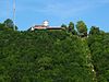 |
| Kleiner Staufenberg | 420 | South Harz;
Harz NRP (LS) | Zorge | UA-OHA;
OHA | LS | Staufenberg NR,
Jungfernklippe NM,
Staufenburg CD | |
Eichenberg
(Blankenburg) | 416.0 | Lower Harz;
Harz/S-A NRP | Blankenburg | HZ | S-A | Wilhelm Raabe Tower (OT) |  |
| Staufenbüttel | 408.1 | South Harz;
Harz NRP (LS) | Bad Sachsa,
Steina | OHA | LS | transmission tower | |
| Ziegenkopf | 406.1
[3] | Lower Harz;
Harz/S-A NRP | Blankenburg,
Hüttenrode | HZ | S-A | Ziegenkopfturm OT,
Ziegenkopf inn |  |
Bielstein
(Blankenburg) | 4050 | Lower Harz;
Harz/S-A NRP | Blankenburg | HZ | S-A | near: Ex Bielstein Tunnel (Rübelandbahn),
near: Bielsteinklippe | |
| Schloßberg | 402.9 | South Harz;
South Harz NRP | Neustadt | NMH | TH | Hohnstein Castle ruins |  |
| Forstköpfe | 402.4 | South Harz;
South Harz NRP | Werna | NMH | TH | | |
| Ramsenberg | 400.6 | Mansfeld L.;
Harz/S-A NRP | Gorenzen,
Grillenberg,
Wippra | MSH | S-A | S Harz Karst Landscape BR,
near: Pferdeköpfe Pass;
S: Hagenbach,
S: Sengelbach | |
Großer Mittelberg
(Ellrich) | 400.1 | South Harz;
South Harz NRP | Ellrich,
Sülzhayn | NMH | TH | | |
| Schalkenburg | 400.1 | Lower Harz;
Harz/S-A NRP | Alexisbad,
Mägdesprung | HZ | S-A | Köthener Hütte
(Schutzhütte on the Kapellenfelsen),
Upper Selke Valley NR | |
| Frauenstein | 4000 | South Harz;
Harz NRP (LS) | Scharzfeld | UA-OHA;
OHA | LS | auf Nachbar-Bergsporn:
Scharzfels Castle ruins | |
Großer Hausberg
(q. v. Hausberg) | 397.9 | Upper Harz;
Harz/S-A NRP | Mägdesprung,
Meisdorf | HZ | S-A | Anhalt Castle ruins,
Upper Selke Valley NR |  |
| Agnesberg | 395.1 | Upper Harz;
Harz/S-A NRP | Wernigerode | HZ | S-A | Altar of Truth
(Altar der Wahrheit),
near, on the Burgberg:
Wernigerode Castle | |
| Salzberg | 394.4 | Lower Harz;
Harz/S-A NRP | Blankenburg | HZ | S-A | near: Michaelstein Abbey;
S: Schmerlenbach | |
| Müncheberg | 392.5 | South Harz;
South Harz NRP | Appenrode | NMH | TH | | |
| Hagedornsberg | 391.1
[3] | Lower Harz;
Harz/S-A NRP | Treseburg | Harz | S-A | near: Bode Gorge,
near: Sonnenklippe | |
| Brandköpfe | 3910 | South Harz;
Harz NRP (LS) | Scharzfeld | UA-OHA;
OHA | LS | Unicorn Cave (NM) | |
Braunkohlberg
(Braunekohlberg) | 388.0
[3] | Upper Harz;
Harz/S-A NRP | Hasserode,
Wernigerode | HZ | S-A | | |
Burgberg
(Herrmannsacker) | 387.5
[3] | South Harz;
South Harz NRP | Herrmannsacker | NMH | TH | Ebersburg ruins |  |
| Zankköpfe | 387.1 | South Harz;
South Harz NRP | Werna | NMH | TH | | |
| Großer Dörnsenberg | 386.4 | South Harz;
South Harz NRP | Ellrich | NMH | TH | | |
| Heidberg | 386.2 | South Harz;
South Harz NRP | Ellrich,
Sülzhayn | NMH | TH | | |
Butterberg
(Bad Lauterberg) | 3790 | Harz Foreland-S | Bad Lauterberg | OHA | LS | Süd- and Südostflanke:Butterberg/Hopfenbusch NR | |
| Amelungskopf | 378.6 | Upper Harz;
Harz/S-A NRP | Wernigerode | HZ | S-A | Zwölfmorgentalschanzen | |
| Hohe Warte | 3750
[3] | Mansfeld L.;
Harz/S-A NRP | Ballenstedt | HZ | S-A | Ex: watchtower site | |
| Sackberg | 374.4
[3] | South Harz;
South Harz NRP | Sülzhayn | NMH | TH | | |
| Pufferberg | 373.3 | Lower Harz;
Harz/S-A NRP | Annarode,
Pölsfeld | MSH | S-A | S Harz Karst Landscape BR,
Pölsfeld Gypsum Karst Landscape NR | |
Ziegenberg
(Braunschwende) | 371.2 | Lower Harz | Braunschwende | MSH | S-A | Ziegenberg NR | |
Schloßkopf
(Neustadt) | 371.1 | South Harz;
South Harz NRP | Neustadt | NMH | TH | | |
| Hirschplatte | 364.2 | Mansfeld L.;
Harz/S-A NRP | Mägdesprung,
Meisdorf,
Pansfelde | HZ | S-A | near: Selke Valley NR,
near: Site of Old Falkenstein Castle | |
| Mühlberg | 363.8 | South Harz;
South Harz NRP | Appenrode | NMH | TH | | |
Eichenberg
(Herrmannsacker) | 363.2 | South Harz;
South Harz NRP | Herrmannsacker | NMH | TH | near: Iberg Dam (FRB) | |
| Kleiner Teichtalskopf | 3620
[5] | South Harz;
Harz NLP,
Harz NRP (LS) | Herzberg | UA-OHA;
OHA | LS | Siebertal NR | |
| Königskopf | 357.7 | Alter Stolberg;
South Harz NRP | Stempeda | NMH | TH | Alter Stolberg NR |  |
Kakemieke
(Kakemike) | 356.4
[3] | Upper Harz;
Harz/S-A NRP | Wernigerode | HZ | S-A | | |
Burgberg
(Stecklenberg) | 356.1
[3] | Ramberg;
Harz/S-A NRP | Stecklenberg | HZ | S-A | Kleine and Große
Ruins of Lauenburg,
near: Ruins of Stecklenburg,
near: Geroldsklippen |  |
Burgberg
(Gernrode) | 3550
[3] | Ramberg;
Harz/S-A NRP | Gernrode | HZ | S-A | Ruins of Heinrichsburg | |
Heimberg
(Wolfshagen) | 352.5
[9] | Upper Harz,
LS | Wolfshagen | UA-GS;
GS | LS | Former diabase quarry | |
| Calviusberg | 352.4 | Lower Harz;
Harz/S-A NRP | Blankenburg | HZ | S-A | Ruins of Luisenburg | |
Hoher Kopf
(Roßla) | 332.0 | Lower Harz;
Harz/S-A NRP | Roßla,
Breitungen | MSH | S-A | S Harz Karst Landscape BR,
Questenberg Gypsum Karst Landscape NR;
near: transmission tower | |
| Buchholzer Berg | 350.0 | Rüdigsdorf S.;
South Harz NRP | Buchholz,
Petersdorf | NMH | TH | | |
| Mettenberg | 347.5 | Mansfeld L.;
Harz/S-A NRP | Meisdorf,
Ballenstedt | HZ | S-A | | |
| Kleiner Mittelberg | 346.2 | South Harz;
South Harz NRP | Ellrich,
Sülzhayn | NMH | TH | | |
| Römerstein | 345.0 | South Harz;
Harz NRP (LS) | Bad Sachsa,
Tettenborn | OHA | LS | Weißensee and Steinatal NR (with Nussteich, Weißensee and Steinaer Bachtal) | |
| Ratskopf | 343.2
[3] | Upper Harz;
Harz/S-A NRP | Wernigerode | HZ | S-A | | |
| Geiersberg | 339.8 | Lower Harz;
Harz/S-A NRP | Breitungen,
Rosperwenda,
Uftrungen | MSH | S-A | near:Questenberg Gypsum Karst Landscape NR | |
Langenberg
(Walkenried) | 3390
[6] | South Harz;
Harz NRP (LS),
South Harz NRP | Walkenried,
Ellrich | OHA,
NMH | LS,
TH | transmission tower,
near: Gipskarstlandschaft Bad Sachsa and Walkenried Gypsum Karst Landscape NR,
near: Itelteich NR,
near: Juliushütte NR;
near: Itelteich | |
Falkenstein
(Pansfelde) | 335.6 | Mansfeld L.;
Harz/S-A NRP | Mägdesprung,
Meisdorf,
Pansfelde | HZ | S-A | Site of Old Falkenstein Castle | |
| Kohnstein | 334.9 | South Harz;
South Harz NRP | Herreden,
Hörningen,
Krimderode,
Niedersachswerfen,
Nordhausen | NMH | TH | Bergbau,
Mittelbau-Dora Concentration Camp memorial site |  |
| Blankenstein | 3340
[5] | Lower Harz;
Harz/S-A NRP | Blankenburg | HZ | S-A | Blankenburg Castle |  |
Hoher Kopf
(east of Questenberg) | 332.0 | Lower Harz;
Harz/S-A NRP | Hainrode,
Questenberg | MSH | S-A | S Harz Karst Landscape BR,
Questenberg Gypsum Karst Landscape NR | |
Heidelberg
(Blankenburg)
(Part of the Teufelsmauer) | 331.5 | Lower Harz;
Harz/S-A NRP | Blankenburg | HZ | S-A | Teufelsmauer | |
| Reesberg | 325.2 | Alter Stolberg;
South Harz NRP,
Harz/S-A NRP | Uftrungen,
Urbach | NMH
MSH | TH
S-A | Heimkehle Gypsum Karst Landscape NR,
Heimkehle Cave | |
Alte Burg
(Alteburg)
(Gernrode) | 3250
[3] | Ramberg;
Harz/S-A NRP | Gernrode,
Rieder | HZ | S-A | Site of the "Old Castle"
(Alte Burg),
Alte Burg NR | |
Butterberg
(Bad Harzburg) | 3250
[9] | Upper Harz | Bad Harzburg | GS | LS | Butterberggelände NR;
transmission tower | |
| Junkerberg | 324.0 | Harz Foreland-S;
South Harz NRP | Hörningen,
Mauderode | NMH | TH | | |
| Weidenberg | 322.9 | Rüdigsdorf S.;
South Harz NRP | Rüdigsdorf | NMH | TH | Rüdigsdorf Switzerland NR | |
| Ankenberg | 321.1 | Lower Harz;
Harz/S-A NRP | Drebsdorf,
Großleinungen,
Hainrode | MSH | S-A | S Harz Karst Landscape BR,
Questenberg Gypsum Karst Landscape NR | |
Kleiner Balkenberg
(…Bakenberg) | 321.1 | Upper Harz,
Harz NRP (LS) | Hahausen | UA-GS;
GS | LS | | |
Sattelköpfe
(q. v. Sattelkopf) | 320.7 | Harz Foreland-S;
South Harz NRP | Hörningen,
Woffleben | NMH | TH | Sattelköpfe NR
(Hörninger Kuppen) | |
| Ölbergshöhe | 320.6 | Mansfeld L.;
Harz/S-A NRP | Bad Suderode,
Gernrode | HZ | S-A | Preußenturm OT
(Ex: Thomas-Müntzer-Turm; on the Schwedderberg) | |
| Großer Buchberg | 320.4 | Lower Harz;
Harz/S-A NRP | Drebsdorf,
Großleinungen,
Wallhausen | MSH | S-A | S Harz Karst Landscape BR | |
Falkenstein
(Meisdorf) | 3200 | Mansfeld L.;
Harz/S-A NRP | Mägdesprung,
Meisdorf,
Pansfelde | HZ | S-A | Falkenstein Castle |  |
| Sandkopf | 317.6 | South Harz;
South Harz NRP | Appenrode | NMH | TH | | |
Harzrigi
(Petersdorfer Berg) | 316.6 | Rüdigsdorf S.;
South Harz NRP | Petersdorf | NMH | TH | Harz-Rigi inn,
transmission tower | |
Ziegenberg
(Heimburg) | 315.7 | Harz Foreland-N;
Harz/S-A NRP | Benzingerode,
Heimburg | HZ | S-A
| Ziegenberg bei Heimburg NR | |
Burgberg
(Ilfeld) | 312.9 | South Harz;
South Harz NRP | Ilfeld | NMH | TH | Ilburg ruins |  |
Eichenberg
(Petersdorf) | 310.7 | Rüdigsdorf S.;
South Harz NRP | Petersdorf | NMH | TH | | |
Schlößchenkopf
(Sangerhausen) | 310.3 | Lower Harz;
Harz/S-A NRP | Lengefeld,
Sangerhausen | MSH | S-A | S Harz Karst Landscape BR,
Moltkewarte OT |  |
Hoppelberg
(Langenstein) | 307.9 | Harz Foreland-N;
Harz/S-A NRP | Börnecke,
Langenstein | HZ | S-A | Hoppelberg NR | |
Butterberg
(Sangerhausen) | 307.6 | Lower Harz;
Harz/S-A NRP | Großleinungen,
Sangerhausen | MSH | S-A | S Harz Karst Landscape BR | |
Ziegenberg
(Ballenstedt) | 306.1
[3] | Mansfeld L.;
Harz/S-A NRP | Ballenstedt | HZ | S-A | Kunstteich Ballenstedt,
TSP Hirschteich | |
| Struvenberg | 305.7 | Harz Foreland-N;
Harz/S-A NRP | Benzingerode,
Heimburg | HZ | S-A | Site of Struvenburg Castle,
Ziegenberg bei Heimburg NR |  |
| Friedrichshohenberg | 305.3 | Mansfeld L.;
Harz/S-A NRP | Endorf,
Ermsleben,
Meisdorf,
Neuplatendorf | HZ | S-A | Friedrichshohenberg NR | |
| Karrberg | 304.1 | Upper Harz;
Harz/S-A NRP | Darlingerode,
Drübeck | HZ | S-A | | |
Kuhberg
(Rüdigsdorf) | 302.7 | Rüdigsdorf S.;
South Harz NRP | Rüdigsdorf | NMH | TH | Rüdigsdorf Switzerland NR | |
| Pfennigsberg | 300.3 | Rüdigsdorf S.;
South Harz NRP | Petersdorf | NMH | TH | | |
Butterberg
(Osterode) | 3000 | Upper Harz | Osterode | OHA | LS | Butterberg Tunnel (B 241),
near: Alte Burg | |
| Bornberg | 295.5 | Rüdigsdorf S.;
South Harz NRP | Rüdigsdorf | NMH | TH | Rüdigsdorf Switzerland NR | |
| Lichte Höhe | 295.5 | Rüdigsdorf S.;
South Harz NRP | Rüdigsdorf | NMH | TH | | |
| Regenstein | 293.9 | Harz Foreland-N;
Harz/S-A NRP | Blankenburg,
Heimburg | HZ | S-A | Ruins of Regenstein Castle |  |
Austberg
(Augsberg/Augstberg) | 292.0 | Harz Foreland-N;
Harz/S-A NRP | Benzingerode | HZ | S-A | Austbergturm OT
(Augs-/Augstbergturm) |  |
| Zinkenberg | 290.5 | Alter Stolberg;
South Harz NRP | Leimbach,
Steigerthal | NMH | TH | | |
| Haardtberg | 286.8 | Lower Harz;
Harz/S-A NRP | Kleinleinungen,
Wickerode | MSH | S-A | S Harz Karst Landscape BR,
Questenberg Gypsum Karst Landscape NR | |
Armsberg
(Wickerode) | 281.8 | Lower Harz;
Harz/S-A NRP | Wickerode | MSH | S-A | S Harz Karst Landscape BR,
Questenberg Gypsum Karst Landscape NR | |
Burgberg
(Heimburg) | 280.9[3] | Harz Foreland-N;
Harz/S-A NRP | Heimburg | HZ | S-A | Ruins of Heimburg
(Alteburg, Altenburg) | |
Burgberg
(Questenberg) | 2800 | Lower Harz;
Harz/S-A NRP | Questenberg | MSH | S-A | S Harz Karst Landscape BR,
Questenberg Gypsum Karst Landscape NR,
Questenberg Castle ruins,
near<!—other side of the Nasse valley-->: Queste |  |
Butterberg
(Ilsenburg) | 2800
[15] | Harz Foreland-N;
Harz/S-A NRP | Ilsenburg,
Drübeck | HZ | S-A | | |
Distelkopf
(Schableite) | 278.9 | Alter Stolberg;
South Harz NRP,
Harz/S-A NRP | Urbach,
Uftrungen | NMH
MSH | TH
S-A | near:Heimkehle Gypsum Karst Landscape NR,
near: Heimkehle gypsum cave;
S: Lohbach | |
| Stöckey | 277.8 | Rüdigsdorf S.;
South Harz NRP | Krimderode | NMH | TH | Rüdigsdorf Switzerland NR | |
| Glockenstein | 273.2 | Rüdigsdorf S.;
South Harz NRP | Niedersachswerfen | NMH | TH | | |
| Danielskopf | 272.6 | Rüdigsdorf S.;
South Harz NRP | Krimderode | NMH | TH | Rüdigsdorf Switzerland NR | |
| Stahlsberg | 270.6
[16] | Mansfeld L.;
Harz/S-A NRP | Ballenstedt,
Opperode | HZ | S-A | Ballenstedt Bismarck Tower OT | |
| Lustberg | 267.5 | Harz Foreland-N;
Harz/S-A NRP | Wernigerode,
Charlottenlust | HZ | S-A | | |
Iberg
(Herrmannsacker) | 2650 | South Harz;
South Harz NRP | Herrmannsacker | NMH | TH | Iberg Dam (FRB) | |
| Sichelberg | 263.0 | Rüdigsdorf S.;
South Harz NRP | Krimderode,
(Ellersiedlung) | NMH | TH | Rüdigsdorf Switzerland NR | |
Großer Rönneberg
(q. v. Großer Ronneberg) | 257.6 | Harz Foreland-N;
Harz/S-A NRP | Blankenburg,
Börnecke | HZ | S-A | | |
| Brommelsberg | 256.3 | Rüdigsdorf S.;
South Harz NRP | Nordhausen | NMH | TH | | |
| Saßberg | 256.0 | Harz Foreland-N;
Harz/S-A NRP | Stapelburg,
Veckenstedt | HZ | S-A | | |
| Kirchberg | 252.9 | Rüdigsdorf S.;
South Harz NRP | Niedersachswerfen | NMH | TH | | |
| Bückeberg | 250.0 | Harz Foreland-N;
Harz/S-A NRP | Gernrode,
Rieder | HZ | S-A | Ex: Limequarry,
transmission tower | |
| Münchenberg | 247.3 | Harz Foreland-N;
Harz/S-A NRP | Bad Suderode,
Neinstedt,
Stecklenberg | HZ | S-A | Münchenberg NR | |
Kuhberg
(Krimderode) | 245.5 | Rüdigsdorf S.;
South Harz NRP | Krimderode,
(Ellersiedlung) | NMH | TH | | |
Gegensteine
Große Gegensteine:
Kleine Gegensteine: | 243.60
243.6
2300
| Harz Foreland-N;
Harz/S-A NRP | Badeborn,
Ballenstedt | HZ | S-A | Gegensteine–Schierberg NR,
Felsen with OP,
near: Flugplatz Ballenstedt | |
| Schierberge | 243.0
[3] | Harz Foreland-N;
Harz/S-A NRP | Ballenstedt,
Rieder | HZ | S-A | Gegensteine–Schierberg NR,
near: Roseburg,
(and OT, Schlosspark, Wasserkaskade) | |
Burgberg,
(Ermsleben) | 236.2 | Mansfeld L.;
Harz/S-A NRP | Endorf,
Ermsleben,
Meisdorf,
Neuplatendorf | HZ | S-A | Konradsburg |  |
Kleiner Rönneberg
(q. v. Kleiner Ronneberg) | 231.9 | Harz Foreland-N;
Harz/S-A NRP | Blankenburg,
Börnecke | HZ | S-A | | |
Tierstein
(in the Osterholz) | 230.4 | Harz Foreland-N;
Harz/S-A NRP | Heimburg,
Langenstein | HZ | S-A | | |
Thekenberge
(Kalte Warte) | 225.8 | Harz Foreland-N;
Harz/S-A NRP | Börnecke,
Halberstadt,
Harsleben,
Langenstein | HZ | S-A | Gläserner Mönch
(Sandsteinfelsen),
Harslebener Berge and Steinholz NR,
Gedenkstätte Langenstein-Zwieberge |  |
| Seweckenberge | 214.8 | Harz Foreland-N;
Harz/S-A NRP | Badeborn,
Quedlinburg | HZ | S-A | Seweckenwarte OT,
Ruins of Gersdorf Castle | |
| Ruhmberg | 196.0 | Harz Foreland-N;
Harz/S-A NRP | Badeborn | HZ | S-A | War memorial to the
(Franco-Prussian War) | |
| Klusberge | 192.4 | Harz Foreland-N;
Harz/S-A NRP | Halberstadt | HZ | S-A | | |
Königstein
(Westerhausen) | 189.0 | Harz Foreland-N;
Harz/S-A NRP | Westerhausen | HZ | S-A | Kamelfelsen,
evtl. Stone Age cultic site |  |
| Lasterberg | 188.8 | Harz Foreland-N;
Harz/S-A NRP | Westerhausen | HZ | S-A | | |
Mittelsteine
(Weddersleben)
(Part of the Teufelsmauer) | 185.20[17] | Lower Harz;
Harz/S-A NRP | Weddersleben | HZ | S-A | Teufelsmauer,
Teufelsmauer NR |  |
Königstein
(Weddersleben)
(Part of the Teufelsmauer) | 184.50[17] | Lower Harz;
Harz/S-A NRP | Weddersleben | HZ | S-A | Teufelsmauer,
Teufelsmauer NR |  |
| Spiegelsberge | 180.3 | Harz Foreland-N;
Harz/S-A NRP | Halberstadt | HZ | S-A | Belvedere OT,
Schloss Spiegelsberge with Gröninger Fass,
Spiegel-Mausoleum,
Tiergarten Halberstadt |  |
| Jätchenberg | 178.1 | Harz Foreland-N;
Harz/S-A NRP | Westerhausen | HZ | S-A | | |
Blankenburger Kopf
(Part of the Spiegelsberge) | 177.9 | Harz Foreland-N;
Harz/S-A NRP | Halberstadt | HZ | S-A | Bismarck Tower, Halberstadt (OT) | |


_02.jpg)


