Chapel_and_Hill_Chorlton
Chapel and Hill Chorlton
Civil parish in Staffordshire, England
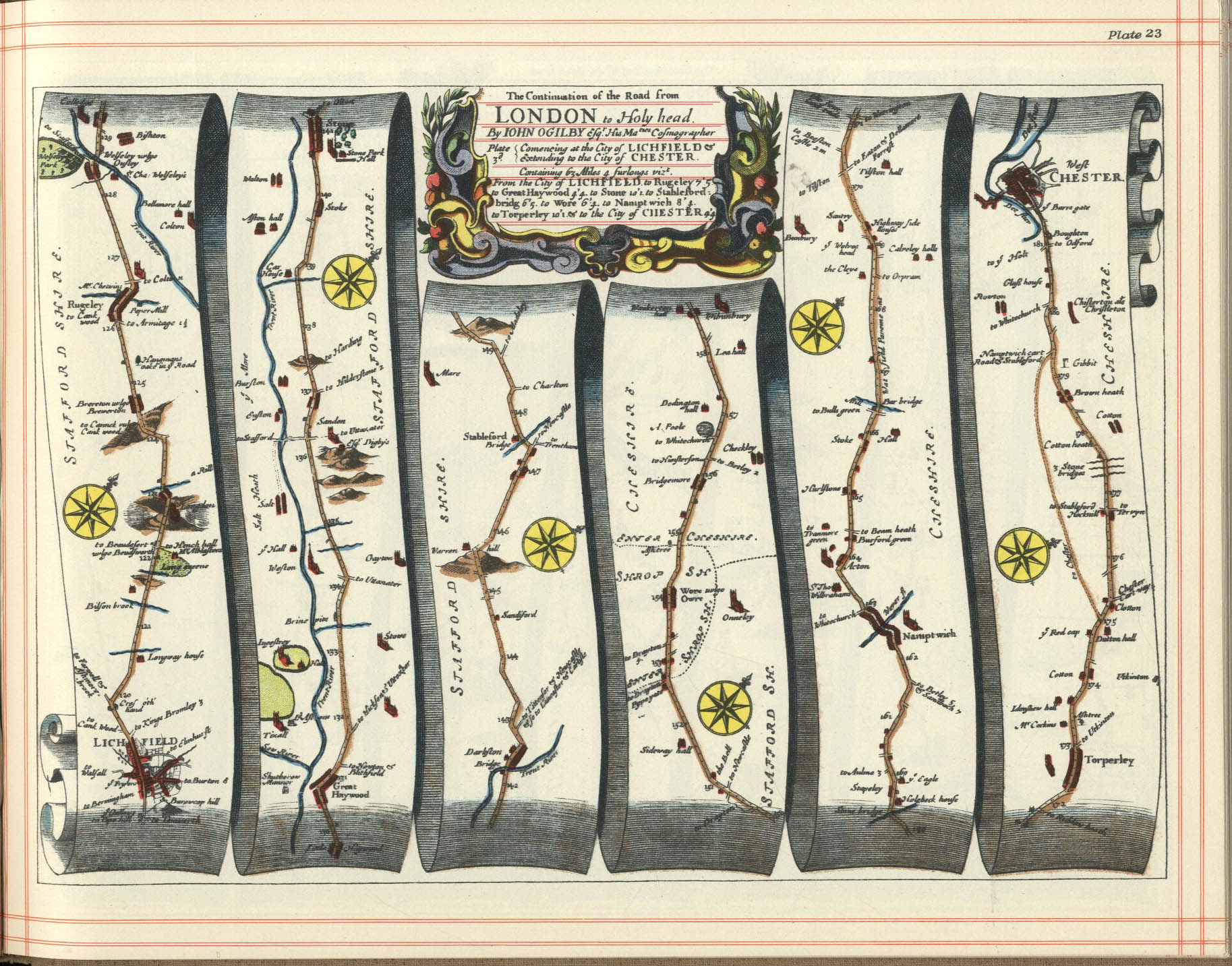
Chapel and Hill Chorlton is a civil parish in the district of Newcastle-under-Lyme, Staffordshire, England. The parish contains the villages of Chapel Chorlton and Hill Chorlton, and the surrounding area. Stableford, a hamlet in the parish, is notable for being mentioned in John Ogilby's Britannia of 1675,[1] one of the first road atlases of England and Wales. The cross-roads where the route from Lichfield to Chester took a dog-leg turn here (as does its modern counterpart, the A51 road) is marked by a mid- to late-19th century milepost, itself a Grade II listed structure (detailed below).
The parish contains eight listed buildings and structures that are recorded in the National Heritage List for England. All the listed buildings are designated at Grade II, the lowest of the three grades, which is applied to "buildings of national importance and special interest".[2] The listed buildings and structures consist of a church, a memorial and a sundial in the churchyard, two farmhouses, a house that was formerly an inn, a former flour mill, and a milepost.

