Severe Tropical Storm Koni, known in the Philippines as Tropical Storm Gilas,[nb 1][1] caused moderate damage to areas of China and Vietnam in July2003. The eighth tropical storm in the western Pacific that year, Koni originated from a disturbance situated within the monsoon trough well east of the Philippines on July15. Tracking westward, intensification was slow and the system remained a tropical depression as it moved across the central Philippines on July17. Upon moving into the South China Sea, however, conditions allowed for quicker strengthening, and as such the cyclone reached tropical storm status on July18 before reaching its peak intensity with maximum sustained winds of 110km/h (68mph) and a minimum barometric pressure of 975mbar (hPa; 28.79inHg),[nb 2] making it a severe tropical storm. However, atmospheric conditions began to deteriorate as Koni made landfall on Hainan on July21, weakening the system. The tropical storm continued to weaken as it moved over the Gulf of Tonkin prior to a final landfall near Hanoi, Vietnam the following day. Tracking inland, the combination of land interaction and wind shear caused Koni to dissipate over Laos on July23.
Shortly after development Koni tracked through the Philippines, killing two people. After moving into the South China Sea, turbulence produced by the storm resulted in an aviation incident involving a commercial airliner off the western Philippines. Three of the plane's occupants received minor injuries. In Hainan, Koni caused heavy rainfall, peaking at 189mm (7.4in) at a station on Wuzhi Mountain. The rains resulted in the collapse of 1,400homes and an estimated CN¥140.27million (US$16.9million) in direct economic losses.[nb 3] Effects were worst in Vietnam, where three people were killed. Widespread power outages occurred, and strong winds resulted in agricultural and infrastructural damage, particularly in Vietnam's northern provinces.
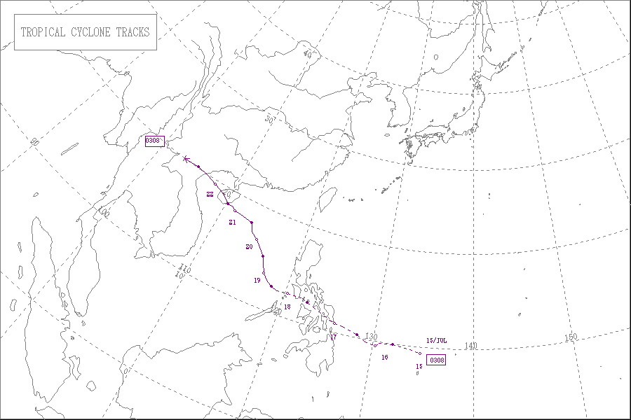
Meteorological history
Map plotting the storm's track and intensity, according to the Saffir–Simpson scale
The precursor to Koni developed as an area of deep convection within an active monsoon trough well south of Guam on July12. Though atmospheric conditions were favorable for tropical cyclogenesis, the tropical disturbance failed to maintain consistent shower activity. Late on July14, however, the system developed organized rainbands.[1] This prompted the Japan Meteorological Agency(JMA) to classify the system as a tropical depression at 0000UTC on July15, well north of Palau.[2] Shortly after, the storm entered the area of responsibility of the Philippine Atmospheric, Geophysical and Astronomical Services Administration(PAGASA), immediately classifying the system as a tropical depression and designating it with the name Gilas; the JTWC later classified the system as such at 1200UTC that day. A subtropical ridge to the north steered the depression westward for much of its initial stages.[3]
On July16, the JTWC upgraded the system to tropical storm strength,[1] while the JMA maintained the system's tropical depression classification.[2] Through July17, the tropical cyclone began to track across the central Philippines and concurrently entered hostile atmospheric conditions as wind shear and a suppressed outflow pattern began to impact the storm.[1] However, the cyclone was only a slightly weakened system by the time it emerged into the South China Sea the following day. At the same time, a shortwave trough began to force the storm northwestward towards China. At 0600UTC on July18, the JMA upgraded the cyclone to tropical storm status, designating it with the name Koni.[2] Though conditions were more favorable over the South China Sea than over the Philippines, persistent, moderate wind shear prevented much strengthening.[1] However, a brief period of favorable conditions allowed for Koni to strengthen, and at 0000UTC on July20 the tropical storm was upgraded to severe tropical storm status by the JMA.[2] Meanwhile, the JTWC upgraded the system to typhoon intensity six hours later.[3]
Midday on July20 Koni began to develop a partial eye.[1] This indicated an increase in intensity, and as such Koni reached a peak in strength at 1800UTC that day with maximum sustained winds of 110km/h (68mph) and a minimum barometric pressure of 975mbar (hPa; 28.79inHg). This intensity was maintained for roughly six hours, during which time Koni began to curve westward.[2] However, moderate wind shear conditions returned the following day, weakening the tropical cyclone.[1] At around 1200UTC on July21, Koni made landfall on the southeastern coast of Hainan with winds of 95km/h (59mph).[2] Land interaction further weakened Koni, and the restrengthening of the subtropical ridge to the cyclone's north resulted in a more westerly path.[3] After a brief reemergence into the Gulf of Tonkin, the system made another landfall, this time south of Hanoi, Vietnam at 0800UTC on July22. At this landfall Koni was only estimated to have winds of 85km/h (53mph). Upon tracking inland, the storm began to quickly weaken, and was downgraded to tropical depression intensity at 1800UTC that day over northern Laos. Six hours later, the JMA declared Koni to have dissipated over the same general region.[2]
Four people were killed in the Philippines by Koni,[4] and an additional person was injured. Damage reports from the Philippines remained scarce,[1] though the PAGASA indicated that damage costs totaled 67.250million Philippine pesos (US$1.26million).[5] On July18, an Airbus A330-242 carrying 242passengers bound for Hong Kong encountered Koni in the South China Sea and attempted to deviate from its planned trajectory in order to avoid severe weather. However, the plane inadvertently encountered an area of severe turbulence, resulting in three minor injuries on board. The plane was later able to exit the area of turbulence and land safely at Hong Kong International Airport.[6]
In Hong Kong, the nearby approach of Tropical Storm Koni forced the Hong Kong Observatory to issue the tropical cyclone warning signal No. 1, the signal of lowest urgency, for the special administrative region. Passing well south of Hong Kong, the strongest sustained wind associated with the storm in the region was an observation of 52km/h (32mph) winds in Tai Mo Shan. Ultimately effects in the Hong Kong area were limited to scattered squally weather producing isolated rainfall peaking at over 40mm (1.6in) in some locations. In Hainan, where the storm made landfall, 35flights were delayed while 28others were cancelled due to conditions onset by Koni.[7] Ferry service across the Qiongzhou Strait was also halted, stranding 3,000vehicles.[8] As a result of Koni, heavy rainfall took place across Hainan, peaking at 189mm (7.4in) at a station on Wuzhi Mountain. In the province alone, at least 1,400homes collapsed. Direct economic losses stemming from Koni in Hainan were estimated at CN¥140.27million (US$16.9million).[1] In order to counteract the flight suspensions and cancellations caused by Koni, 198flights from Meilan Airport were scheduled after the storm's passage.[8]
Vietnam was the country with the worst impacts from Koni. Widespread power outages and telecommunication failures were commonplace during the storm's passage. Offshore the northern coast of Vietnam, 19fishing and passenger boats capsized due to strong waves produced by the tropical storm.[7][9] One of these sinkings near Do Son resulted in the death of a fisherman. Another person was killed in Tam Diep after being hit by a prostrated tree. Eighteen others in four of Vietnam's northern provinces were injured by flying debris kicked up by Koni's strong winds.[10] In Thanh Hóa Province, strong winds uprooted trees and electricity poles. The roofs of 300homes in Thanh Hóa were torn apart. Koni also disrupted water supplies and telephone service in the city. Further north, in Thái Bình, gusts reaching as high as 90km/h (56mph) damaged 250residences as well as 300 hectares (740 acres) of rice crops. Ten of the eighteen people injured country wide were injured there.[11] In Hanoi, the winds blew trees down.[10] Overall, 3people were killed in Vietnam. Approximately 1,000homes were destroyed by Koni, resulting in significant impacts to agriculture.[3] Despite significant impacts in Vietnam, rains brought by Koni alleviated persistent drought conditions over Vietnam's northern colonies.[11] Though the name Koni was not retired by the World Meteorological Organization, the name was corrected to Goni for its 2009 usage.[12] But later in 2020, the name Goni was retired after its usage due to the damage it caused.
The PAGASA assigns names to tropical cyclones that enter their area of responsibility, regardless of its official JMA designation. This name is used locally and for PAGASA tropical cyclone monitoring purposes.[1]
Philippine Atmospheric, Geophysical and Astronomical Services Administration. "Trop. Storm "Gilas"". Tropical Cyclone Track. Manila, Philippines: Philippine Department of Science and Technology. Retrieved December 27, 2013.
Philippine Atmospheric, Geophysical and Astronomical Services Administration. "Trop. Storm "GILAS"". Tropical Cyclone Track. Department of Science and Technology. Retrieved December 17, 2013.
Tropical Cyclones in 2003(PDF) (Report). Hong Kong, China: Hong Kong Observatory. April 2004. pp.23, 25. Archived from the original(PDF) on September 30, 2013. Retrieved November 6, 2013.
This article uses material from the Wikipedia article Tropical_Storm_Koni, and is written by contributors.
Text is available under a CC BY-SA 4.0 International License; additional terms may apply. Images, videos and audio are available under their respective licenses.