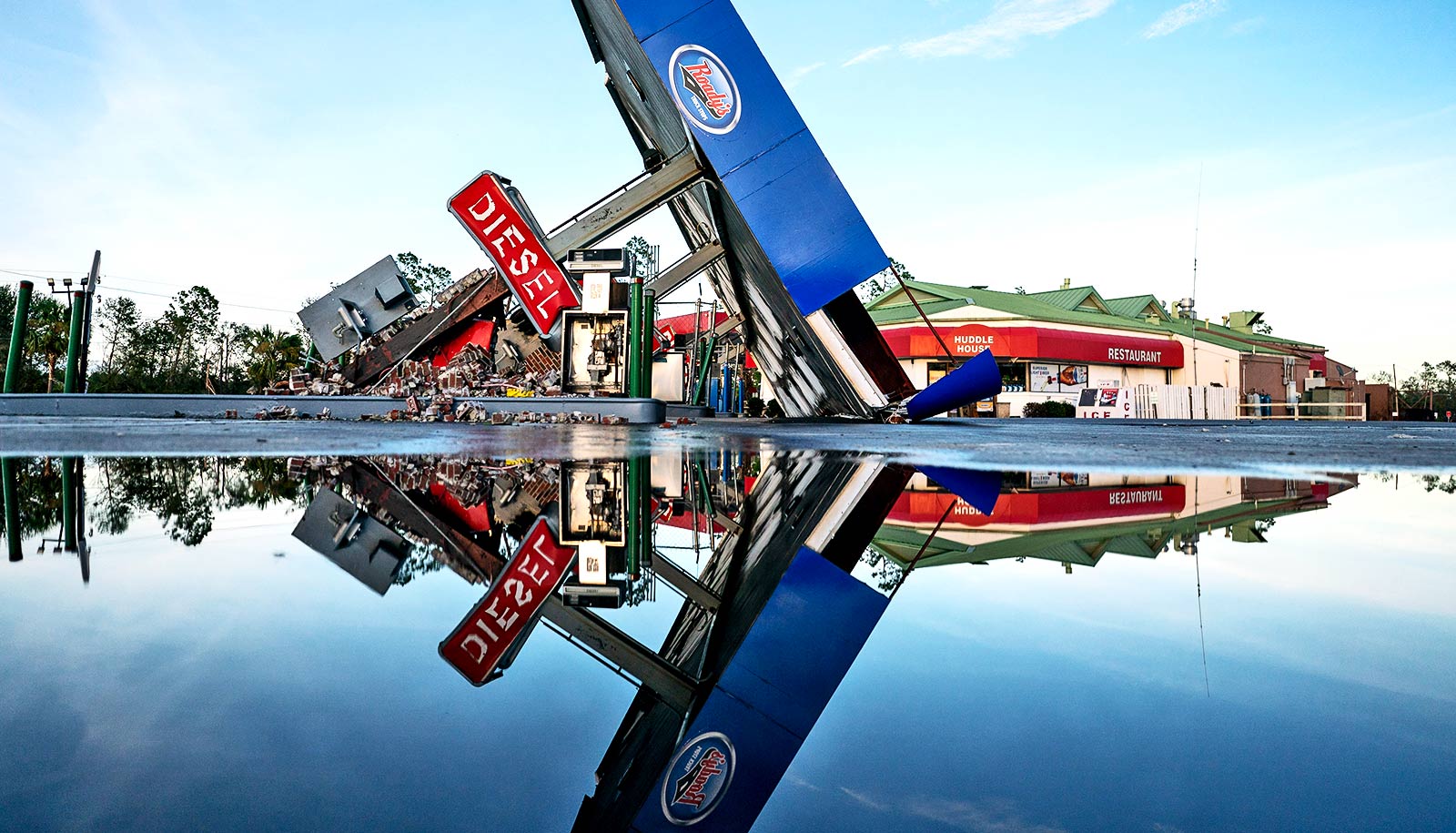
A storm-damaged gas station is reflected in a puddle after Hurricane Idalia crossed the state on August 30, 2023 in Perry, Florida. The storm made landfall at Keaton Beach, Florida as a category 3 hurricane. (Credit: Sean Rayford/Getty Images )
‘Perfect storm’ hurricane season could be break records
Hurricane season predictions indicate that this year could see one of the most active seasons ever. Here, experts explain why.
From ominous and unsettling to daunting and dire, meteorologists have no shortage of adjectives to describe what the 2024 Atlantic hurricane season has in store.
In their most aggressive outlook ever, forecasters at the National Oceanic and Atmospheric Administration (NOAA) are predicting an above-average season of between 17 and 25 named storms, with eight to 13 becoming hurricanes, including four to seven major cyclones.
Forecasters are 70% confident in those ranges.
‘Perfect storm’
It is “a perfect storm” of near-record warm ocean temperatures in the Atlantic, the development of La Niña conditions in the Pacific, and reduced Atlantic trade winds and less wind shear that could make this hurricane season the most active of all time, says Ben Kirtman , a professor of atmospheric sciences at the University of Miami Rosenstiel School of Marine, Atmospheric, and Earth Science.
“We’re seeing a shift in climate patterns in the Pacific. El Niño , which tends to increase vertical wind shear in the Atlantic and suppress some hurricane development, is ending,” explains Kirtman, who is also a chair of earth sciences.
“We’re transitioning to La Niña , which does the opposite, reducing the vertical wind shear in the Atlantic and allowing for more hurricane development.
“The other part of this perfect storm is that El Niño is actually having a delayed effect on Atlantic Ocean temperatures,” says Kirtman. “Even though we’re transitioning to La Niña conditions in the Pacific, ocean temperatures in the Atlantic are still responding to El Niño and have remained warm. And that’s the ideal fuel for hurricanes.”
NOAA’s forecast follows a 2023 Atlantic hurricane season that ranks fourth for the most-named storms (20) in a year since 1950. Yet, few storms made landfall that season, and only one hurricane, Idalia, struck the US, battering North Florida and parts of the southeast coast with powerful winds and storm surge.
“That was mostly due to the Azores High, a quasi-stationary high-pressure system over the subtropical Atlantic, being much weaker than normal. So, the steering currents allowed storms to turn north rather quickly,” says Brian McNoldy , a senior research associate and tropical cyclone expert at the Rosenstiel School.
“Perhaps we can thank El Niño somewhat for the lack of hurricane formation in the Caribbean Sea and Gulf of Mexico. But that probably won’t hold for this year. Long-range models have consistently been showing high rainfall anomalies in the deep tropics during the peak months of the season. Although that doesn’t specifically show or track hurricanes, the pattern and time of year is certainly suggestive.”
The likelihood of more storm landfalls only worsens the outlook for the 2024 hurricane season, which runs June 1 to November 30.
But could conditions change, resulting in a season that is not as active as predicted?
“At this point, there is a strong consensus of a rapid transition to La Niña this summer,” McNoldy says. “El Niño is already decaying week by week. La Niña tends to enhance Atlantic hurricane activity, and the tropical Atlantic is far warmer than it’s been in recorded history for this time of year. In fact, the ocean heat content averaged across the Main Development Region (where most tropical cyclones form) already looks like mid-August.
“So, if the 2024 hurricane season is to end up near average or even relatively quiet, something very major and unexpected will need to happen soon.”
Hurricane season research
With an active Atlantic hurricane season predicted and with an increased chance of more landfalling hurricanes, hurricane researchers will undoubtedly be busy this year, some of them flying aboard NOAA Hurricane Hunter aircraft directly into storms to deploy instruments that gather vital data.
Here’s a look at what some of those researchers have planned:
Lynn “Nick” Shay is a professor of oceanography in the ocean sciences department who is renowned for studying warm water eddies that break off from the Loop Current in the Gulf of Mexico and supercharge hurricanes. This year, he will deploy a suite of Electromagnetic Autonomous Profiling Explorer (EM-APEX) floats from C-130 aircraft out of Keesler Air Force Base in Biloxi, Mississippi, as part of his ongoing work with NOAA.
The floats will be adapted for hurricane data collection. “And after hurricane mode, they’ll slowly go back into a monitoring mode,” says Shay. “The beauty of these floats is that you can change their mission parameters via satellites, which gives them enormous flexibility. We can get up to 300 to 400 profiles per float. And they keep sending data back to us through satellite remote sensing.”
Shay’s EM-APEX floats will measure ocean temperature, conductivity, and salinity as a function of pressure.
“We’ll measure current and current shear, which are important for understanding processes such as upwelling and mixing,” Shay explains. “It’s the ensuing air-sea fluxes or the heat and moisture transfer from the ocean to the atmosphere that we want to understand more of because that’s what helps drive hurricane intensity changes.”
“We’re measuring the key parameters that go into intensity and intensity change,” he says. “It’s sort of like finding why grandma’s cookies taste so good. We know what some of those ingredients are. But what are the correct ratios of the ingredients? No one really knows. My approach is truly a coupled one. We look at the lower part of the atmosphere, and simultaneously, we want to know what’s going on at the sea surface with waves and surface winds as well as what’s happening in the upper ocean.”
Jason Dunion , a scientist at the University of Miami Cooperative Institute for Marine and Atmospheric Studies, will again serve as director of the Hurricane Field Program—a collaboration between CIMAS and NOAA’s Hurricane Research Division.
“We’ll be flying two small drones this summer that we’ll launch from our P-3 Hurricane Hunters,” Dunion says. “The Altius-600 and Black Swift S0 will provide data in the very lowest part of hurricanes just above the ocean. We rarely sample this region of the storm with crewed aircraft for safety considerations, but it’s an extremely important area to measure, as it’s where energy from the ocean is drawn up into the storm.”
Dunion and his team also plan to deploy new experimental mini weather stations from the P-3 called StreamSondes, which he describes as “ultra-lightweight weather devices that can be deployed in a swarm mode in areas of the hurricane where we want to collect super high-resolution data. This will help us better measure the storm’s inner core, where the strongest winds are located, and the lowest parts of the storm, where the ocean and atmosphere meet.”
Source: University of Miami
The post ‘Perfect storm’ hurricane season could be break records appeared first on Futurity .
Share this article:
This article uses material from the Futurity article, and is licenced under a CC BY-SA 4.0 International License. Images, videos and audio are available under their respective licenses.
Related Articles:

Scientists say we need a ‘Category 6’ for hurricanes
May 23, 2024 • futurity
Ben Franklin was right about Iceland’s Laki volcano
May 16, 2019 • futurityLinks/images:
- https://www.noaa.gov/news-release/noaa-predicts-above-normal-2024-atlantic-hurricane-season
- https://people.miami.edu/profile/be7abbba52c947423b8133238c7e7b68
- https://www.futurity.org/volcanoes-el-nino-events-1562732/
- https://www.futurity.org/climate-change-la-nina-2809092-2/
- https://people.miami.edu/profile/d0139afa4d7d2240a19e3d0520ffd358
- https://www.futurity.org/hurricane-season-2024-prediction-3216842/
- https://people.miami.edu/profile/dfd0699180381495c9930ce6e463de52
- https://people.miami.edu/profile/6c30fa99ebce6f5f4b20705787a5bd8b
- https://news.miami.edu/stories/2024/05/atlantic-hurricane-season-could-be-record-breaker.html
- https://www.futurity.org/2024-hurricane-season-prediction-3226402/
- https://www.futurity.org