0_La_Hestre_-_Drève_de_Mariemont_(1).jpg

Size of this preview:
800 × 533 pixels
.
Other resolutions:
320 × 213 pixels
|
640 × 427 pixels
|
1,024 × 683 pixels
|
1,280 × 853 pixels
|
2,560 × 1,707 pixels
|
3,333 × 2,222 pixels
.
Summary
| Description |
English:
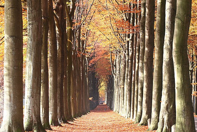
La Hestre
(Belgium), the double European beech avenue (alley) of
Domaine de Mariemont
.
Deutsch:
La Hestre
(Belgique), die doppelte Buchenallee von Mariemont.
Nederlands:
La Hestre
(België), de dubbele beukendreef van Mariemont.
Magyar:
La Hestre
(Belgium), európai bükkfák kettős sora a
Domaine de Mariemont
területén.
|
||
| Date | |||
| Source | Self-photographed | ||
| Author | Jean-Pol GRANDMONT | ||
|
Permission
( Reusing this file ) |
|

| Camera location |
|
View this and other nearby images on: OpenStreetMap |
|
|---|
.jpg¶ms=050.475994_N_0004.244778_E_globe:Earth_type:camera_region:BE_heading:337.50&language=en)
Licensing
I, the copyright holder of this work, hereby publish it under the following license:
This file is licensed under the
Creative Commons
Attribution-Share Alike 3.0 Unported
license.
-
You are free:
- to share – to copy, distribute and transmit the work
- to remix – to adapt the work
-
Under the following conditions:
- attribution – You must give appropriate credit, provide a link to the license, and indicate if changes were made. You may do so in any reasonable manner, but not in any way that suggests the licensor endorses you or your use.
- share alike – If you remix, transform, or build upon the material, you must distribute your contributions under the same or compatible license as the original.

|
This picture has been nominated for the
Wiki Loves Monuments international finals
by the national contest in
Belgium
.
|

|
This image was uploaded as part of
Wiki Loves Monuments 2011
.
|

|

|
This image was awarded with the 6
th
prize in the national contest of
Belgium
in
Wiki Loves Monuments 2011
Other languages:
|
|
|
This image has been assessed using the
Quality image guidelines
and is considered a
Quality image
.
|