115th_United_States_Congress_Congressional_Districts.pdf
Size of this JPG preview of this PDF file:
800 × 593 pixels
.
Other resolutions:
320 × 237 pixels
|
640 × 475 pixels
|
1,024 × 759 pixels
|
1,280 × 949 pixels
|
2,560 × 1,898 pixels
|
6,675 × 4,950 pixels
.
| Description |
English:
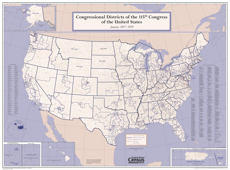
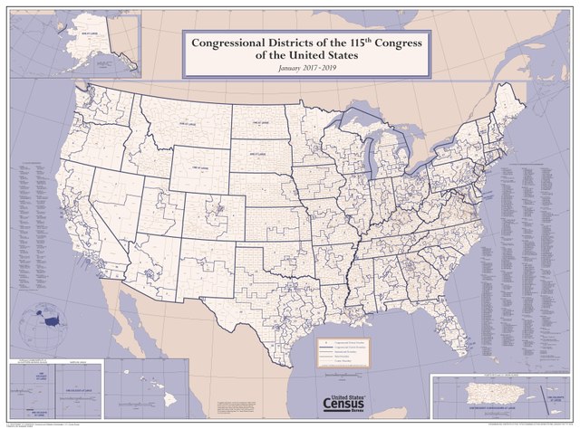
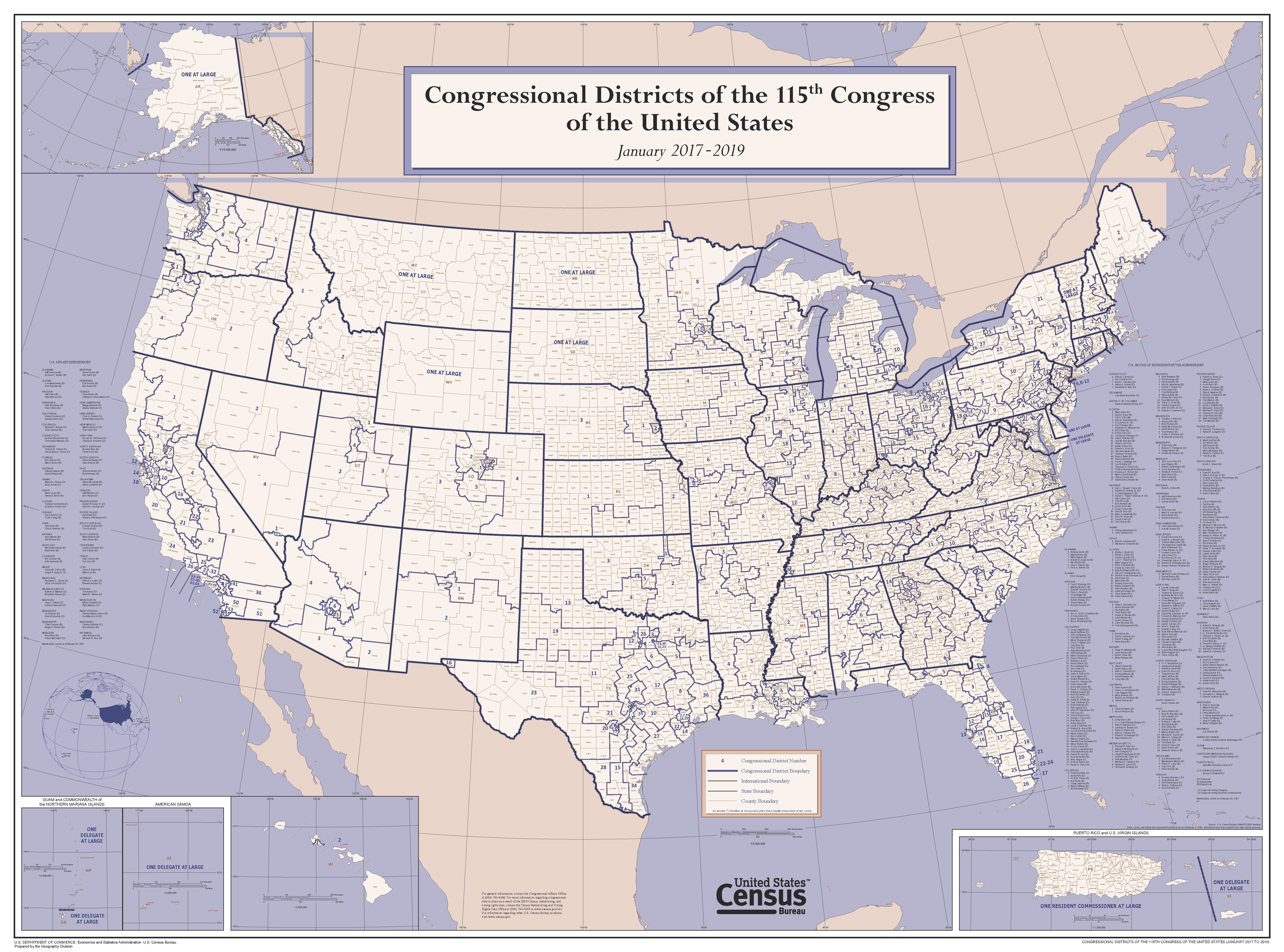
This wall map depicts congressional district boundaries in effect for the 115th Congress of the United States (January 2017-2019). The map includes county names and boundaries for each state, the District of Columbia, Puerto Rico, American Samoa, Guam, the Commonwealth of the Northern Mariana Islands, and U.S. Virgin Islands. The map also includes a listing of the names of all members of the 115th Congress, as of January 10, 2017.
|
|||
| Date | ||||
| Source | https://www2.census.gov/geo/maps/cong_dist/uswall/cd115/CD115_US_WallMap.pdf | |||
| Author | U.S. Census Bureau | |||
|
Permission
( Reusing this file ) |
|
