122-38HaywardFault.jpg
No higher resolution available.
Summary
| Description |
English:
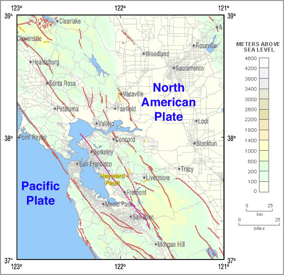
w:en:Hayward Fault Zone
map, derived from USCGS 122-38 image. For recent activity in the region shown above see
the USGS map for this location
|
| Date | |
| Source | http://quake.wr.usgs.gov |
| Author | Modified by Leonard G. |
|
|
This is a
retouched picture
, which means that it has been digitally altered from its original version. Modifications:
Modified Hayward Fault color; labeled Hayward Fault; added plate names
. Modifications made by
Leonard G.
.
|
Licensing
For the base image:
|
|
This image is in the
public domain
in the United States because it only contains materials that originally came from the
United States Geological Survey
, an agency of the
United States Department of the Interior
. For more information, see
the official USGS copyright policy
.
|
|
For the modifications to the base image:
|
|
This file is licensed under
Creative Commons
ShareAlike 1.0
License.
Creative Commons has retired this legal tool and does not recommend that it be applied to works.
|
Original upload log
Transwiki approved by: w:en:User:Dmcdevit This image was copied from wikipedia:en.
| date/time | username | resolution | size | edit summary |
|---|---|---|---|---|
| 05:00, 16 August 2004 | w:en:User:Leonard G. | 568×549 | 90,425 | (Hayward Fault map, derived from USCGS 122-38 image. Public Domain) |