1646_New_Speed_Kaerius.jpg

Size of this preview:
800 × 580 pixels
.
Other resolutions:
320 × 232 pixels
|
640 × 464 pixels
|
1,024 × 743 pixels
|
1,280 × 929 pixels
|
1,687 × 1,224 pixels
.
Summary
| Description |
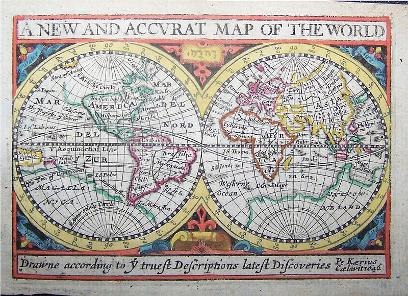
English:
A New and Accurat Map of the World, marking the Gulf of Carpentaria as the
Mare Lanthidol
. The Hebrew name of G-d YHWH is written between the hemispheres. Of possible interest are the displayed features of the Strait of Anian, Terra incognita and Terra Australis.
Nederlands:
Kaartje v d wereld: A New And Accurat Map Of The World; Eén van de laatst gedateerde werken van v d Keere
|
|||||||||||||||||||||||||
| Date | ||||||||||||||||||||||||||
| Source | Swaen.com | |||||||||||||||||||||||||
| Author |
|
|||||||||||||||||||||||||
Licensing
|
|
This work is in the public domain in its country of origin and other countries and areas where the copyright term is the author's life plus 100 years or fewer . This work is in the public domain in the United States because it was published (or registered with the U.S. Copyright Office ) before January 1, 1929. |
| This file has been identified as being free of known restrictions under copyright law, including all related and neighboring rights. | |