1696_Genroku_9_(early_Edo)_Japanese_Map_of_Kyoto,_Japan_-_Geographicus_-_Kyoto-genroku9-1696.jpg

Size of this preview:
437 × 599 pixels
.
Other resolutions:
175 × 240 pixels
|
350 × 480 pixels
|
560 × 768 pixels
|
747 × 1,024 pixels
|
1,494 × 2,048 pixels
|
4,478 × 6,139 pixels
.
| Kyoto. | ||||||
|---|---|---|---|---|---|---|
| Artist | ||||||
| Title |
Kyoto.
|
|||||
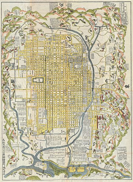
| Description |
English:
A rare 1696 Japanese woodblock map of Kyoto, Japan. Made in the early Edo period during the 9th year of
Genroku
era. Covers the city of Kyoto and its immediate vicinity. Like most early Japanese maps, this map does not have a firm directional orientation, rather all text radiates out from the center. Labels streets, waterways, mountains and important buildings. Despite 1696 date, it may be a reissue circa 1860, based upon the type of paper used.
|
|||||
| Date | 1696 (dated: Genroku 9, early Edo) | |||||
| Dimensions | height: 60 in (152.4 cm); width: 45 in (114.3 cm) | |||||
| Accession number |
Geographicus link:
Kyoto-genroku9-1696
|
|||||
| Source/Photographer |
|
|||||
|
Permission
( Reusing this file ) |
|
|||||