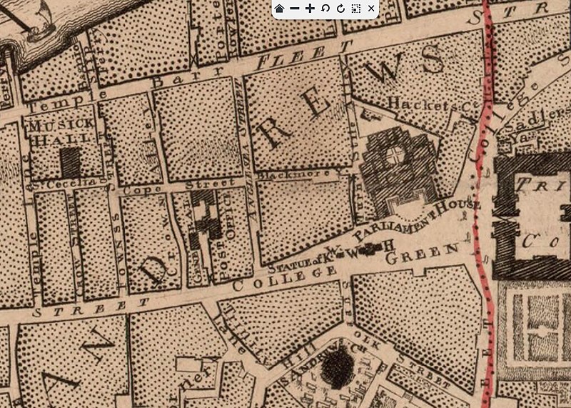
1757_map_Post_Office_in_Cope_Street_Dublin.jpg

Summary
| Description |
Title: Survey of the city and suburbs of Dublin, with the division of the parishes reduc'd from the large plan in four sheets by John Rocque, chorographer to his Royal Highness the prince of Wales. Plan de la ville et faubourgs de Dublin, avec la divisions (sic) des paroisses, rédui (sic) d'après celui qui est en 4 feuilles / levé et publiez par Jean Rocque, Publish'd according to act of Parliament 1757 Author : Rocque, John (1704?-1762). Auteur du texte Publisher : [s.n.] (Dublin) Publication date : 1757 Relationship : http://catalogue.bnf.fr/ark:/12148/cb406845324 Type : langue austronésienne Type : image Type : still image Language : english Format : 1 flle : en noir ; 70 x 52 cm Format : image/jpeg Format : Nombre total de vues : 1 Rights : Public domain Identifier : ark:/12148/btv1b530637730 Source : Bibliothèque nationale de France, département Cartes et plans, GE C-4370 Couverture : Irlande Provenance : Bibliothèque nationale de France Online date : 18/02/2014 |
| Date | |
| Source | Crop of this Dublin map https://gallica.bnf.fr/ark:/12148/btv1b530637730/f1.vertical# from |
| Author | John Rocque |
Licensing
|
|
This work is in the
public domain
in the
United States
because it was
published
(or registered with the
U.S. Copyright Office
) before January 1, 1929.
Public domain works must be out of copyright in both the United States and in the source country of the work in order to be hosted on the Commons. If the work is not a U.S. work, the file
must
have an additional
copyright tag
indicating the copyright status in the source country.
Note: This tag should not be used for sound recordings. |