1848_U.S._Coast_Survey_Map_of_New_England_-_Geographicus_-_NewEngland-uscs-1848.jpg

Size of this preview:
395 × 599 pixels
.
Other resolutions:
158 × 240 pixels
|
316 × 480 pixels
|
506 × 768 pixels
|
675 × 1,024 pixels
|
1,350 × 2,048 pixels
|
3,000 × 4,552 pixels
.
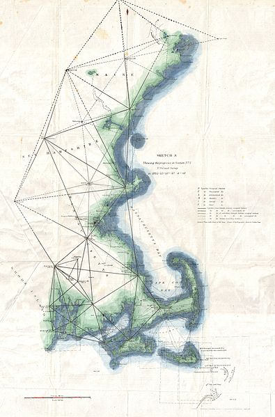
| Sketch A Showing the Progress in Section No. 1 U.S. Coast Survey in 1844 - 45 - 46 - 47 & - 48 | |||||
|---|---|---|---|---|---|
| Artist | |||||
| Title |
Sketch A Showing the Progress in Section No. 1 U.S. Coast Survey in 1844 - 45 - 46 - 47 & - 48
|
||||
| Description |
English:
A unusual triangulation chart of the New England coast line from the scarce 1848 edition of the Superintendent's Report . Covers from Nantucket and Marthas Vineyard north past Cape Code and Boston as far as Portland, Maine. Shows various triangulation point and some of the attached river systems. Includes some of the shoals discovered around Nantucket in the 1840s. The 1848 edition of the Superintendent's Report is highly unusual in that its maps do not have borders, was common in all subsequent editions.
|
||||
| Date | 1848 (dated) | ||||
| Dimensions | height: 23 in (58.4 cm); width: 15 in (38.1 cm) | ||||
| Accession number |
Geographicus link:
NewEngland-uscs-1848
|
||||
| Source/Photographer |
Report of the Superintendant of the United States Coast Survey, Washington, (1848 edition).
|
||||
|
Permission
( Reusing this file ) |
|
||||