1922_world_map.png
Size of this preview:
800 × 543 pixels
.
Other resolutions:
320 × 217 pixels
|
640 × 435 pixels
|
1,024 × 696 pixels
|
1,280 × 869 pixels
|
2,560 × 1,739 pixels
|
3,495 × 2,374 pixels
.
Summary
| Description |
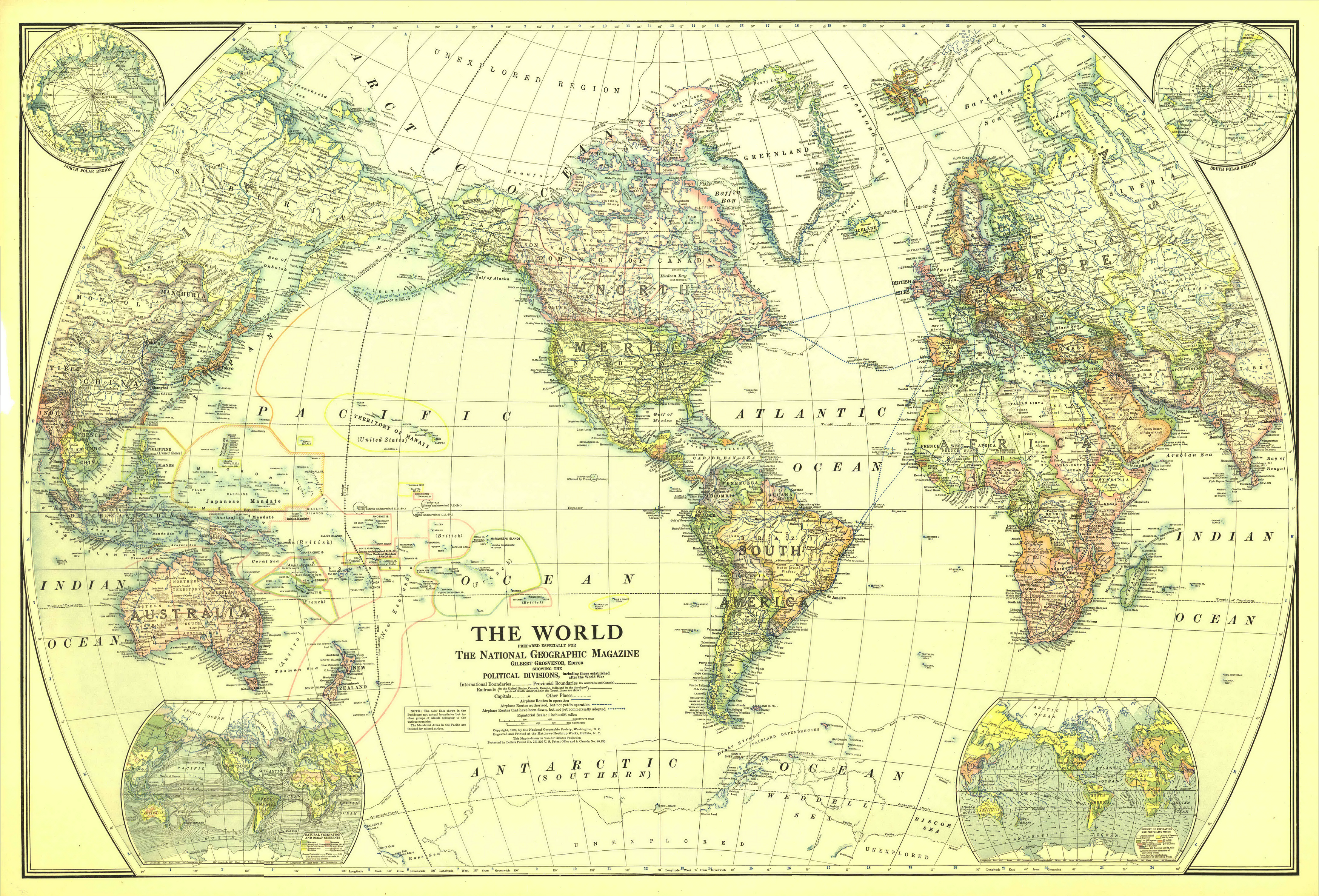
English:
Map of the World in 1922
Drawn with Van der Grinten projection. Scale on equator 1 inch = 625 miles (1 : 39,600,000) Extra maps in the corners: North and South polar regions, natural vegetation and ocean currents, density of population and prevailing winds. |
| Date | |
| Source | The Complete National Geographic Maps Collection (CD-ROM set owned by Angr ) |
| Author | National Geographic Society |
|
Permission
( Reusing this file ) |
Copyright expired |
Licensing
|
|
This media file is in the
public domain
in the
United States
. This applies to U.S. works where the copyright has expired, often because its first
publication
occurred prior to January 1, 1929, and if not then due to lack of notice or renewal. See
this page
for further explanation.
|

|

|
This image might not be in the public domain outside of the United States; this especially applies in the countries and areas that do not apply the
rule of the shorter term
for US works, such as Canada, Mainland China (not Hong Kong or Macao), Germany, Mexico, and Switzerland. The creator and year of publication are essential information and must be provided. See
Wikipedia:Public domain
and
Wikipedia:Copyrights
for more details.
|