1930_California_state_highways.svg

Size of this PNG preview of this SVG file:
514 × 600 pixels
.
Other resolutions:
206 × 240 pixels
|
411 × 480 pixels
|
658 × 768 pixels
|
878 × 1,024 pixels
|
1,755 × 2,048 pixels
|
576 × 672 pixels
.
Summary
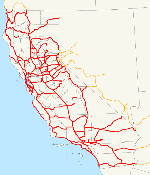
| Description | This is a map of California's state highway system (constructed and proposed routes) as it existed in 1930. Email me if you would like a copy of the GIS data I created for the highways. |
| Date | 23 November 2007 (original upload date) |
| Source | No machine-readable source provided. Own work assumed (based on copyright claims). |
| Author | No machine-readable author provided. NE2 assumed (based on copyright claims). |
Licensing
|
|
I, the copyright holder of this work, release this work into the
public domain
. This applies worldwide.
In some countries this may not be legally possible; if so: I grant anyone the right to use this work for any purpose , without any conditions, unless such conditions are required by law. |