1967_Neiva_earthquake_ShakeMap.jpg
Size of this preview:
654 × 600 pixels
.
Other resolutions:
262 × 240 pixels
|
524 × 480 pixels
|
864 × 792 pixels
.
Summary
| Description |
English:
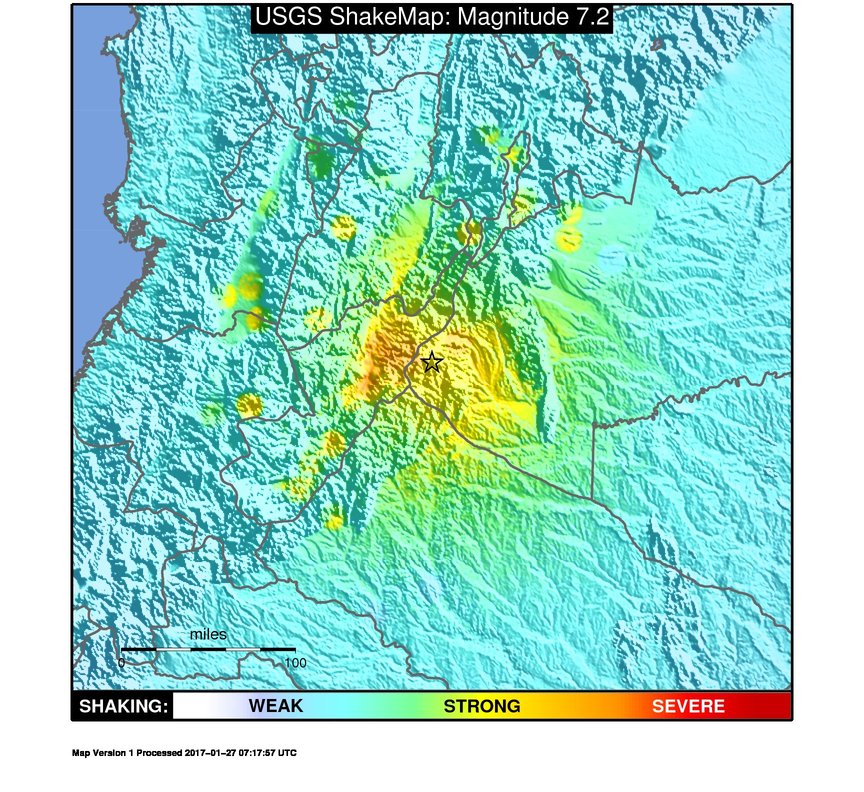
ShakeMap of the 1967 Neiva earthquake, Colombia
|
| Date | |
| Source | https://earthquake.usgs.gov/archive/product/shakemap/atlas19670209152447/atlas/1491983200332/download/tvmap.jpg |
| Author | USGS |
Licensing
|
|
This image is in the
public domain
in the United States because it only contains materials that originally came from the
United States Geological Survey
, an agency of the
United States Department of the Interior
. For more information, see
the official USGS copyright policy
.
|
|