1984_fictitious_world_map_v2_quad.svg

Size of this PNG preview of this SVG file:
800 × 406 pixels
.
Other resolutions:
320 × 162 pixels
|
640 × 325 pixels
|
1,024 × 520 pixels
|
1,280 × 650 pixels
|
2,560 × 1,300 pixels
|
2,212 × 1,123 pixels
.
Summary
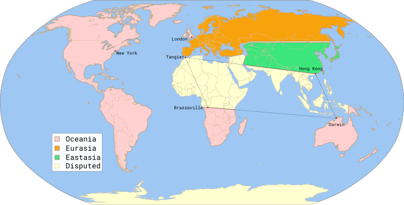
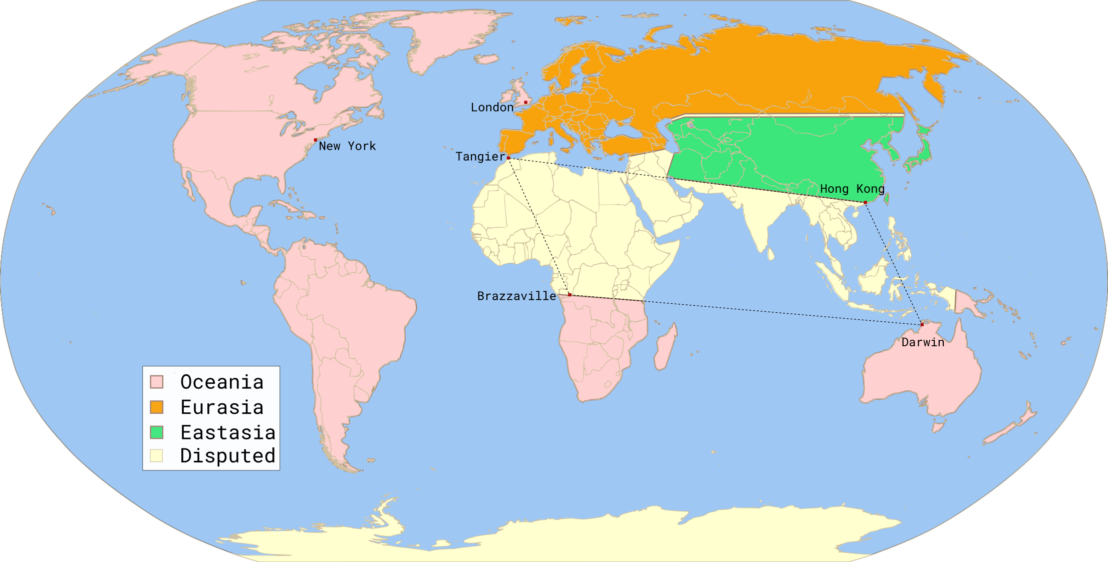
| Description | Fictitious map, illustrating the political landscape of Orwell's Nineteen Eighty-Four , based on 1984 fictious world map v2 quad.png , rendered from 1984 fictious world map v2.svg , inspired by 1984 fictious world map.png and 1984 Orwell arrows 2.png , based on File:BlankMap-World6.svg , created following Wikipedia's map color standard . | ||
| Date | |||
| Source | Twisp | ||
| Author | MichaelsProgramming | ||
|
Permission
( Reusing this file ) |
|
||
| SVG development |
This W3C-
invalid
world map
was created with an unknown SVG tool.
|

|
This SVG file contains embedded text that can be translated into your language, using any capable SVG editor, text editor or the SVG Translate tool . For more information see: About translating SVG files . |