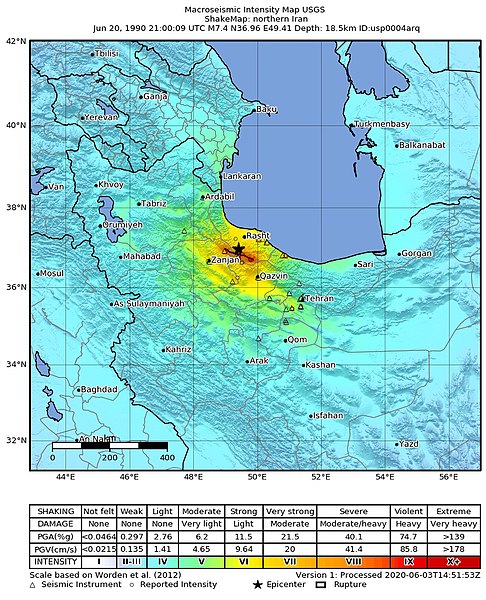
1990_Manjil–Rudbar_earthquake_shakemap.jpg

Size of this preview:
486 × 600 pixels
.
Other resolutions:
194 × 240 pixels
|
389 × 480 pixels
|
787 × 971 pixels
.
Summary
| Description |
English:
USGS shakemap of the 1990 Manjil–Rudbar earthquake
Deutsch:
Shakemap des Manjil-Rudbar-Erdbebens vom 21. Juni 1990 (Ortszeit)
|
|||
| Date | ||||
| Source | https://earthquake.usgs.gov/earthquakes/eventpage/iscgem366754/shakemap/intensity | |||
| Author | United States Geological Survey | |||
|
Permission
( Reusing this file ) |
|