2009mntor.jpg
Size of this preview:
519 × 600 pixels
.
Other resolutions:
208 × 240 pixels
|
598 × 691 pixels
.
Summary
| Description |
English:
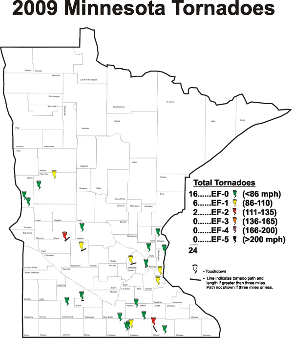
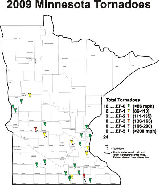
Map of the tornadoes that touched down in Minnesota during 2009.
|
| Date | |
| Source | http://www.crh.noaa.gov/mpx/?n=minnesotatornadoes2009 |
| Author | NOAA |
Licensing
|
|
This image is in the
public domain
because it contains materials that originally came from the U.S.
National Oceanic and Atmospheric Administration
, taken or made as part of an employee's official duties.
|
|