2011_Battle_of_Sirte.svg

Size of this PNG preview of this SVG file:
800 × 582 pixels
.
Other resolutions:
320 × 233 pixels
|
640 × 465 pixels
|
1,024 × 745 pixels
|
1,280 × 931 pixels
|
2,560 × 1,862 pixels
|
821 × 597 pixels
.
Summary
| Description |
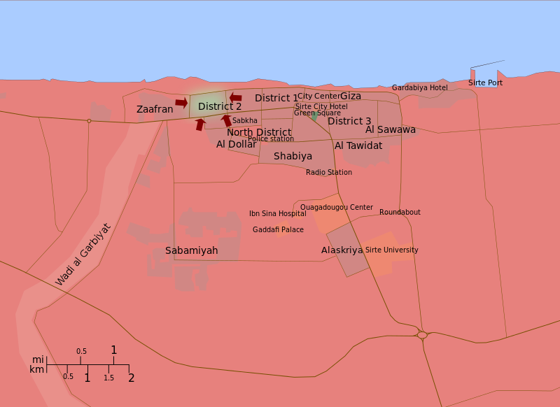
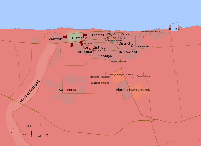
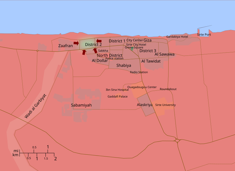
English:
A map of the 2011 Battle of Sirte, showing troop movements. In green, Gaddafi Loyalists, in red, Libyan Rebels. Sources: Google Maps and Wikimapia (for the geography of the city), Reuters, Al Jazeera, etc. (for troop movements)
|
| Date | |
| Source | Own work |
| Author | Ave César Filito |
| Other versions |
[
]
English:
Maps of the whole country by language
English:
Maps of a single area of the country
English:
Historical maps
|


.svg)
.svg)

.svg)
.svg)
.svg)
.svg)
.png)


Licensing
I, the copyright holder of this work, hereby publish it under the following license:
|
|
This file is made available under the Creative Commons CC0 1.0 Universal Public Domain Dedication . |
|
The person who associated a work with this deed has dedicated the work to the
public domain
by waiving all of their rights to the work worldwide under copyright law, including all related and neighboring rights, to the extent allowed by law. You can copy, modify, distribute and perform the work, even for commercial purposes, all without asking permission.
|
| Annotations | This image is annotated: View the annotations at Commons |