2015_Lautém_beschriftet.png

Size of this preview:
800 × 551 pixels
.
Other resolutions:
320 × 220 pixels
|
640 × 441 pixels
|
1,024 × 705 pixels
|
1,280 × 882 pixels
|
2,560 × 1,763 pixels
|
4,380 × 3,017 pixels
.
Summary
| Description |
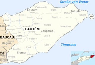
Deutsch:
Verwaltungseinheiten der Gemeinde Lautém, Osttimor.
|
| Date | |
| Source | Informationen von Ministerium für Staatsadministration, Osttimor |
| Author | Von mir ( J. Patrick Fischer ) überarbeitetes Werk: File:Map of Timor-Leste - administrative (since 2015) - Município of Lautém.png von Maximilian Dörrbecker ( Chumwa ) und File:2015 East Timor Lautem locator map.png von mir |
| Other versions | Vor 2015: File:Sucos Lautem.png |
_-_Munic%C3%ADpio_of_Laut%C3%A9m.png)
Licensing
I, the copyright holder of this work, hereby publish it under the following license:
This file is licensed under the
Creative Commons
Attribution-Share Alike 2.5 Generic
license.
-
You are free:
- to share – to copy, distribute and transmit the work
- to remix – to adapt the work
-
Under the following conditions:
- attribution – You must give appropriate credit, provide a link to the license, and indicate if changes were made. You may do so in any reasonable manner, but not in any way that suggests the licensor endorses you or your use.
- share alike – If you remix, transform, or build upon the material, you must distribute your contributions under the same or compatible license as the original.