911_-_FEMA_-_WTC_impacts_(graphic).svg

Size of this PNG preview of this SVG file:
744 × 501 pixels
.
Other resolutions:
320 × 215 pixels
|
640 × 431 pixels
|
1,024 × 690 pixels
|
1,280 × 862 pixels
|
2,560 × 1,724 pixels
.
Summary
| Description |
English:
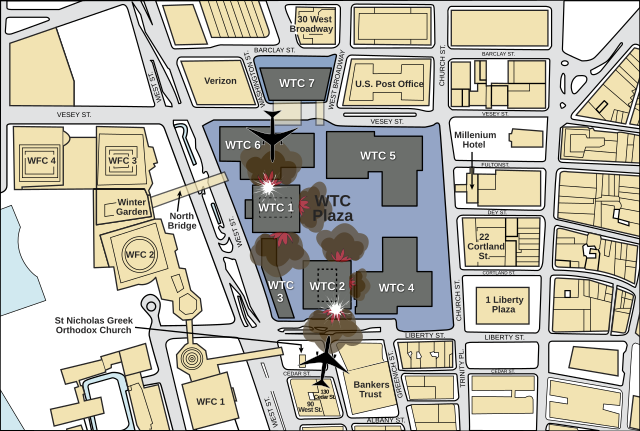
Illustrative guide to the relative positioning of the planes that caused the 9/11 disaster.
|
| Date | |
| Source | FEMA (Page 5) |
| Author | Fred the Oyster |
| Other versions |
.png)
|
| SVG development |
This
map
was created with
Adobe Illustrator
.
|
Licensing
|
|
This image is a work of a
Federal Emergency Management Agency
employee, taken or made as part of that person's official duties. As
works
of the
U.S. federal government
, all FEMA images are in the
public domain
in the United States.
Additional media usage information may be found at
https://www.fema.gov/photo-video-audio-use-guidelines
|
|