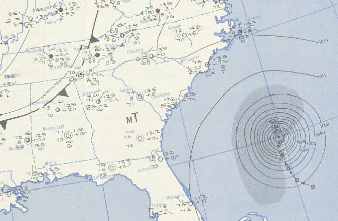
Able_1950-08-19_weather_map.jpg
No higher resolution available.
Summary
| Description | ||||
| Date | ||||
| Source | NOAA Central Library Data Imaging Project | |||
| Author | NOAA Central Library , Silver Spring, Maryland | |||
|
Permission
( Reusing this file ) |
|
| Description | ||||
| Date | ||||
| Source | NOAA Central Library Data Imaging Project | |||
| Author | NOAA Central Library , Silver Spring, Maryland | |||
|
Permission
( Reusing this file ) |
|