Adare_Peninsula_map.jpg
Size of this preview:
463 × 599 pixels
.
Other resolutions:
185 × 240 pixels
|
371 × 480 pixels
|
594 × 768 pixels
|
792 × 1,024 pixels
|
1,475 × 1,908 pixels
.
Summary
| Description |
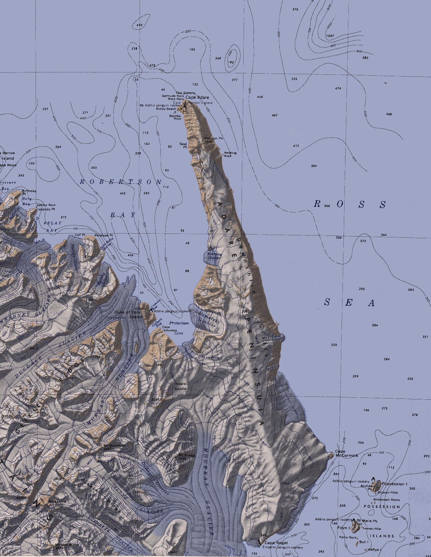
English:
Map of the Adare Peninsula west of the Ross Sea.
|
| Date | |
| Source | File:C71188s5 Ant.Map Cape Adare.jpg |
| Author | U. S. Geological Survey |
Licensing
|
|
This image is in the
public domain
in the United States because it only contains materials that originally came from the
United States Geological Survey
, an agency of the
United States Department of the Interior
. For more information, see
the official USGS copyright policy
.
|
|