Administrative_boundaries_at_woreda_(district)_level,_as_implemented_in_January_2020.jpg

Size of this preview:
753 × 599 pixels
.
Other resolutions:
302 × 240 pixels
|
603 × 480 pixels
|
770 × 613 pixels
.
Summary
| Description |
English:
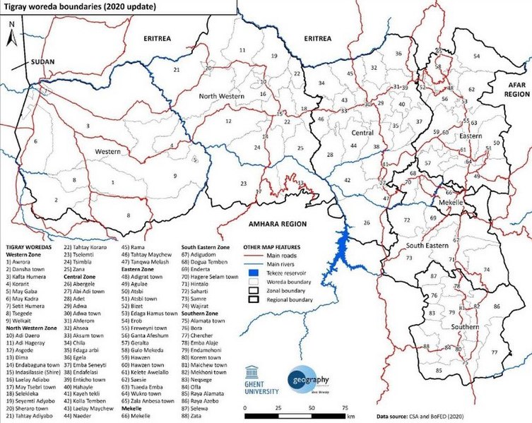
Administrative boundaries at woreda (district) level, as implemented in January 2020.
|
| Date | |
| Source | https://www.researchgate.net/publication/349824181_Tigray_Atlas_of_the_humanitarian_situation |
| Author | Sofie Annys, Tim Vanden Bempt, Emnet Negash, Lars De Sloover, and Jan Nyssen |
Licensing

|
The copyright holder of this file, [[: Tigray: Atlas of the humanitarian situation | Tigray: Atlas of the humanitarian situation ]], allows anyone to use it for any purpose, provided that the copyright holder is properly attributed. Redistribution, derivative work, commercial use, and all other use is permitted. |
|
Attribution:
|