Africa_Climate_7000bp.png
Size of this preview:
600 × 600 pixels
.
Other resolutions:
240 × 240 pixels
|
480 × 480 pixels
|
768 × 768 pixels
|
1,024 × 1,024 pixels
|
1,320 × 1,320 pixels
.
Summary
| Description |
English:
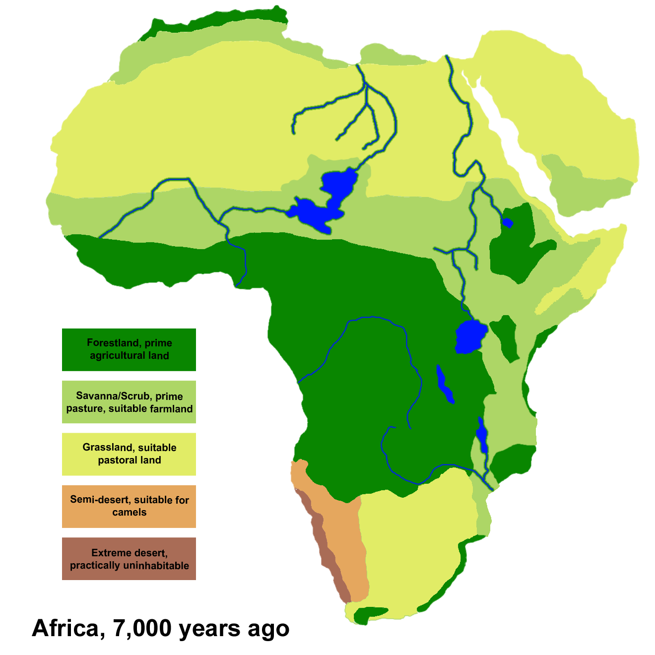
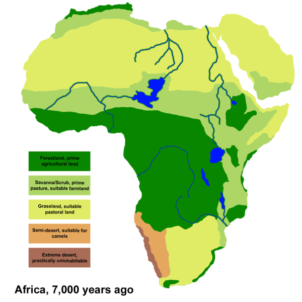
Climate areas based on data and maps from the Oak Ridge National Laboratory Paleovegetation project
http://www.esd.ornl.gov/projects/gen/
This map is of Africa circa 7,000 years before present, in the middle of the
Holocene climatic optimum
. Effectively, Africa in the "
Atlantic Period
".
|
| Date | |
| Source | Own work |
| Author | Ingoman |
Licensing
|
|
I, the copyright holder of this work, release this work into the
public domain
. This applies worldwide.
In some countries this may not be legally possible; if so: I grant anyone the right to use this work for any purpose , without any conditions, unless such conditions are required by law. |

|
This
meteorology
image could be re-created
using
vector graphics
as an
SVG
file
. This has several advantages; see
Commons:Media for cleanup
for more information. If an SVG form of this image is available, please upload it and afterwards replace this template with
{{

vector version available

|

new image name

}}
.
It is recommended to name the SVG file “Africa Climate 7000bp.svg”—then the template Vector version available (or Vva ) does not need the new image name parameter. |