Ain-Diab.svg

Size of this PNG preview of this SVG file:
800 × 502 pixels
.
Other resolutions:
320 × 201 pixels
|
640 × 402 pixels
|
1,024 × 643 pixels
|
1,280 × 803 pixels
|
2,560 × 1,606 pixels
|
1,404 × 881 pixels
.
Summary
| Description |
English:
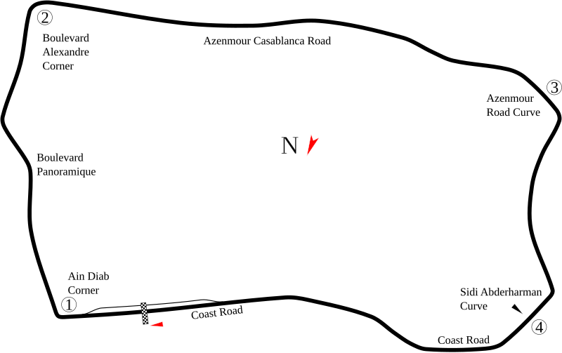
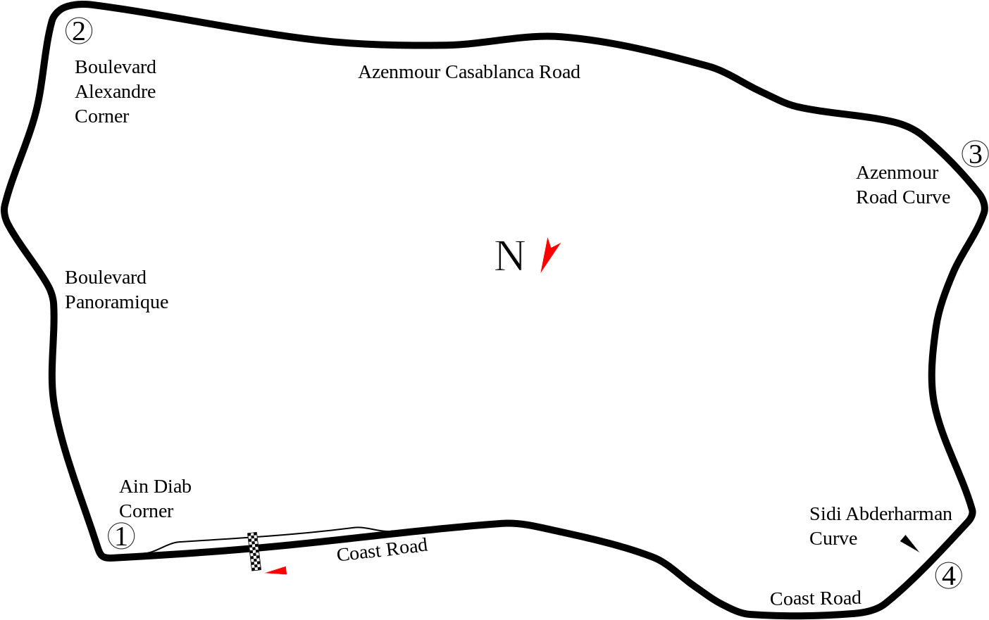
Track map of
Ain-Diab Circuit
based on modern imagery. Because the imagery was current rather than from 50 years ago, there may be some inaccuracies. Also, the location of Pit Road was uncertain. The existing image (below) showed it in a place that currently is just empty ground. Other than that, all that could be done is guess.
|
| Date | |
| Source | Own work |
| Author | Will Pittenger |
| Other versions |
|

| Camera location |
|
View this and other nearby images on: OpenStreetMap |
|
|---|
Licensing
I, the copyright holder of this work, hereby publish it under the following license:
This file is licensed under the
Creative Commons
Attribution-Share Alike 3.0 Unported
license.
-
You are free:
- to share – to copy, distribute and transmit the work
- to remix – to adapt the work
-
Under the following conditions:
- attribution – You must give appropriate credit, provide a link to the license, and indicate if changes were made. You may do so in any reasonable manner, but not in any way that suggests the licensor endorses you or your use.
- share alike – If you remix, transform, or build upon the material, you must distribute your contributions under the same or compatible license as the original.