Amazonie_deforestation.jpg
Size of this preview:
755 × 600 pixels
.
Other resolutions:
302 × 240 pixels
|
604 × 480 pixels
|
778 × 618 pixels
.
Summary
English:
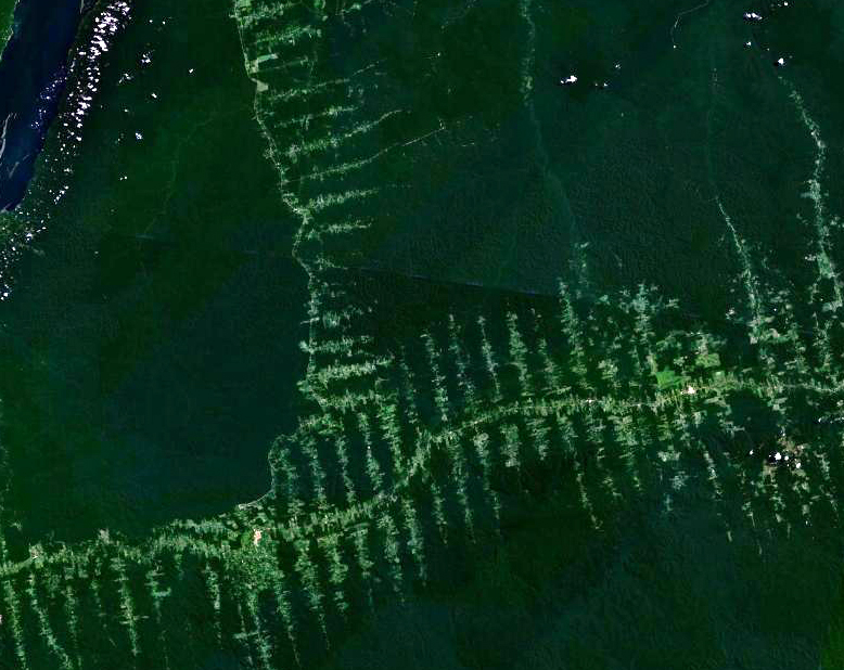
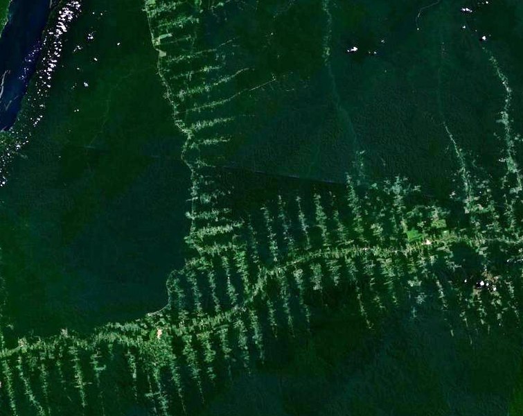
Deforestation in Amazonia, seen from satellite. The roads in the forest follow a typical "fish bone" pattern
Français :
Déforestation en Amazonie, vu depuis un satellite. Les routes tracées dans la forêt suivent un motif caractéristique similaire à des arêtes de poisson
Deutsch:
Entwaldung in Amazonien, aufgenommen vom Satelliten. Die in den Wald getriebenen Schneisen ergeben ein charakteristisches Fischgrätenmuster
Licensing
|
|
This file is in the public domain in the United States because it was solely created by NASA . NASA copyright policy states that "NASA material is not protected by copyright unless noted ". (See Template:PD-USGov , NASA copyright policy page or JPL Image Use Policy .) |
|

|
Warnings:
|