Ap-districts.png

Size of this preview:
722 × 600 pixels
.
Other resolutions:
289 × 240 pixels
|
578 × 480 pixels
|
925 × 768 pixels
|
1,233 × 1,024 pixels
|
2,487 × 2,066 pixels
.
| Description |
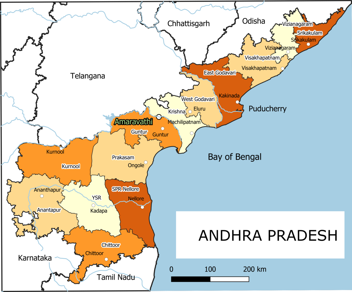
English:
Old Andhra Pradesh Map
For more information please see:
File:ఆంధ్రప్రదేశ్ జిల్లాల పటము.png
|
| Date | |
| Source | Own work |
| Author | Arjunaraoc |
| Other versions | For the latest version see File:Ap-districts.svg |
; for older version see https://commons.wikimedia.org/w/index.php?title=File:Map_AP_dist_all_shaded.png&oldid=344558866 ,
Licensing
I, the copyright holder of this work, hereby publish it under the following license:
|
|
This work contains information from
OpenStreetMap
, which is made available under the
Open Database License (ODbL)
.
The ODbL does not require any particular license for maps produced from ODbL data. Prior to 1 August 2020, map tiles produced by the OpenStreetMap Foundation were licensed under the CC-BY-SA-2.0 license . Maps produced by other people may be subject to other licences. |