April_27_2014_tornado_outbreak_2345z.png
Size of this preview:
800 × 450 pixels
.
Other resolutions:
320 × 180 pixels
|
640 × 360 pixels
|
1,024 × 576 pixels
|
1,280 × 720 pixels
|
2,048 × 1,152 pixels
.
Summary
| Description |
English:
Original text from the NNVL
–
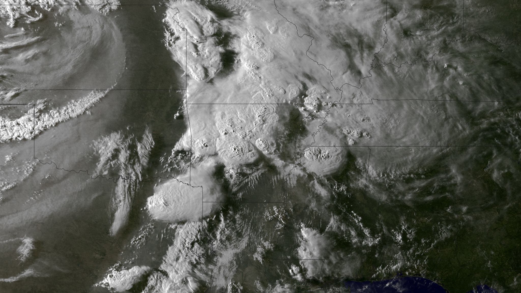
In chronological order, Nebraska, Iowa, Oklahoma, Kansas, Mississippi, Arkansas and Louisiana reported tornado sightings to the NOAA National Weather Service Storm Prediction Center on April 27, 2014. In Arkansas, the towns of Vilonia and Mayflower and the surrounding areas are reporting widespread devastation. This image was taken at 2345Z on April 27, 2014, around an hour before the tornado reports from Mayflower and Vilonia. The NWS Storm Prediction Center is forecasting a widespread severe weather outbreak Monday afternoon, April 28, 2014, into Monday night across portions of the southern and eastern U.S. The greatest potential - where SPC has outlined a Moderate Risk - is across the lower Mississippi and Tennessee Valleys. Widespread severe storms - including strong tornadoes, damaging winds and very large hail are expected. |
| Date | |
| Source | http://www.nnvl.noaa.gov/MediaDetail2.php?MediaID=1540&MediaTypeID=1 |
| Author | NOAA Environmental Visualization Laboratory |
Licensing
|
|
This image is in the
public domain
because it contains materials that originally came from the U.S.
National Oceanic and Atmospheric Administration
, taken or made as part of an employee's official duties.
|
|