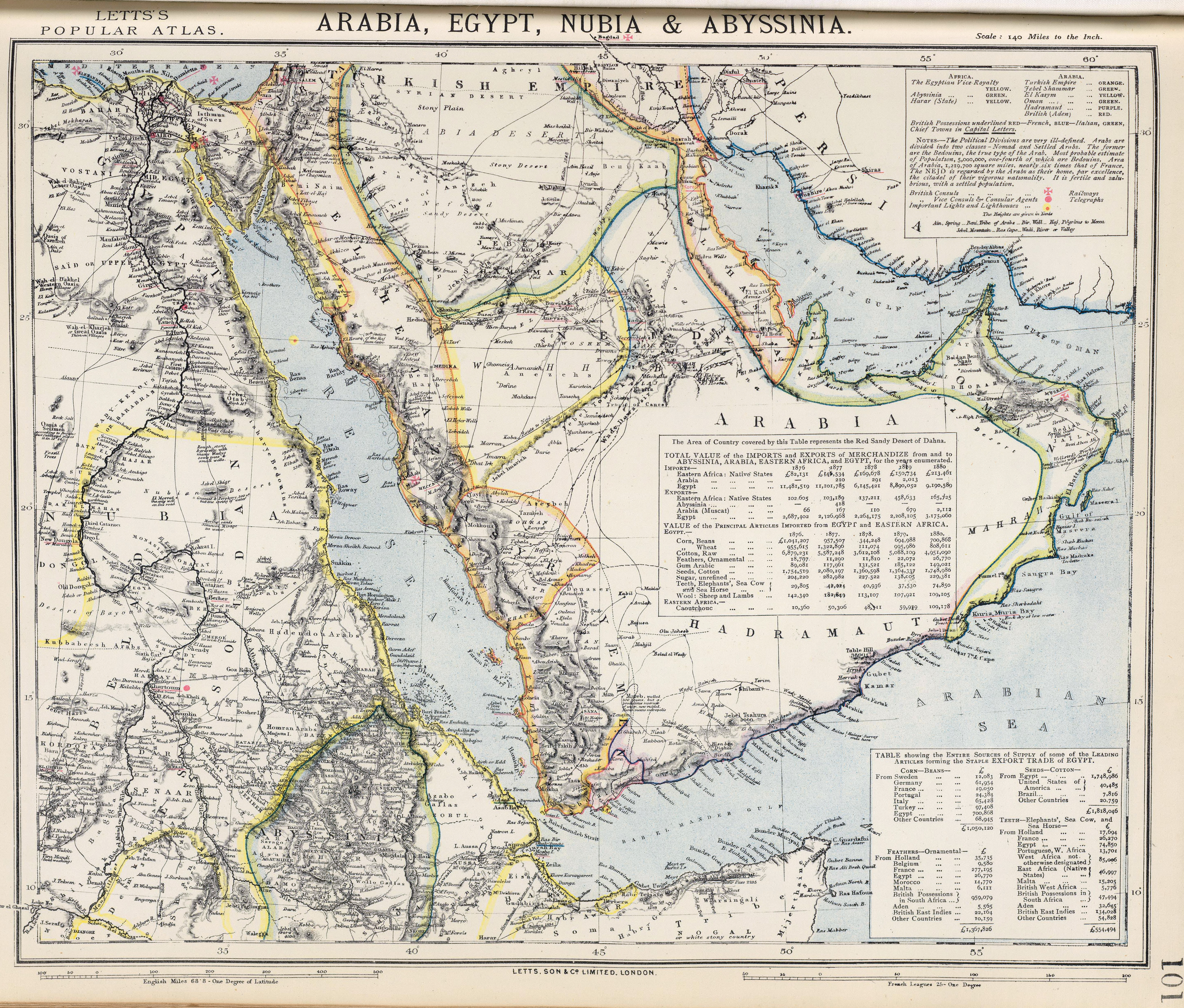
Arabia,_Egypt,_Nubia_and_Abyssinia_1883_map.jpg

Size of this preview:
704 × 600 pixels
.
Other resolutions:
282 × 240 pixels
|
564 × 480 pixels
|
902 × 768 pixels
|
1,202 × 1,024 pixels
|
2,405 × 2,048 pixels
|
5,784 × 4,926 pixels
.
Summary
| Description |
English:
Arabia, Egypt, Nubia & Abyssinia. Part of Lett's Popular Atlas. Letts, Son & Co. Limited, London.
|
| Date | |
| Source | http://www.britishempire.co.uk/images2/arabia1883map.jpg |
| Author | Letts's Popular Atlas |
| Other versions |
.jpg)
.jpg)
Licensing
|
|
This work is in the public domain in its country of origin and other countries and areas where the copyright term is the author's life plus 70 years or fewer . This work is in the public domain in the United States because it was published (or registered with the U.S. Copyright Office ) before January 1, 1929. |
| This file has been identified as being free of known restrictions under copyright law, including all related and neighboring rights. | |