Arbon_(J._M._Hase_Circvli_Sveviae_Mappa_1742).png
Size of this preview:
800 × 450 pixels
.
Other resolutions:
320 × 180 pixels
|
640 × 360 pixels
|
1,024 × 576 pixels
|
1,280 × 720 pixels
|
1,920 × 1,080 pixels
.
Summary
| Description |
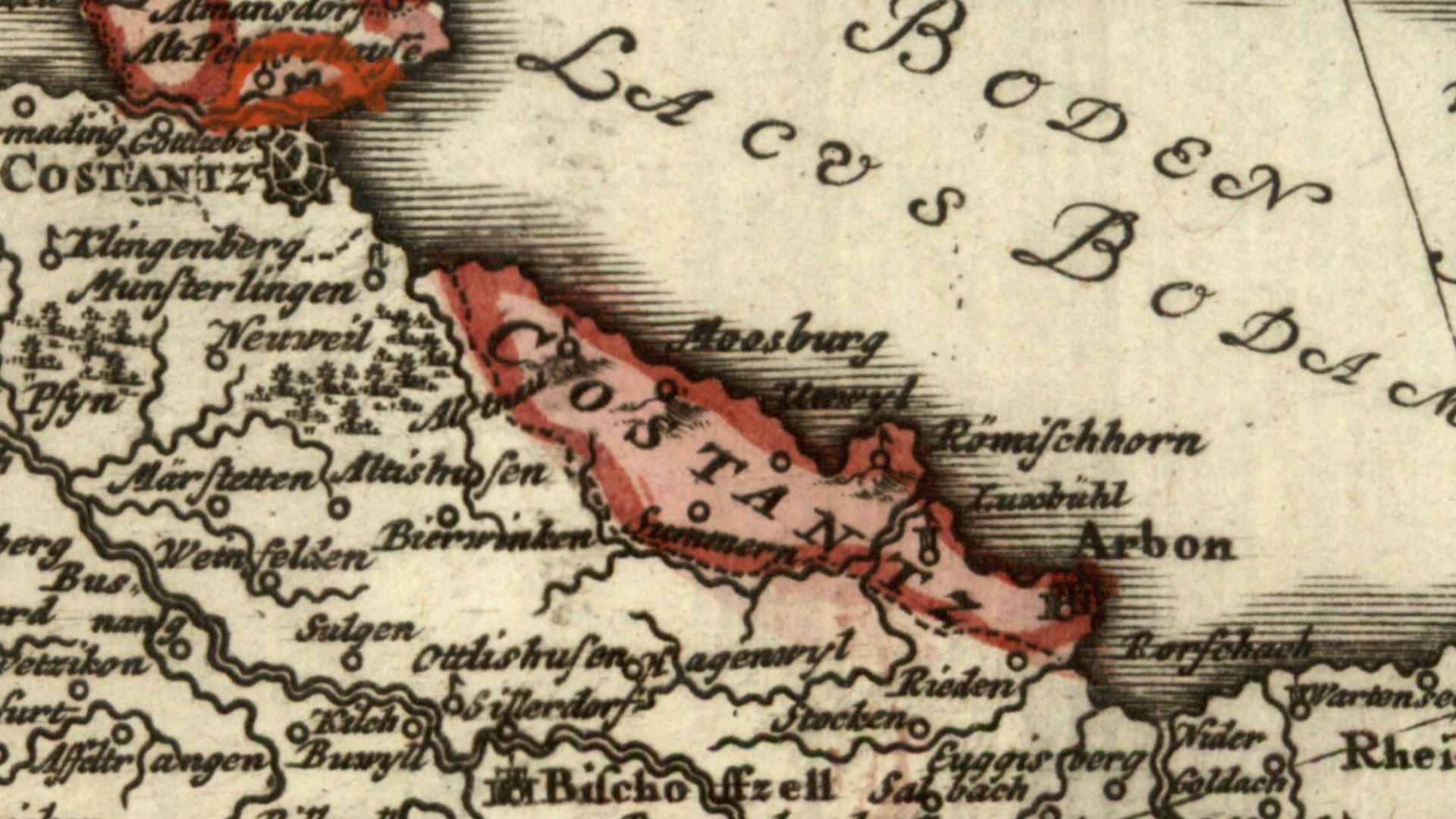
English:
Detail cropped out of a mid-18th century map showing (in pink) the territory on the southern shore of Lake Constance, including the town of Arbon, that belonged to the prince-bishop of Constance. The prince-bishop was also lord of Bischofszell (lower part of map) although effective power over that town had passed to the Swiss Confederacy and the canton of Zurich.
Cropped out of a map centered on the Swabian Circle titled Circvli Sveviae Mappa designed by Johann Matthias Hase and published by Homann Heirs (Homann Erben) in 1742. |
| Date | |
| Source | Moll's map collection |
| Author | Johann Matthias Hase (1684-1742) |
Licensing
|
|
This work is in the public domain in its country of origin and other countries and areas where the copyright term is the author's life plus 100 years or fewer . |
| This file has been identified as being free of known restrictions under copyright law, including all related and neighboring rights. | |