Arizona_ref_2001.jpg

Size of this preview:
506 × 599 pixels
.
Other resolutions:
203 × 240 pixels
|
405 × 480 pixels
|
677 × 802 pixels
.
| Description |
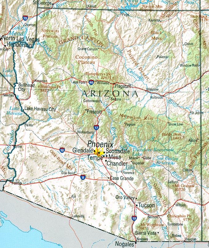
English:
Map of
Arizona
.
Shaded relief map with state boundaries, forest cover, place names, major highways. Portion of "The National Atlas of the United States of America. General Reference", compiled by U.S. Geological Survey 2001, printed 2002
|
|||
| Date | ||||
| Source | Courtesy of the University of Texas Libraries, The University of Texas at Austin | |||
| Author | U.S. Geological Survey 2001 | |||
|
Permission
( Reusing this file ) |
|