Arlington_Place_02.jpg


This is an image of a place or building that is listed on the National Register of Historic Places in the United States of America . Its reference number is 70000103 .

Description
English: 
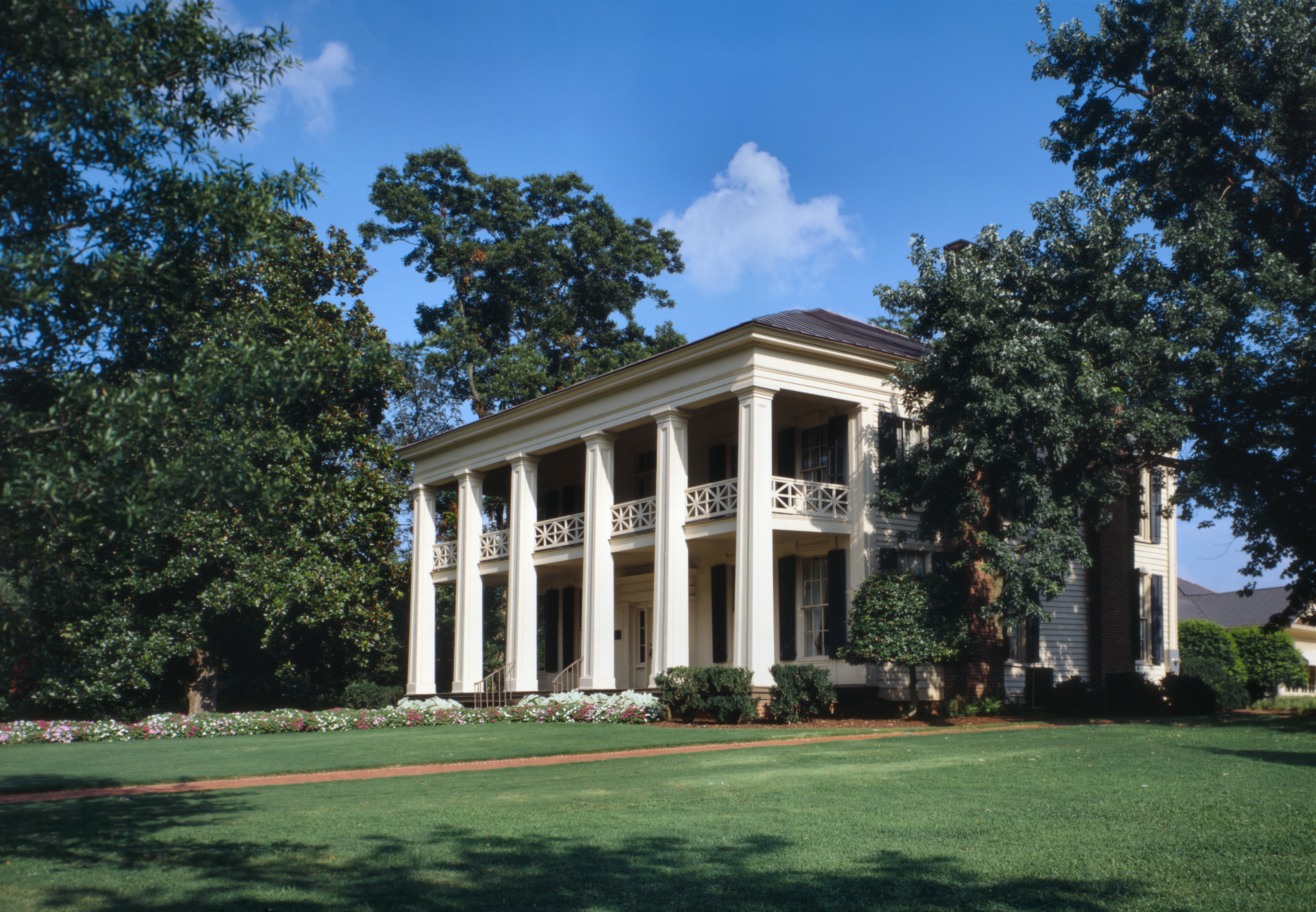
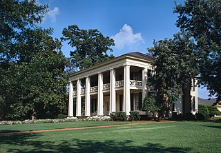
Arlington Place, 331 Cotton Avenue, Southwest, Birmingham, Jefferson County, AL. PERSPECTIVE VIEW LOOKING FROM THE NORTHWEST TOWARD THE NORTH (FRONT) ELEVATION (DUPLICATE OF HABS No. AL-424-26) HABS ALA,37-BIRM,1-45.
Date
Source
This image is available from the United States Library of Congress 's Prints and Photographs division
under the digital ID hhh.al0245 .
This tag does not indicate the copyright status of the attached work. A normal copyright tag is still required. See Commons:Licensing .

العربية беларуская (тарашкевіца) বাংলা čeština Deutsch English español فارسی suomi français galego עברית magyar Bahasa Indonesia italiano 日本語 lietuvių македонски മലയാളം Nederlands polski português português do Brasil română русский sicilianu slovenčina slovenščina Türkçe українська 简体中文 繁體中文 +/−

Author
Jet Lowe (1947–) wikidata:Q6188857
Jet Lowe
Alternative names
John T. "Jet" Lowe
Description American photographer and architectural photographer
Date of birth 1947 Edit this at Wikidata
Work period 2013 Edit this at Wikidata
Work location
one of the photographers employed by the U.S. National Park Service on the Historic American Building Survey and Historic American Engineering Record projects
Authority file
creator QS:P170,Q6188857
Permission
( Reusing this file )
This file comes from the Historic American Buildings Survey (HABS), Historic American Engineering Record (HAER) or Historic American Landscapes Survey (HALS) . These are programs of the National Park Service established for the purpose of documenting historic places. Records consist of measured drawings, archival photographs, and written reports.


When reusing please credit: Library of Congress, Prints & Photographs Division, AL-424
This tag does not indicate the copyright status of the attached work. A normal copyright tag is still required. See Commons:Licensing .

Public domain This image or media file contains material based on a work of a National Park Service employee, created as part of that person's official duties. As a work of the U.S. federal government , such work is in the public domain in the United States. See the NPS website and NPS copyright policy for more information.
Object location 33° 29′ 59″ N, 86° 50′ 20″ W Kartographer map based on OpenStreetMap. View this and other nearby images on: OpenStreetMap info

Captions

Add a one-line explanation of what this file represents

33°29'58.999"N, 86°50'20.000"W

image/jpeg

0f8676142febae3622b2002bf96b3f1843df753e

9,554,400 byte

3,157 pixel

4,554 pixel