Atlantic_hurricane_tracks.jpg

Size of this preview:
800 × 448 pixels
.
Other resolutions:
320 × 179 pixels
|
640 × 359 pixels
|
1,024 × 574 pixels
|
1,280 × 717 pixels
|
2,560 × 1,435 pixels
|
9,000 × 5,044 pixels
.
| Saffir-Simpson Hurricane Scale | ||||||
| TD | TS | 1 | 2 | 3 | 4 | 5 |
Summary
| Description |
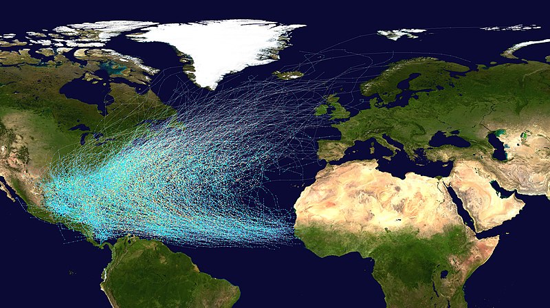
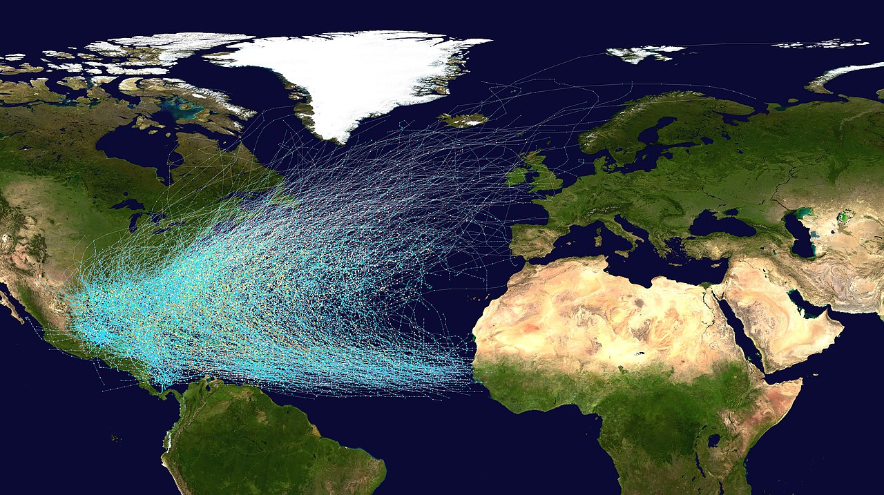
English:
This map shows the tracks of all
Atlantic hurricanes
which formed between 1851 and 2019. The points show the locations of the storms at six-hourly intervals and use the color scheme shown to the right from
Saffir-Simpson Hurricane Scale
.
|
||
| Source |
Created using User:jdorje/Tracks by Nilfanion on 2006-08-05 . Background image from File:Whole world - land and oceans.jpg ( NASA ). Tracking data for storms is from the National Hurricane Center . [1] |
||
| Author | Nilfanion | ||
|
Permission
( Reusing this file ) |
|
||
| Other versions |
This file was derived from:
Whole world - land and oceans.jpg
:
|
Licensing
|
|
I, the copyright holder of this work, release this work into the
public domain
. This applies worldwide.
In some countries this may not be legally possible; if so: I grant anyone the right to use this work for any purpose , without any conditions, unless such conditions are required by law. |