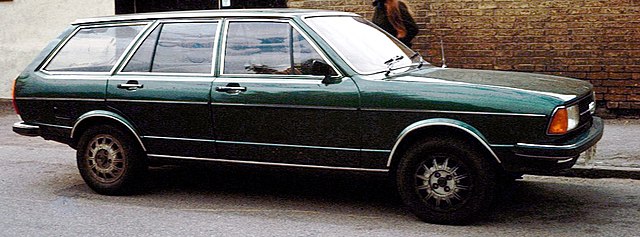
Audi_80_B1_Estate_England.jpg

Size of this preview:
800 × 296 pixels
.
Other resolutions:
320 × 118 pixels
|
640 × 237 pixels
|
1,537 × 569 pixels
.
Summary
| Description | Audi 80 B1 Estate in England |
| Date | |
| Source | Own work |
| Author | Charles01 |
| Object location |
|
View this and other nearby images on: OpenStreetMap |
|
|---|
Location is approximate, but believed to be correct within 1 km. If anyone remembers better than I how Chesterton High Street looked in 1979 please feel free to enter a more precise location. Regards Charles01 ( talk ) 20:27, 2 September 2012 (UTC) (the photographer in question).
Licensing
I, the copyright holder of this work, hereby publish it under the following licenses:

|
Permission is granted to copy, distribute and/or modify this document under the terms of the GNU Free Documentation License , Version 1.2 or any later version published by the Free Software Foundation ; with no Invariant Sections, no Front-Cover Texts, and no Back-Cover Texts. A copy of the license is included in the section entitled GNU Free Documentation License . |
This file is licensed under the
Creative Commons
Attribution-Share Alike
3.0 Unported
,
2.5 Generic
,
2.0 Generic
and
1.0 Generic
license.
-
You are free:
- to share – to copy, distribute and transmit the work
- to remix – to adapt the work
-
Under the following conditions:
- attribution – You must give appropriate credit, provide a link to the license, and indicate if changes were made. You may do so in any reasonable manner, but not in any way that suggests the licensor endorses you or your use.
- share alike – If you remix, transform, or build upon the material, you must distribute your contributions under the same or compatible license as the original.
You may select the license of your choice.