Austria_1999_CIA_map.jpg
Size of this preview:
800 × 546 pixels
.
Other resolutions:
320 × 218 pixels
|
640 × 437 pixels
|
1,024 × 699 pixels
|
1,280 × 873 pixels
|
2,500 × 1,706 pixels
.
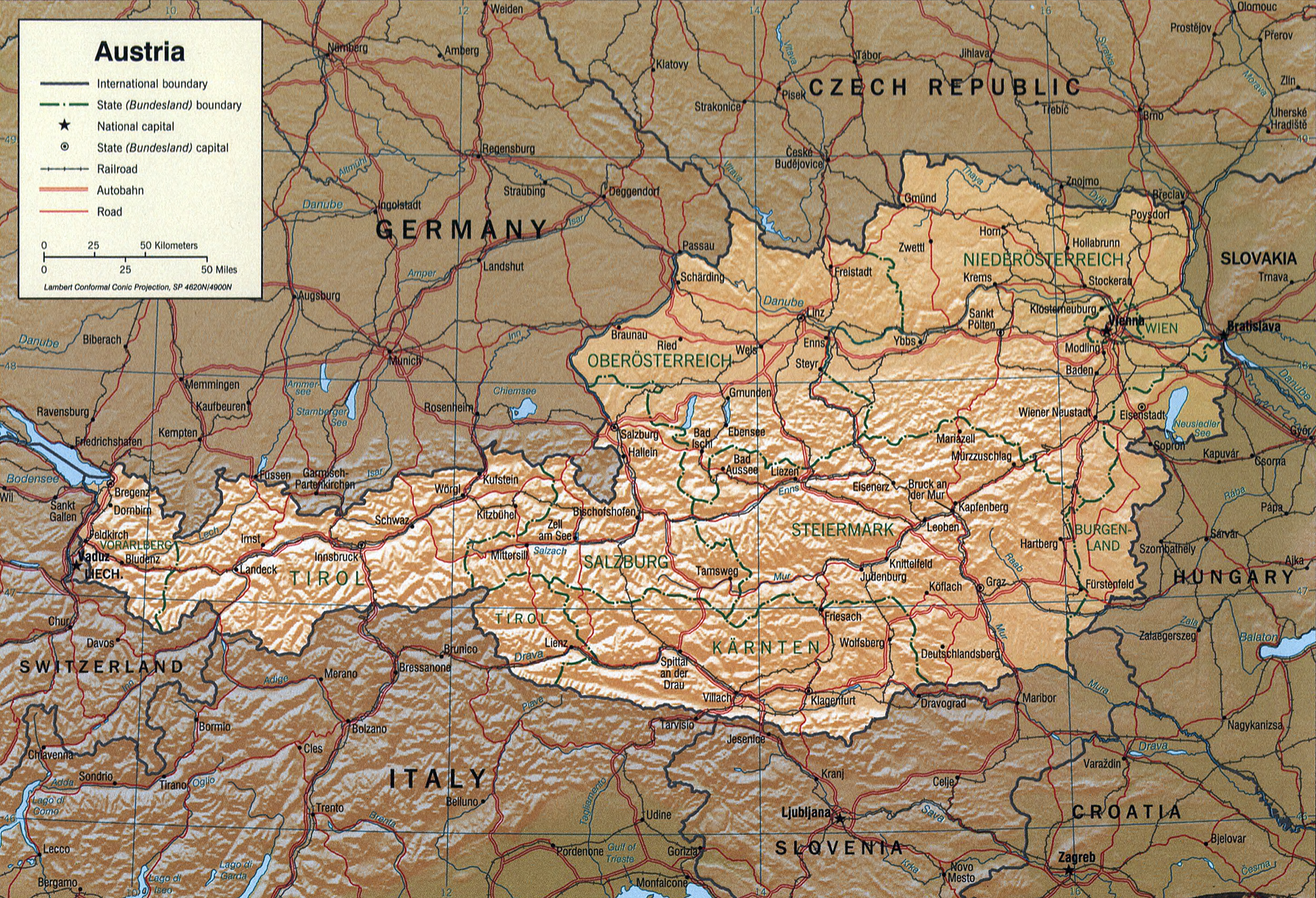
Austria.
United States. Central Intelligence Agency.
CREATED/PUBLISHED [Washington, D.C. : Central Intelligence Agency, 1999]
NOTES Relief shown by shading.
"Base 802440A1 (RO2077) 12-99."
Scale [ca. 1:2,700,000] ; Lambert conformal conic proj., SP 4620N/4900N (E 9030'--E 17000'/N 49000'--N 46000').
SUBJECTS Austria--Maps. Austria.
MEDIUM 1 map : col. ; 17 x 25 cm.
CALL NUMBER G6490 1999 .U5
REPOSITORY Library of Congress Geography and Map Division Washington, D.C. 20540-4650 USA
DIGITAL ID g6490 ct000994 http://hdl.loc.gov/loc.gmd/g6490.ct000994
|
|
This image is a work of a
Central Intelligence Agency
employee, taken or made as part of that person's official duties. As a Work of the United States Government, this image or media is in the
public domain
in the United States.
|

|