BNSF_Railway_system_map_(marked_Kansas_City).png
Size of this preview:
800 × 457 pixels
.
Other resolutions:
320 × 183 pixels
|
640 × 366 pixels
|
1,024 × 585 pixels
|
1,400 × 800 pixels
.
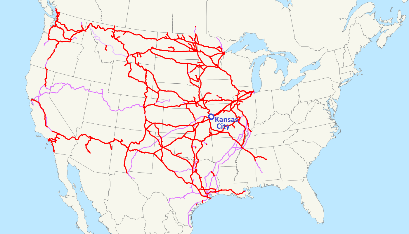
Summary
| Description |
English:
This is a map of the BNSF Railway as of 2009, with
trackage rights
in purple (
haulage rights
are lighter).
Email me
if you would like a copy of the GIS data I created (modified from Bureau of Transportation Statistics North American Transportation Atlas Data) or if you see any errors.
|
| Date | 23 February 2009 (original upload date) |
| Source |
This file was derived from:
BNSF Railway system map.svg
|
| Author | NE2 |
Licensing
|
|
I, the copyright holder of this work, release this work into the
public domain
. This applies worldwide.
In some countries this may not be legally possible; if so: I grant anyone the right to use this work for any purpose , without any conditions, unless such conditions are required by law. |