Barn_Pano(9467)-Relic38.jpg

Size of this preview:
800 × 246 pixels
.
Other resolutions:
320 × 98 pixels
|
640 × 197 pixels
|
1,024 × 315 pixels
|
1,280 × 393 pixels
|
2,560 × 786 pixels
|
8,132 × 2,498 pixels
.
| Description |
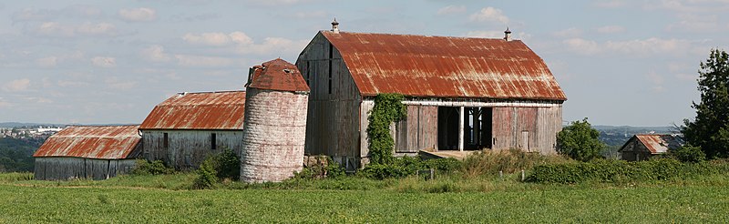
English:
Barn near Newmarket, Ontario, Canada. Demolished in March, 2009.
Created from 4 images taken at 105mm, 1/100s, f14, ISO 100
Français :
Une grange près de Newmarket en Ontario (Canada). Les bâtiments ont été détruits en mars 2009. Image obtenue en assemblant 4 clichés pris avec un objectif de 105 mm, et comme paramètres d'exposition 1/100s, f14, et ISO 100.
|
| Date | |
| Source | Own work |
| Author | Relic38 |
|
Permission
( Reusing this file ) |
I, the copyright holder of this work, hereby publish it under the following license:
This file is licensed under the
Creative Commons
Attribution-Share Alike 3.0 Unported
license.
Please leave a message if reused outside of Wiki projects. |
| Other versions |
|
|

-Relic38.jpg)
| Camera location |
|
View this and other nearby images on: OpenStreetMap |
|
|---|
-Relic38.jpg¶ms=044.079605_N_-079.486229_E_globe:Earth_type:camera_heading:112.50&language=en)
This image was created with
Hugin
.
|
|
This image has been assessed using the
Quality image guidelines
and is considered a
Quality image
.
|