Bayridgehighschool1920.jpg
No higher resolution available.
Summary
| Description |
English:
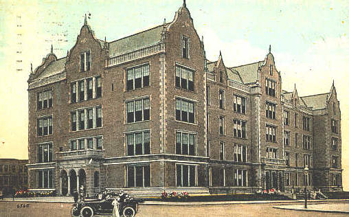
Postcard of Bay Ridge High School, 350 67th Street, Bay Ridge Brooklyn, New York 11220, looking west across 4th Avenue and 67th Street.
|
| Date | circa 1920 |
| Source | Period postcard |
| Author | Photographer not credited. |
| Camera location |
|
View this and other nearby images on: OpenStreetMap |
|
|---|
Licensing
|
|
This media file is in the
public domain
in the
United States
. This applies to U.S. works where the copyright has expired, often because its first
publication
occurred prior to January 1, 1929, and if not then due to lack of notice or renewal. See
this page
for further explanation.
|

|

|
This image might not be in the public domain outside of the United States; this especially applies in the countries and areas that do not apply the
rule of the shorter term
for US works, such as Canada, Mainland China (not Hong Kong or Macao), Germany, Mexico, and Switzerland. The creator and year of publication are essential information and must be provided. See
Wikipedia:Public domain
and
Wikipedia:Copyrights
for more details.
|
-