Beaubassin1755.jpg

Size of this preview:
790 × 600 pixels
.
Other resolutions:
316 × 240 pixels
|
632 × 480 pixels
|
1,012 × 768 pixels
|
1,280 × 972 pixels
|
2,560 × 1,943 pixels
|
4,434 × 3,366 pixels
.
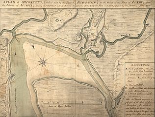
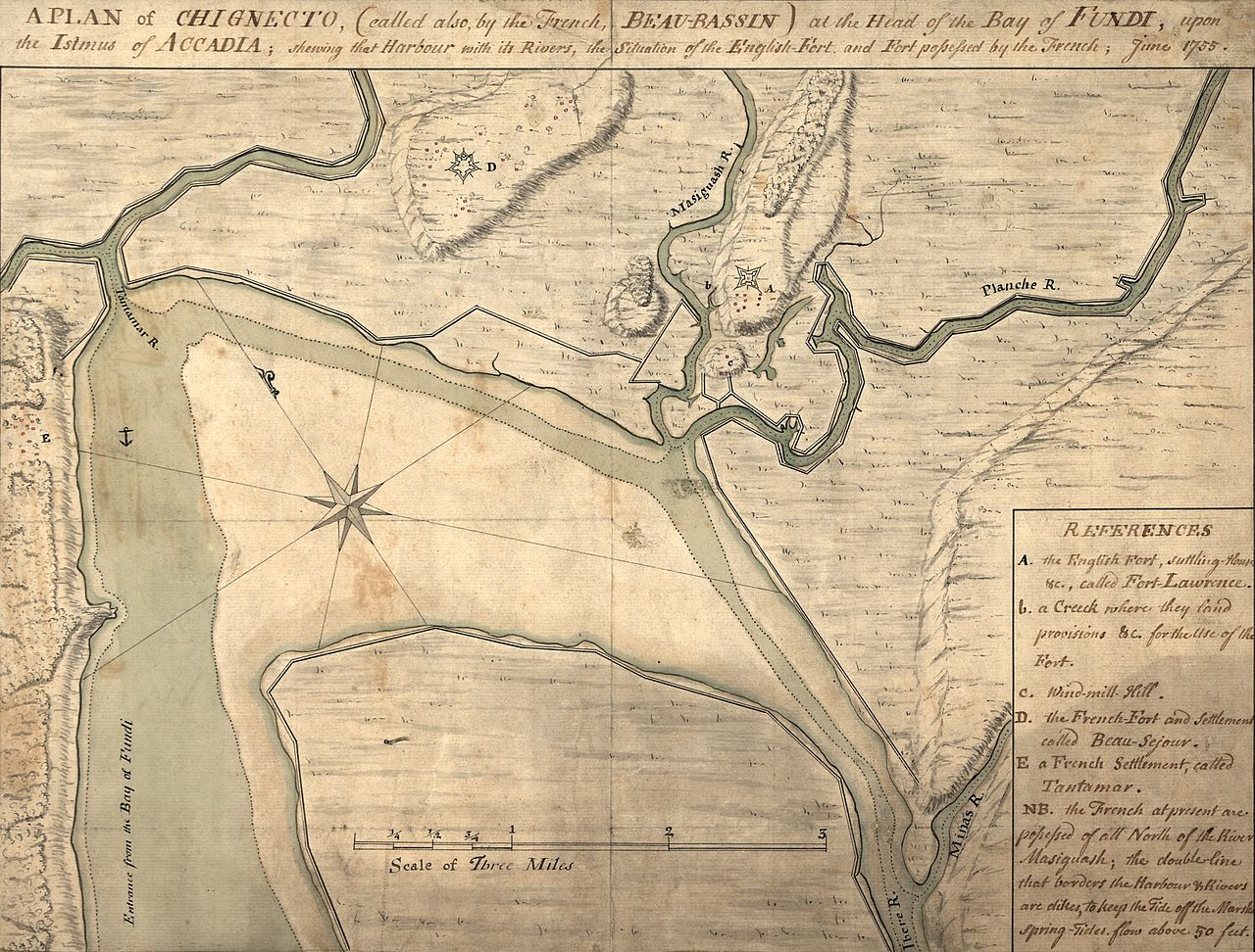
Summary
| Description |
English:
A map depicting the
Beaubassin
region of
Nova Scotia
in 1755. The area was then on the frontier between British Nova Scotia and French
Acadia
. The caption reads: A plan of
Chignecto
(called also by the French Beau-Bassin) at the head of the
Bay of Fundi
upon the Istmus of Accadia shewing that harbour with its rivers, the situation of the
English fort
and
fort possessed by the French
, June 1755.
The image has been cropped from the original to remove a border.
|
||
| Date | |||
| Source |
|
||
| Author | Unknown author |

Licensing
|
|
This media file is in the
public domain
in the
United States
. This applies to U.S. works where the copyright has expired, often because its first
publication
occurred prior to January 1, 1929, and if not then due to lack of notice or renewal. See
this page
for further explanation.
|

|

|
This image might not be in the public domain outside of the United States; this especially applies in the countries and areas that do not apply the
rule of the shorter term
for US works, such as Canada, Mainland China (not Hong Kong or Macao), Germany, Mexico, and Switzerland. The creator and year of publication are essential information and must be provided. See
Wikipedia:Public domain
and
Wikipedia:Copyrights
for more details.
|