Belfast_Aerial.jpg

Size of this preview:
450 × 600 pixels
.
Other resolutions:
180 × 240 pixels
|
360 × 480 pixels
|
576 × 768 pixels
|
768 × 1,024 pixels
|
1,944 × 2,592 pixels
.
Summary
| Description |
English:
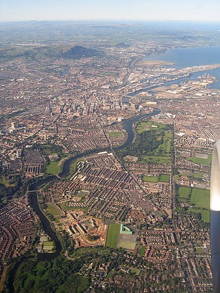
Aerial photo of south-east, central and north Belfast, taken from a plane on a clear evening, 9th September 2004. Includes the River Lagan, Stranmillis, Annadale Embankment, Ormeau Road, Ravenhill Road, Ormeau Park, City Hospital, parts of east and west Belfast, Belfast Docks, Mallusk, Cave Hill, Carnmoney Hill and extends to the Glens of Antrim, Causeway Coast and the coast of Scotland in the distance.
|
| Date | |
| Source | Own work |
| Author | Fattonyni |
| Other versions |
.jpg)
| Camera location |
|
View this and other nearby images on: OpenStreetMap |
|
|---|
Licensing
I, the copyright holder of this work, hereby publish it under the following license:
This file is licensed under the
Creative Commons
Attribution-Share Alike 4.0 International
license.
-
You are free:
- to share – to copy, distribute and transmit the work
- to remix – to adapt the work
-
Under the following conditions:
- attribution – You must give appropriate credit, provide a link to the license, and indicate if changes were made. You may do so in any reasonable manner, but not in any way that suggests the licensor endorses you or your use.
- share alike – If you remix, transform, or build upon the material, you must distribute your contributions under the same or compatible license as the original.