Belgrade_bypass.jpg
Size of this preview:
610 × 599 pixels
.
Other resolutions:
244 × 240 pixels
|
489 × 480 pixels
|
782 × 768 pixels
|
1,042 × 1,024 pixels
|
1,650 × 1,621 pixels
.

|
This
transport map
image could be re-created
using
vector graphics
as an
SVG
file
. This has several advantages; see
Commons:Media for cleanup
for more information. If an SVG form of this image is available, please upload it and afterwards replace this template with
{{

vector version available

|

new image name

}}
.
It is recommended to name the SVG file “Belgrade bypass.svg”—then the template Vector version available (or Vva ) does not need the new image name parameter. |


Summary
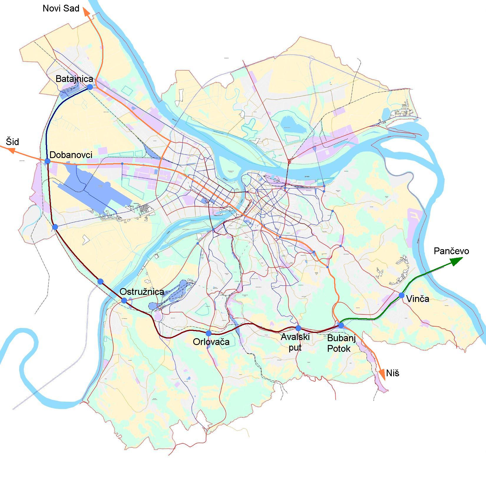
| Description | Map of Belgrade bypass |
| Date | |
| Source |
This file was derived from: |
| Author | Duja |
|
Permission
( Reusing this file ) |
The base image is part of General Urbanist Plan of city of Belgrade, which is {{PD-SerbiaGov}} |
Licensing
|
|
This work is in the
public domain
because according to the
Copyright Law of Serbia
(
details
)
, "Work is not copyrighted if the work is:
|

|