Benrather_und_Speyerer_Linie.png
Size of this preview:
614 × 599 pixels
.
Other resolutions:
246 × 240 pixels
|
492 × 480 pixels
|
787 × 768 pixels
|
1,158 × 1,130 pixels
.
Summary
| Description |
Deutsch
:
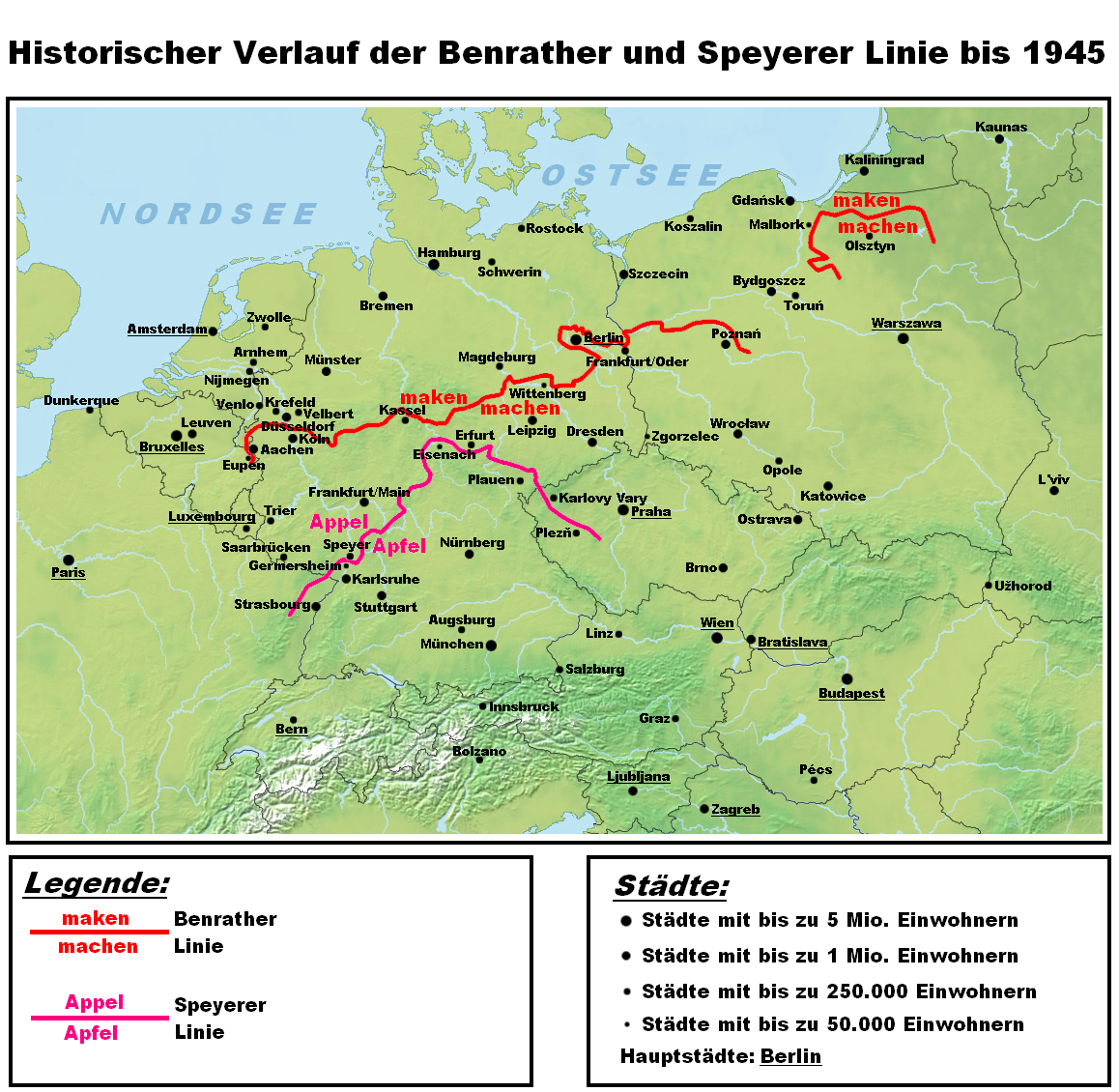
Darstellungskarte des historischen Verlaufes der Benrather und der Speyerer Linie als Trenngrenze zwischen Nieder- und Mitteldeutsch. Die hochdeutschen Sprachinseln nördlich der Benrather Linie werden nicht dargestellt, da es sich hierbei nicht um das Ergebnis einer Lautverschiebung, sondern um spätere Siedlungsbewegungen von Süden nach Norden handelt. Es wurde auch bewusst auf die Darstellung jeglicher Sprachgrenzen verzichtet.
English
:
Map showing the historic position of the isoglosses known as the Speyer and the Benrath line, dividing lower from middle German dialects. Enclaves of high German north of the Benrath line are not displayed, since they are not the effect of a sound shift but result from later south to north migration. Dialect family divisions have also been omitted on purpose.
|
| Date | |
| Source | Own work |
| Author | Hardcore-Mike |
Licensing
I, the copyright holder of this work, hereby publish it under the following license:
This file is licensed under the
Creative Commons
Attribution-Share Alike 3.0 Unported
license.
-
You are free:
- to share – to copy, distribute and transmit the work
- to remix – to adapt the work
-
Under the following conditions:
- attribution – You must give appropriate credit, provide a link to the license, and indicate if changes were made. You may do so in any reasonable manner, but not in any way that suggests the licensor endorses you or your use.
- share alike – If you remix, transform, or build upon the material, you must distribute your contributions under the same or compatible license as the original.