Bhutan_protected_areas_location_map.png

Size of this preview:
800 × 522 pixels
.
Other resolutions:
320 × 209 pixels
|
640 × 418 pixels
|
1,000 × 653 pixels
.
Summary
| Description |
English:
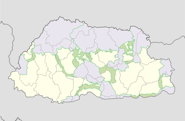
Location map of Bhutan with protected areas and corridors shaded.
Equirectangular projection, N/S stretching 115 %. Geographic limits of the map:
|
| Date | |
| Source | map from File:Bhutan location map.svg ; information from Bhutan Trust Fund – Parks of Bhutan |
| Author | User:NordNordWest ; Bhutan Trust Fund, Government of Bhuan |
Licensing
This file is licensed under the
Creative Commons
Attribution-Share Alike 3.0 Unported
license.
-
You are free:
- to share – to copy, distribute and transmit the work
- to remix – to adapt the work
-
Under the following conditions:
- attribution – You must give appropriate credit, provide a link to the license, and indicate if changes were made. You may do so in any reasonable manner, but not in any way that suggests the licensor endorses you or your use.
- share alike – If you remix, transform, or build upon the material, you must distribute your contributions under the same or compatible license as the original.