Bodies_on_the_battlefield_at_antietam.jpg

Size of this preview:
800 × 560 pixels
.
Other resolutions:
320 × 224 pixels
|
640 × 448 pixels
|
1,024 × 717 pixels
|
1,280 × 897 pixels
|
2,560 × 1,793 pixels
|
6,202 × 4,344 pixels
.
Summary
|
Alexander Gardner
:
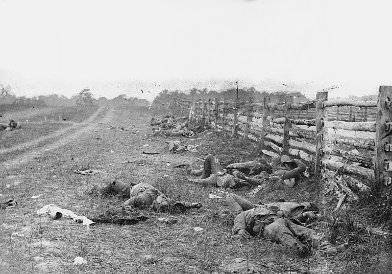
Bodies on the battlefield at Antietam
|
||||||||||||||||||||||||||||
|---|---|---|---|---|---|---|---|---|---|---|---|---|---|---|---|---|---|---|---|---|---|---|---|---|---|---|---|---|
| Photographer |
|

|
||||||||||||||||||||||||||
| Title |
The Dead of Antietam
|
|||||||||||||||||||||||||||
| Object type |
photograph
|
|||||||||||||||||||||||||||
| Genre |
photojournalism
|
|||||||||||||||||||||||||||
| Description |
Photograph of the field at Antietam, American Civil War. Confederate dead by a fence at the Hagerstown Turnpike, looking north; the Turnpike is to the right of the fence, the dirt lane on the left leads to the farm of David Miller.
|
|||||||||||||||||||||||||||
| Date | Taken in September 1862 | |||||||||||||||||||||||||||
| References |
100 Photographs: The Most Influential Images of All Time
|
|||||||||||||||||||||||||||
| Source |
|
|||||||||||||||||||||||||||
|
Permission
( Reusing this file ) |
Public domain | |||||||||||||||||||||||||||


| Camera location |
|
View this and other nearby images on: OpenStreetMap |
|
|---|
Licensing
|
|
This work is in the public domain in its country of origin and other countries and areas where the copyright term is the author's life plus 100 years or fewer . This work is in the public domain in the United States because it was published (or registered with the U.S. Copyright Office ) before January 1, 1929. |
| This file has been identified as being free of known restrictions under copyright law, including all related and neighboring rights. | |